|
a History &
Pictorial
nature is
the jewel
The Americans acted unilaterally in the development of the New York Reservation State Park at Niagara Falls. The park became reality on April 30th 1885 when signed into law by Governor Hill. The new Reservation State Park would consist of 412 acres including Prospect Park, Goat Island and Bath Island. The cost to create this park was estimated at approximately $1.4 million dollars. The New York Reservation State Park was officially opened to the public on July 15th 1885. Cost is free
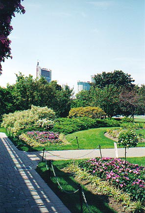
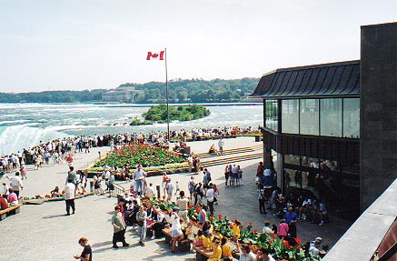
Ontario's Niagara Parks was established on May 24th 1888, to preserve and enhance the natural beauty of Niagara Falls, the Niagara Gorge and the Niagara River. Today, the Niagara Parks consists of 3,099 acres stretching 35 miles (56km) along the Niagara River between Fort Erie and Niagara on the Lake. From natural majestic beauty of the Falls of Niagara...to the manicured green lawns and emerald parks...to the excitement of many exhilarating attractions, the Niagara Parks is one of the finest and most stunningly beautiful parks in North America. The jewels in the Niagara Parks system are Queen Victoria Park , Queenston Heights Park, the Niagara Glen and Kings Bridge Park. Cost is free.
Index
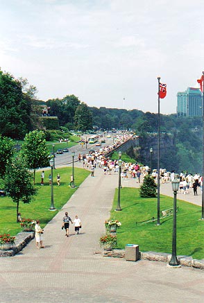
Queen Victoria Park looking south
Beginnings
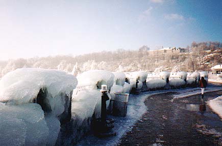
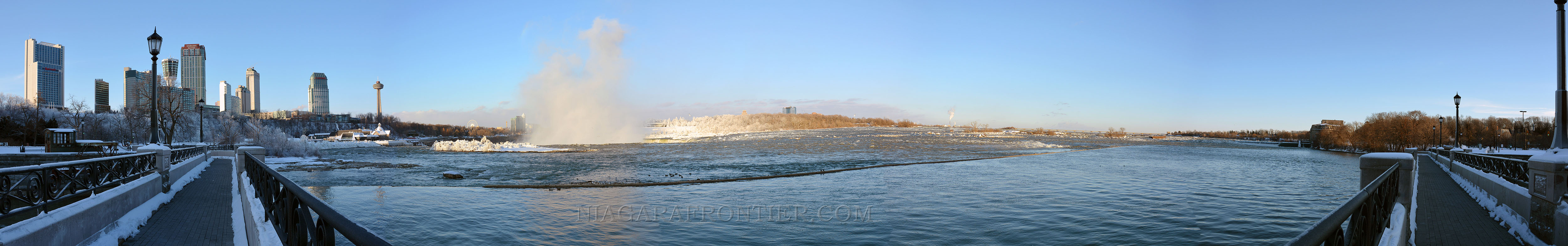
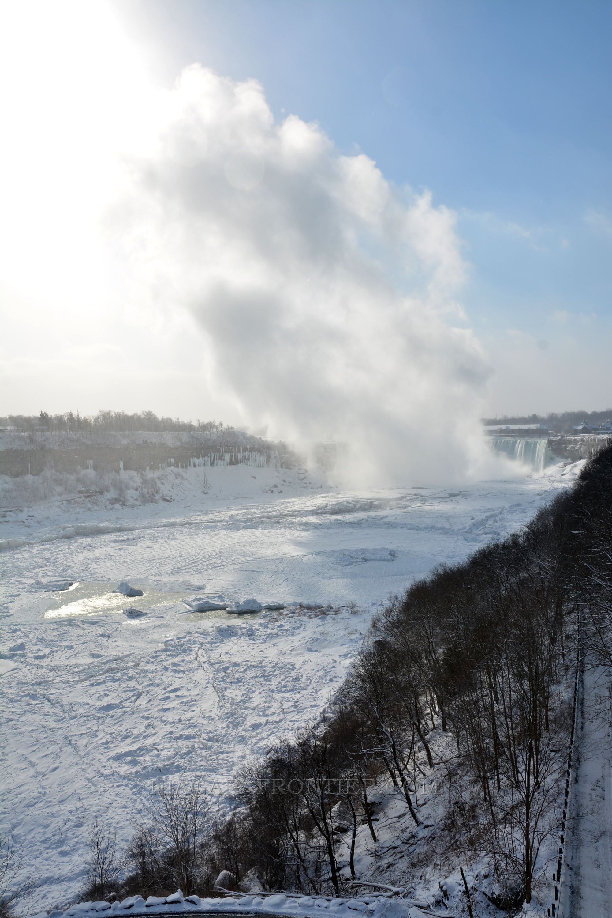
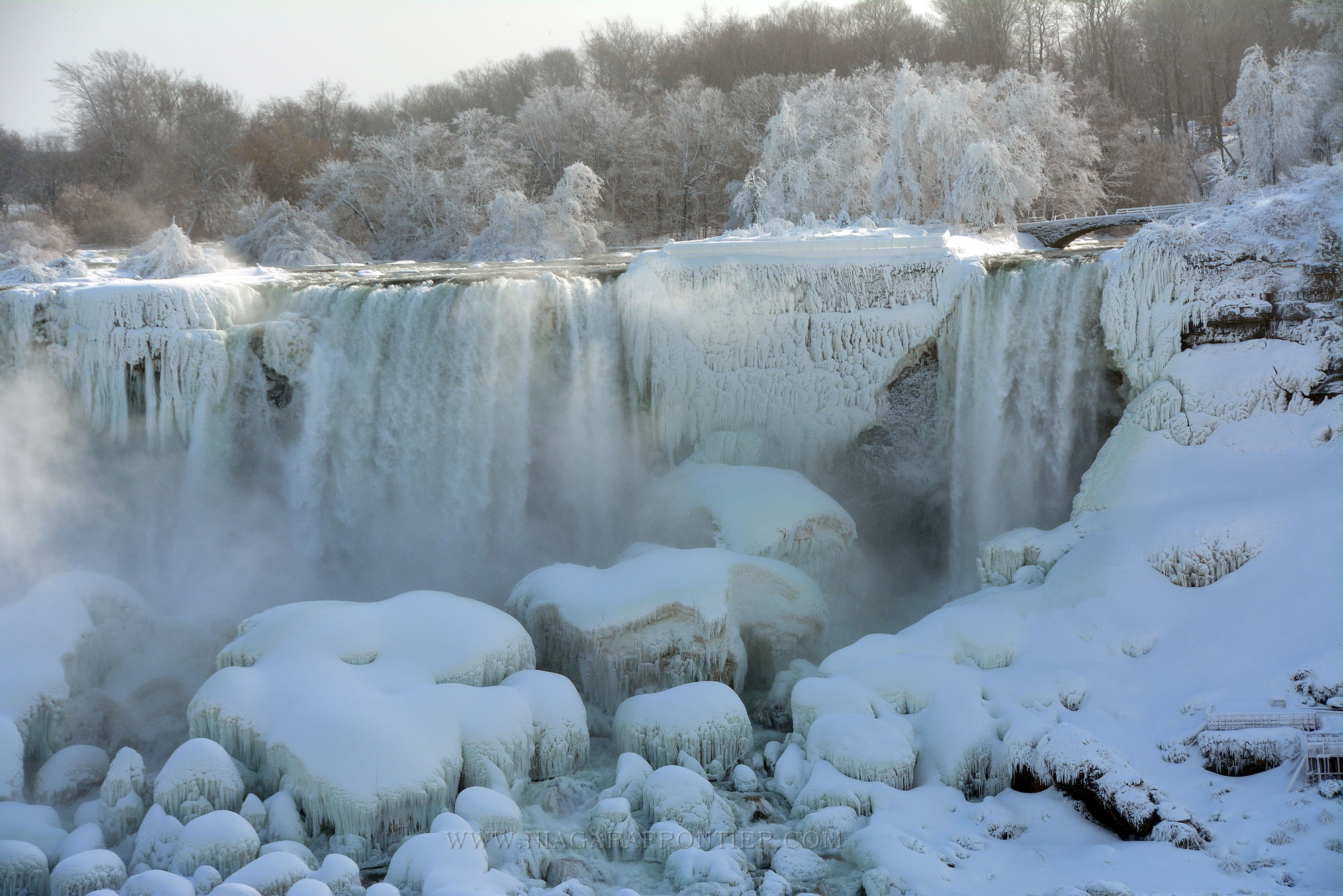
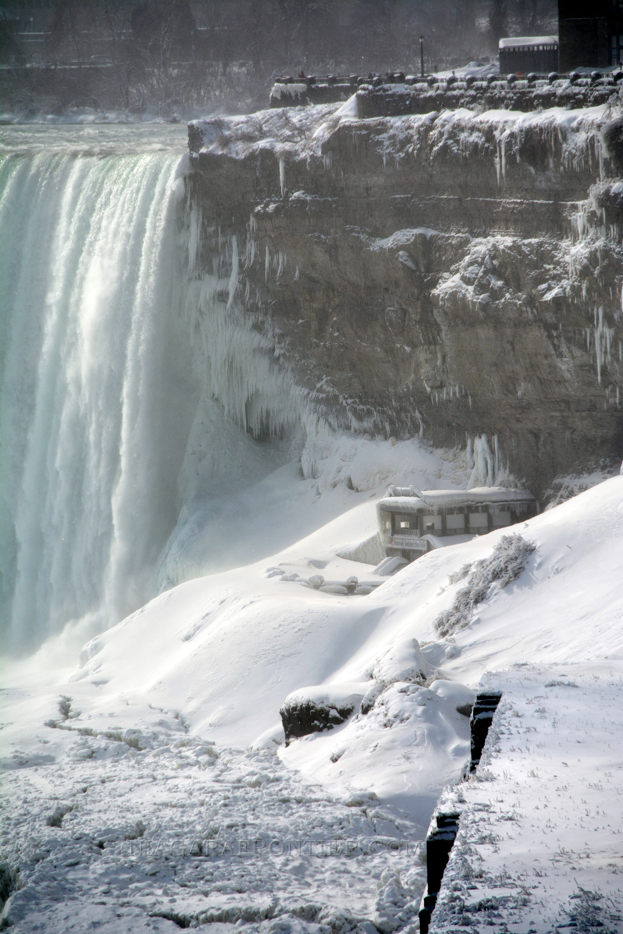
A view of the winter ice conditions at the brink of the Horseshoe Falls
Since 1535, the beauty of Niagara Falls was written about by explorers to the New World. During the early 1700's, the British and the French battled each other for control of this area. By 1760, the British had forced the French to retreat from Niagara. In 1779, French philanthropist, the Duc de la Rochefouchauld, while visiting Colonel John Graves Simcoe and his wife Elizabeth was the first visitor to realize that trade and development could do more damage to the beauty of the Falls than any war could. He wrote a proposal that the government take over and preserve the Falls. Rochefouchauld also saw the importance of vantage points from which to view the beauty of the Falls. The British realized the importance of preserving the land along the banks of the entire Niagara River as a military reserve. This allowed the British to command the many strategic areas overlooking the Niagara river below. In 1786, the British Government commissioned surveyor Augustus Jones to create a military reserve on behalf of the British Government along the length of the gorge and the river. This reserve would be the width of a chain length (the standard measurement of the day). A chain length was equal to 66 feet (20m). In 1852, ownership and jurisdiction of the military chain reserve was turned over to the Government of Upper Canada from the British Government. In 1856, Frederic Church, an American landscape artist came to Niagara Falls. In order to preserve the natural beauty of the Falls along both sides of the border and to prevent unwelcome commercialization, Church began a campaign to establish public parks along each side of the Canadian and American borders at Niagara Falls. In 1867, Canada became a Nation. In 1869, Frederic Church met a strong supporter of his public parks proposal in Frederick Law Olmstead, an American landscape architect. The articulate and well spoken Olmstead lobbied many politicians in the Western New York area of the Niagara frontier. Olmstead made a similar appeal to Canadian Governor - General , Lord Dufferin. In 1878, during a speech, Lord Dufferin publicly announced his support for a public park at Niagara Falls. Lord Dufferin along with the Premier of Ontario, Oliver Mowat lobbied Governor Robinson of New York State to support the public parks proposal. In January of 1879, Governor Robinson recommended Lord Dufferin's public parks proposal to the New York State Legislature. By September of 1879, the New York state geological survey report had been concluded and the results shared with the Ontario Government. The report suggested land acquisitions should be carried out by both governments. The Ontario Government supported the report but suggested that the Dominion of Canada should assume the cost of establishing the park since it was claiming jurisdiction over the lands involved. This financial dispute delayed the development of the Canadian public park at Niagara Falls for three and a half years. In February of 1880, Premier Mowat introduced a law entitled "An Act Respecting Niagara Falls and adjacent Territory". The ownership of the chain reserve was still an issue yet to be determined. Mowat thought his law would force the Federal government into action. The Government of Canada responded by creating a Federal Niagara Parks Commission but no action to develop a national park was undertaken. The Americans acted unilaterally in the development of the New York Reservation State Park at Niagara Falls. The park became reality on April 30th 1885 when signed into law by Governor Hill. The new Reservation State Park would consist of 412 acres including Prospect Park, Goat Island and Bath Island. The cost to create this park was estimated at approximately $1.4 million dollars. The New York Reservation State Park was officially opened to the public on July 15th 1885. In 1883, the new Governor - General of Canada, the Marquis of Lorne, resurrected the development of a public park. In 1883, the Canadian Southern Railroad wanted to build a bridge across the Niagara Gorge near the Falls. This proposal spurned Premier Mowat of the Province of Ontario into action to protect the landscape near along the Niagara River. On March 20th 1885, Premier Mowat introduced the "Niagara Falls Park Act - an Act for the Preservation of the Natural Scenery about Niagara Falls". It was passed into law on March 30th 1885. Casimir Gzowski became the first chairman of the Niagara Falls Park Commission. Other founding members included John Langmuir and John G. MacDonald. The original park was comprised of 154 acres which included the area between present day Clifton Hill and Cynthia Islands (presently known as Dufferin Islands). The width of the park was extended beyond the original chain length to approximately 300 yards west from the Niagara River to the glacial moraine which rises approximately 100 feet above the plain. Nineteen private properties were expropriated and the cost of parks creation was estimated at $436,813.24. On April 23rd 1887, "the Queen Victoria Niagara Parks Act" was passed by the Government of the Province of Ontario. The recommendations by the founding Commission were adopted. The first Park Superintendent was James Wilson. The Queen Victoria Niagara Parks was officially opened to the public on Victoria Day - May 24th 1888.
The Greenhouse Gardens
Development
The Table Rock overlooking the Horseshoe Falls
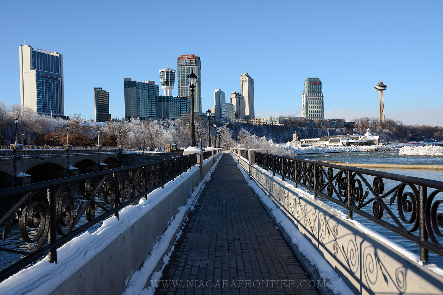
Work immediately began on the creation of the park. Gate houses were erected at each entrance into the park. The main entrance was located at the north end of the park. The gate house was named the Mowat Gate. The gate house at Dufferin Islands was called the Dufferin Gate. New roads were built and existing roads were straightened and widened. Entrance into the park was free however a toll for vehicles and pedestrians (50 cents and 10 cents respectively) was charged for those wishing to cross the Cedar Island Bridge in order to view the upper rapids or Dufferin Islands. Pre-existing buildings of a questionable nature were torn down. Saul Davis was allowed to continue to own and operate the Table Rock House and his Museum. Davis also continue to operate the "Behind the Sheet" attraction until 1888. In 1889, a protective pipe railing was built along the edge of the gorge from the Table Rock to the new Suspension Bridge. In 1888, six fresh water fountains were built. The fountains were fed by spring water flowing from the glacial moraine above. The first washroom was a wooden structure built near Inspiration Point which was located 1000 feet north of the Davis Museum (Table Rock). The washroom drained into the gorge. In 1901, a new and much larger washroom facility was built. This washroom was fed by spring water which was utilized to flush the toilet to the river below.
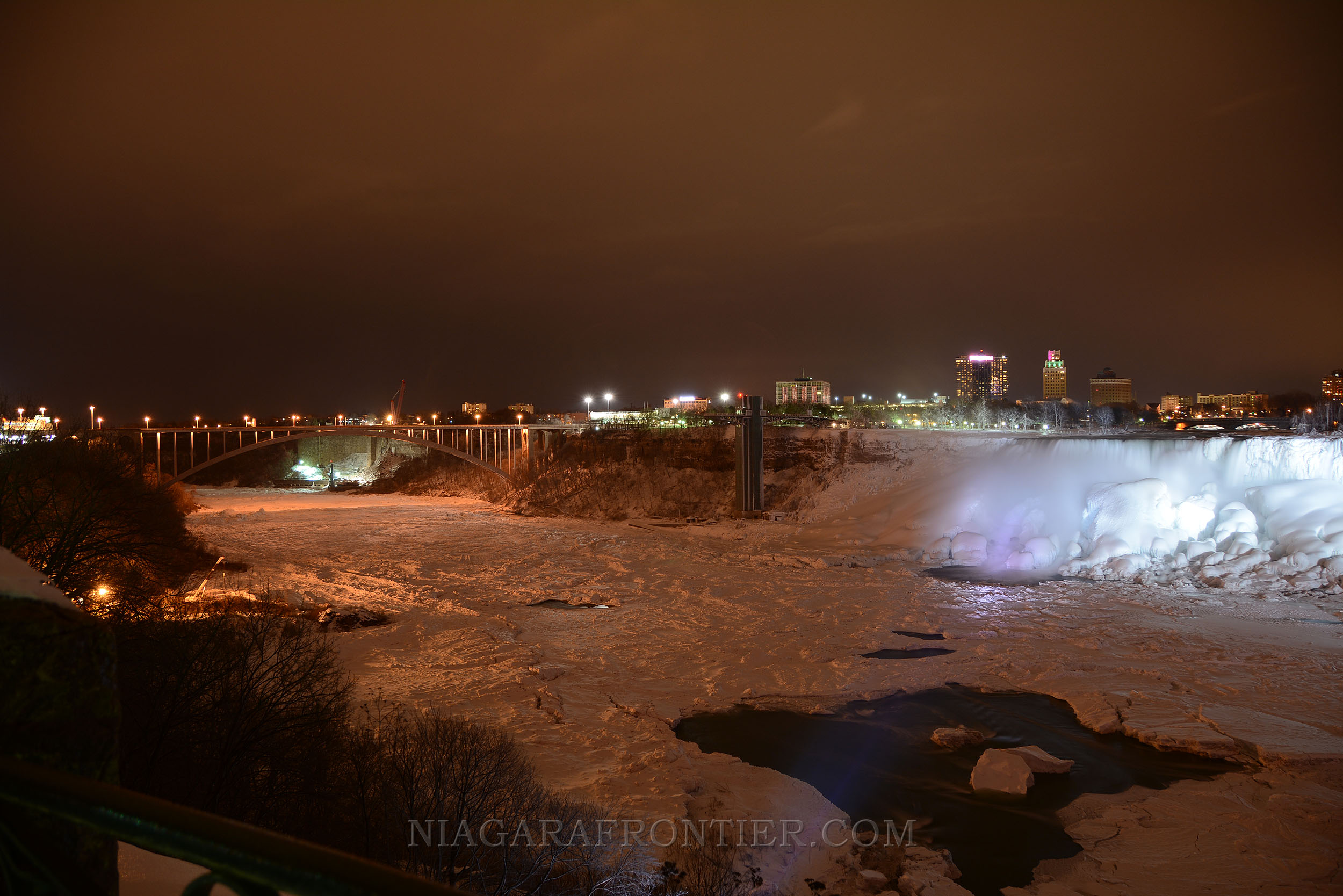
Great Gorge in Winter
Water & Ice
Financial Affairs
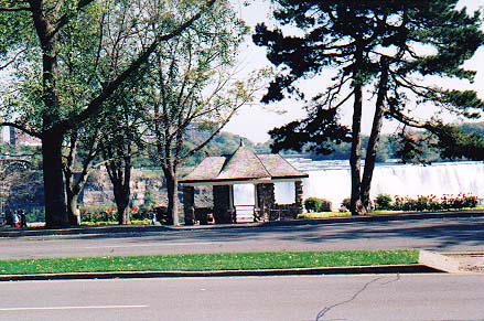
A view of Rambler's Rest Observation Building
The Queen Victoria Niagara Falls Park was created and designed to generate sufficient funds in order to pay for the cost of running the park and making improvements. The income revenue was considerably less than was expected. In order to compensate for this deficit and to generate new capital, the Queen Victoria Niagara Falls Park Commission decided to franchise facilities and attractions in order to generate income. On December 4th 1891, the first such source was the lease given to a private company to operate the Queenston to Chippawa Electric Railway. On May 24th 1893, the Niagara Falls Park and River Railway began operation between Queenston and Queen Victoria Park. In 1894, the track was doubled. A hydraulic lift was built to replace the Saul Davis' old stairway leading to the "Behind the Sheet" attraction. Guides were hired to assist tourists. In 1889, a lease was given to Samuel Barnett to operate a restaurant in the former Museum building. John Zybach was awarded a franchise for photographic rights a Table Rock. Zybach later joined J.T. Brundage in operating the "Behind the Sheet" attraction, hydraulic lift, museum, restaurant and photograph for a ten year period. The largest revenue source came from the leasing of the water rights along the Canadian shore for Hydro Electric Generation. Originally, American Companies were awarded leases to build power plants and generate hydro electric power before the creation of Ontario Hydro. The first power stations included the Ontario Power Company and the Toronto Power Company. Today the largest revenue source for the Niagara Parks continues to be through the generation of hydro electricity by Ontario Power Generation (Ontario Hydro). Since their meagre beginnings, the financial affairs of Niagara Parks Commission have evolved to where in 1997 it generated an annual gross income of $60 million dollars. Today the Niagara Parks Commission employs close to two thousand people and has an annual operating budget of $70 million dollars. The Commission is exempt from corporate income taxes under the Income Tax Act (Canada) and Ontario Corporation Tax Act. The Commission is also classified as an Other Government Organization by the Ministry of Finance and as such, the Commission’s audited financial statements are published as part of the Public Accounts. In 2010, the Commission posted an operating profit of $5.6 million. After depreciation and interest expenses were accounted for, NPC experienced a net loss of $3.7 million in 2010. This does not include the costs for maintenance and depreciation of the three decommissioned hydro generating facilities. When factored in, NPC realized a net loss of $9.2 million for the fiscal year. In 2010, the Niagara Parks spent $3.6 million dollars on marketing and promotions. In 2012, the Niagara Parks spent $1.9 million dollars on marketing and promotions. With 1,346 seasonal and 264 full-time staff, NPC was one of the Niagara Region’s largest employers, circulating $33.5 million back into the Niagara Region economy in payroll alone.
Changing Times
the Victoria Park Restaurant (the Refectory)
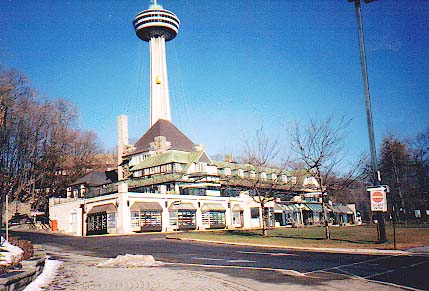
In 1888, the Table Rock tunnel was originally built. On May 24th,1893, the Chippawa to Queenston single track railway was officially opened to the public. The Railway was granted a forty year lease at a fee of $10,000 per year in order to generate money. A second track was laid in 1894. In 1894, the Niagara Parks Greenhouse was built. It is located opposite the Toronto Power Station a short distance South of the Horseshoe Falls. The Greenhouse remains in operation today and is open year round. In the early 1900's, Queen Victoria Park near the Horseshoe Falls was known as "The Front". This was an area where tourism and entrepreneurialism mixed together. This unfortunately resulted in numerous freak shows and other side shows springing up on the doorstep of the Falls of Niagara. Legislation was subsequently passed to restrict such activities. The area of River Road at the base of Clifton Hill has always been an area busy with tourists. The was in part because of the Falls View International Bridge located nearby. In the early 1900's, this was where the Frontier Amusement Park was located on a five acre parcel of land on which the Skyline Brock Hotel is now situated. The amusement park remained in operation until it closed because of financial difficulties in 1909. In 1904, the new Refectory Restaurant was built. In 1860, the original Refectory (Victoria Park Restaurant) was built. During its existence it served as Thomas Barnett's Museum. From 1889 to 1902, it was known as the Dufferin Cafe. In 1902, the Ontario Power Company needed the land where the Dufferin cafe was located. In 1904, the new Refectory Restaurant was built and remains in operation today. The name "Refectory" is the name for a room used for meals in a monastery. In 1907, the observation buildings at Ramblers Rest and Inspiration Point were rebuilt with stone. The Ramblers Rest building remains in use today. In 1908, electric incandescent lights were erected on existing trolley posts throughout the park. In 1916, tungsten lights replaced the incandescent lights. In 1908, government authority was received by the Niagara Parks Commission to begin its expansion along the shoreline of the Niagara River between Lake Erie and Lake Ontario through land expropriation. Construction of the Niagara Parkway began but it was created in well planned and designed segments. In 1912, the Niagara Parkway from Queen Victoria Park to Bridgeburg (currently known as Fort Erie) was completed. In 1914, the spring water reservoirs at Table Rock and the Refectory Restaurant were replaced. Spring water use was discontinued because of contamination. In 1915, the Niagara Parkway from Chippawa to Fort Erie was completed. In 1919, the Niagara Parks Commission took over control and operation of the Table Rock House. In 1920, the Queenston Heights Restaurant was built. It is located within Queenston Heights Park overlooking the beautiful lower Niagara River. The restaurant is open year round. In 1921, the Niagara Parkway from the Niagara River Whirlpool to the Niagara Glen was completed. In 1921, sanitary drinking fountains were installed in the park. In 1923, the Niagara Glen Restaurant was built. Today it functions as a souvenir shop and snack bar. It is open on a seasonal basis. In 1923, the Niagara Parkway had been extended to Queenston. In 1926, the Niagara Parks Commission Administration Building was built. Today it is located in Queen Victoria Park across from the American Falls and is home of the Niagara Parks Police. In 1926, the old Table Rock House was torn down. It was replaced by a new building located farther South. In 1926, the Refectory Restaurant was renovated. By 1931, the entire Niagara River Parkway from Lake Erie to Lake Ontario was completed. The original section of River Road was a toll road but those tolls were removed soon after when it was realized that the tolls were choking off access to other areas along the Niagara Parkway and tourism itself. On July 26th, 1936, the Niagara Parks School of Horticulture was established on a 200 acre site a short distance North of the Niagara Glen. Today the Niagara Parks Commission Botanical Gardens and School of Horticulture is world renown. In addition to its many thousands of assorted plant and tree species. It is also revered as a school for the budding student horticulturists. In the latter months of 1996, the Niagara Parks Commission opened a world class Butterfly Conservatory on the grounds of the gardens. The Botanical Gardens are open year round but is much prettier in Summer and Fall. The Butterfly Conservatory is open year round. In 1939, during World War II, Canadian Military Forces guarded all hydro electric power plants. Barbed wire barriers were laid so that the closest point that tourists could view the Falls from was the Refectory Restaurant. In 1945, the main Table Rock tunnel was replaced with a new tunnel. In 1948, The Princess Elizabeth Building was constructed. It was located along River Road opposite Clifton Hill. It was utilized as the ticket office for the Maid of the Mist as well as a souvenir shop and snack bar. It has been replaced by the new Maid of the Mist Complex. In 1952, the movie "Niagara" featuring Marilyn Monroe was filmed. In 1959, the Clifton Hill/River Road area underwent a rejuvenation when Louis Tussaud's English Wax Museum was built on Clifton Hill. Further development followed with the building of more attractions and motels in the area. Mr. Charles Augoperger, a lawyer from Buffalo, New York came to Niagara Falls with a dream of building an observation tower above the Falls. In July of 1962, the Seagram Tower ( currently known as the Minolta Tower) was opened to the public. At 325 feet above ground level and built on the top of the glacial moraine in the Falls View area, it was the then tallest structure around. In latter months of 1964, the Skylon Tower officially opened to the public. The Skylon Tower became (and currently still is) the tallest structure in Niagara Falls at 775 feet above the Niagara River basin. In 1966, the Niagara Parks Commission built an Incline Railway between the Table Rock at the edge of the Horseshoe Falls and the Falls View area above to the Seagram Tower (currently the Minolta Tower). The Falls View area is located on the top of the glacial moraine which borders the Western edge of the park. This made both area easily accessible. In 1985, the People Mover Transit System began operation. The Commission secured stimulus grant funding to renovate its heritage sites in the amount of $ 8,939,056 and as of October 31, 2011 all funds were utilized and the projects were complete. In 2012 the Commission received $ 4,000,000 in capital funding to renovate the Falls Incline Railway in order to make it more accessible to visitors. The Falls Incline Railway capital project was in progress as of October 31, 2012. The Commission entered into a capital funding agreement with the City of Niagara Falls to rehabilitate a bridge located on the Parkway that was in a state of disrepair and was also in progress as of October 31, 2012. There was also some additional funding received from the Province to complete some smaller capital works projects in 2012.
Journey Behind the Falls
Other Buildings & Developments
Between the Refectory Building and the Administration building was the Works Department building which housed a blacksmith shop. In 1901, a corrugated steel shed was added to the Works Department Building to accommodate visitors horses and carriages. In 1915, a detached frame building was erected next to the Works Department building. It served as the carpenter shop. In 1918, a paint shop was added. In 1956, the Works Department moved to its new quarters in a new building at the foot of Fraser Hill south of the Horseshoe Falls. In 1920, the fountain pond was renovated and lined with concrete. The island pond which preceded the development of Queen Victoria Park was fed by natural springs from the side of the moraine. Development of this aquatic garden began in 1911. Both picnic pavilions located north of the Refectory building were erected between 1905 and 1906. The pavilions were constructed of pipe frame with a corrugated steel roof and concrete floor. Each pavilion had cold and hot running water. From 1922 to 1923, tennis courts were laid out and a pond was constructed in the area of the Canadian Niagara Power Generating Station. In 1910, two bath houses were built at Dufferin Islands. In 1914, rustic shelters were built at Dufferin Islands. In 1907 and 1924, the bridges at Dufferin Islands were reconstructed and new islands constructed. In 1920, several of the cascades through the islands were shortened. In July 1931, the International Railway Company (the successor to the Niagara Falls Park and River Railway) was not renewing its operating contract following a span of forty-one years. On September 1st 1932, all of the International Railway Company's assets became the property of the Parks Commission and sold at auction for debt payment. The abandoned railway property allowed the Parks Commission to widen the length of River Road. Between 1935 and 1936, the Parks Commission made major improvements and renovations from Queen Victoria park to the Whirlpool. Improvements included removal of the railroad tracks and wooden ties. A stone retaining wall and walkway were installed along the route. In addition, buildings in poor shape near the Lower Arch Bridge were torn down. In 1937, the souvenir store at the Clifton Incline was replaced with a new larger and more modern building. In 1937, the new Clifton Gatehouse was completed. On July 24th 1948, new the Princess Elizabeth building opened. Tickets for the Clifton Incline and Maid of the Mist were available here for purchase.
Administration Building
The previous Administration building had been contained in a small brick cottage which had originally been used in connection with the private Butch Estate (previously the Zimmerman Estate). In 1907, the Administration Offices were moved into the Refectory Building. The cottage was converted into a headquarters building for the Niagara Parks Police (later known as Station #2) and public washrooms. The cottage stood until it was demolished in 1928. On May 25th 1959, the Niagara Parks Commission purchased the Oak Hall estate. This building became what is today the current administration offices of the Niagara Parks Commission.
A colour fountain in Queen Victoria Park
Waterworks
In 1899, the City of Niagara Falls with consent of the Parks Commission erected a new large waterworks plant in the vicinity of the Table Rock House. The original leased signed was for ten (10) years. When the agreement lapsed in September of 1909, the City of Niagara Falls Waterworks was allowed to continue to operate its Niagara Parks plant for the next twenty (20) years. In late 1926, the City of Niagara Falls Waterworks Commissioners proposed to the Niagara Parks Commission the building of a new modern water pumping and filtration plant at a new site south of Queen Victoria Park near Dufferin islands. The City of Niagara Falls Waterworks would ultimately choose to locate its new plant in Chippawa along the shores of the Welland River. On June 2nd 1930, the City of Niagara Falls waterworks department agreed to remove the waterworks plant from the Niagara Parks, although the old stone pump house was not demolished until 1937.
Queen Victoria Park looking north from Table Rock
Great Gorge Ice Bridge
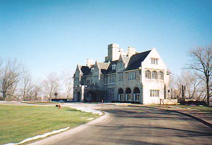
Oak Hall
a view of Oak Hall
Estate
Clark Hill was the original name of the beautiful estate situated on the high ground just north-west of Dufferin Islands. It is today known as Oak Hall and is the current administration offices of the Niagara Parks Commission. It was once the home of Colonel John Clark, who commanded the 2nd Lincoln Militia for the British during the War of 1812. The original house disappeared many years ago, but it stood well back from Portage Road amongst the many trees on the site near the present structure of Oak Hall. Colonel Clark occupied the home until his death in 1837. Following his death, the home was purchased by Samuel Street Junior. Mr. Street operated a mill along the banks below the moraine. This property formerly included Dufferin Islands as well. During his ownership, Mr. Street rebuilt the house and made many improvements to the property. The next owner, Mr. Sutherland Macklem, inherited a considerable portion of the Mr. Street property. Mr. Macklem made many more improvements to the grounds surrounding the islands. Macklem opened Dufferin Islands (formerly Cynthia Islands) to members of the general public. Dufferin Islands were later designated parklands under the fledgling Queen Victoria Niagara Falls Parks Commission. Soon after the death of Sutherland Macklem, his property was sold to James R. Smith on August 5th 1898. Mr. Smith was a wealthy lumber merchant from Tonawanda, New York. In 1904, Grace Grant inherited the property from her father James Smith. Grace was married to Doctor Harry Grant, a successful Buffalo oculist. Grace and her husband took up residence in the existing house. In 1916, the Grants sold the house and adjoining property to Walter H. Schoellkopf Sr. (1882-1955). On July 15th 1924, mining millionaire, Harry Oakes purchased the property from Walter H. Schoellkopf Sr.. Harry Oakes hired the architectural firm of Findlay and Foulis to design and build the Tudor style mansion. This is the same firm which designed and built the Table Rock House. This project took four years to complete. In 1928, Harry Oakes and his family moved into their rebuilt mansion which was situated on top of Clark Hill overlooking Dufferin Islands. The cost of this home exceeded $500,000. Mr. Oakes rebuilt this estate house to include thirty-five (35) rooms, seventeen (17) bathrooms and air conditioning throughout. It also included a swimming pool and a five hole golf course. Harry Oakes named his estate Oak Hall. In 1935, Harry Oakes and his family moved to Nassau in the Bahamas in order to avoid taxes. In 1943, Lady Eunice Oakes, deeded Oak Hall to the Government of Canada so that it be used as a convalescent hospital for the Royal Canadian Air Force. When there was no longer a need for the convalescent hospital, the Canadian Government deeded the property back to Lady Oakes. Sir Sydney Oakes, the eldest son moved back to Oak Hall with his wife, Lady Greta. They lived here for several years before returning back to the Bahamas. On May 25th 1959, the Niagara Parks Commission purchased the Oak Hall estate. Read more about the life and times of Harry Oakes.
Incline Railways
The Niagara Falls Queen Victoria Park Commission upon taking over the assets of the International Railway Company's in 1932, included two incline railways built to transport tourists up and down the gorge wall to provide access to the Niagara River below. The incline railways were as a result of a December 1891 agreement with the Parks Commission, that allowed the International Railway Company to build and operate incline railways and elevators and where necessary to acquire those which already existed through terms fixed by an arbitrator. The first incline to be built was the Whirlpool Rapids Incline. The incline had a building for offices and a store at the top of the gorge along with a drive shed. At the bottom of the gorge was a wooden promenade which paralleled the Whirlpool Rapids. At each end of this boardwalk was a framed building. This incline predated the creation of Queen Victoria Park. The second incline railway was built in 1894 at the bottom of Clifton Hill. The International Railway Company had negotiated to build this incline with the Parks Commission in 1891. The incline was built to the north of the Maid of the Mist Boat landing. The International Railway Company (IRC) operated and maintained both incline railways until 1932, when property rights to both were assumed by the Niagara Parks Commission. On May 5th 1934, the Whirlpool Rapids Incline was destroyed by fire. In 1935, a lease was granted to Robertson Engineering & Construction Company for the building and operation of an elevator at the site of the former Whirlpool Rapids Incline. The new elevator began operation in 1937.
Whirlpool Golf Course
In 1947, the 18 hole Whirlpool Golf Course began operation. This public golf course owned and operated by the Niagara Parks is 150 acres in size.
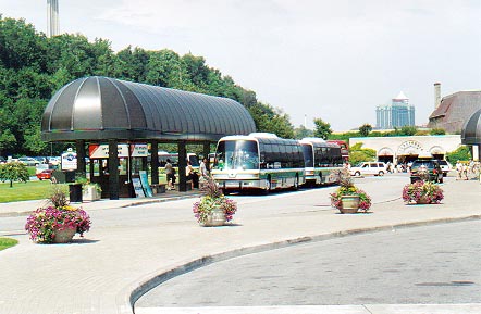
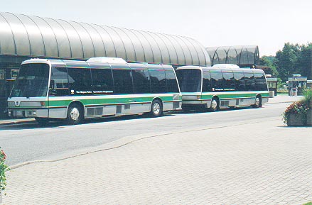
People Mover Transit System
the People Mover Transit Bus at the Table Rock Station
Many years ago, parking was allowed along both sides of Queen Victoria Park near the Falls. This resulted in traffic gridlock and of course many angry outbursts and frayed nerves. In order to alleviate this seasonal problem and to make visiting all the Niagara Parks Commission tourist attractions a pleasant experience, all roadside parking in Queen Victoria Park has been prohibited. Instead, the Niagara Parks Commission built a massive parking lot along the Niagara Parkway, several miles (km) south of the Falls. This parking lot can be located almost directly opposite the Hydro Control Dam. The Niagara Parks Commission created the People Mover Transit System to shuttle visitors from the parking lot to all the tourist attractions along the Niagara Parks between Chippawa and Queenston. For a parking fee, all visitors are shuttled in futuristic and climate controlled comfort bus type vehicles. The fleet of quiet People Mover Vehicles are propelled by propane. The People Mover Vehicle operate at twenty minute intervals all day and evening. Visitors may ride this transit system as many times as they want and can get of or on at any tourist attraction along the way. Without a doubt, the PEOPLE MOVER is the best way to visit the Niagara Parks and its many attractions. A large parking lot is located directly opposite the Horseshoe Falls. A parking fee is charged. This price is subject to fluctuate according to traffic demand. Access to this parking lot is available at the Fraser Hill entrance which runs westerly from the Niagara Parkway just south of the Table Rock Pavilion. This lot is quite often full.....DON'T PANIC....just proceed to the Rapidsview Parking lot Finding parking space in tourist congested areas in other places throughout Niagara Falls may be difficult at times. Please be PATIENT & COURTEOUS. The full People Mover Transit System operates during the tourist season only (April 1st - October14th). During Winter months, a modified schedule is available. Tickets may be purchased along the 30 kilometer (19 mile) route at any of the many ticket booths set up at various stops along the way. In 2012, a new and modern bus transportation system called "WEGO" was introduced and takes the place of the former People Mover system. The WEGO bus system operates along the same previously established routes along the Niagara Parks but is also connected to the transit system operated by the City of Niagara Falls. The new system was developed through major financial grants from the Province of Ontario and Canadian Government.
The People Mover Transit Bus at Table Rock
Other exciting Niagara Parks Commission sites to visit include:
To Learn more about the attractions available throughout the Niagara Parks and prices of admission visit:
Date last updated:
March 05, 2014
THANK YOU FOR VISITING
NIAGARA PARKS
|
||||||||||

