The Niagara Parks Commission
Dufferin Islands
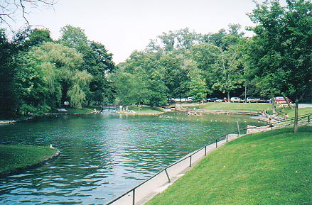
A view of Dufferin Islands Nature Area in Summer
Dufferin Islands are located approximately ½ mile (800m) upriver from the Horseshoe Falls along the banks of the Niagara River.
Dufferin Islands are part of an embayment cut into the debris left behind from the last Wisconsin Glacier fifty (50) thousand years ago. Dufferin Islands were formed from the following causes:
1) The strongest current of the Niagara River hugs the Canadian shoreline and causes rapid erosion.
2) The rock shelf of the Niagara River above the Horseshoe Falls which causes the water cascades, tilts approximately 6 meters (20 feet) in 1.5 kilometers (1 mile) towards the Canadian shore. This action forces water directly into the area of Dufferin Islands.
As a result, Dufferin Islands were formed. Dufferin Islands consists of four small islands.
In 1794, a saw and grist mill was built on Dufferin Islands in order to utilize the fast moving waters flowing around the islands to propel a water wheel.
A sizable natural gas well was discovered on the shore line of Dufferin Islands. Rising gas could be seen bubbling to the surface of the water. A unknown person realized that this discovery had the potential to attract tourists. As a result, a barrel with a pipe protruding from the top was placed over the gas rising to the surface. A cork was then placed into the pipe to allow the gas to build up. When an audience had arrived to see this advertised spectacle, the cork was removed and the gas ignited beginning "the Burning Spring" - Niagara's first tourist attraction. The "Burning Spring" continued as a tourist attraction until the formation of Queen Victoria Park in 1888.
The Islands, formerly known as Cynthia Islands and Clark Hill Islands remained privately owned until 1886. After being purchased by the Province of Ontario during the creation of Queen Victoria Park, the islands were renamed Dufferin Islands after the then Canadian Governor-General, the Earl of Dufferin.
Today, Dufferin Islands are maintained by the Niagara Parks Commission as a beautiful and quiet nature area which consists of four inter-laced islands with walking paths connected together by bridges. In the summer, a nature and picnic area is maintained. The fast moving waters through Dufferin Islands have since been reduced drastically by the hydro-electric water diversion upstream. The water intake gates for the Ontario Hydro-Electric Power Plant are located along the Niagara River, south of the mouth of Dufferin Islands.
Dufferin Islands are open year round. Cost is free.
To learn more about Dufferin Islands visit the Origins of Niagara Falls
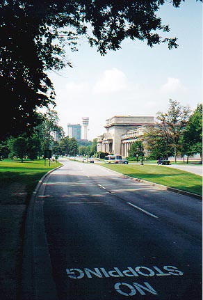
A view looking towards
Queen Victoria Park and the Falls of Niagara
with the Toronto Power House (right) and Minolta Tower (center)
| NIAGARA FALLS THUNDER ALLEY NAVIGATOR | ||
| SITE MAP | ||
Date last updated:
February 20, 2012
The preceding locations and facts about them are but a few of many famous sites & attractions to be found in Niagara Falls. The best of it is FREE to see...so think of Niagara Falls when planning your next vacation. If you have questions of a current or historical nature about the Niagara Falls area or suggestions feel free to
e-mail Rick at:
THANK YOU FOR VISITING THE
NIAGARA FALLS
DUFFERIN ISLANDS
PAGE