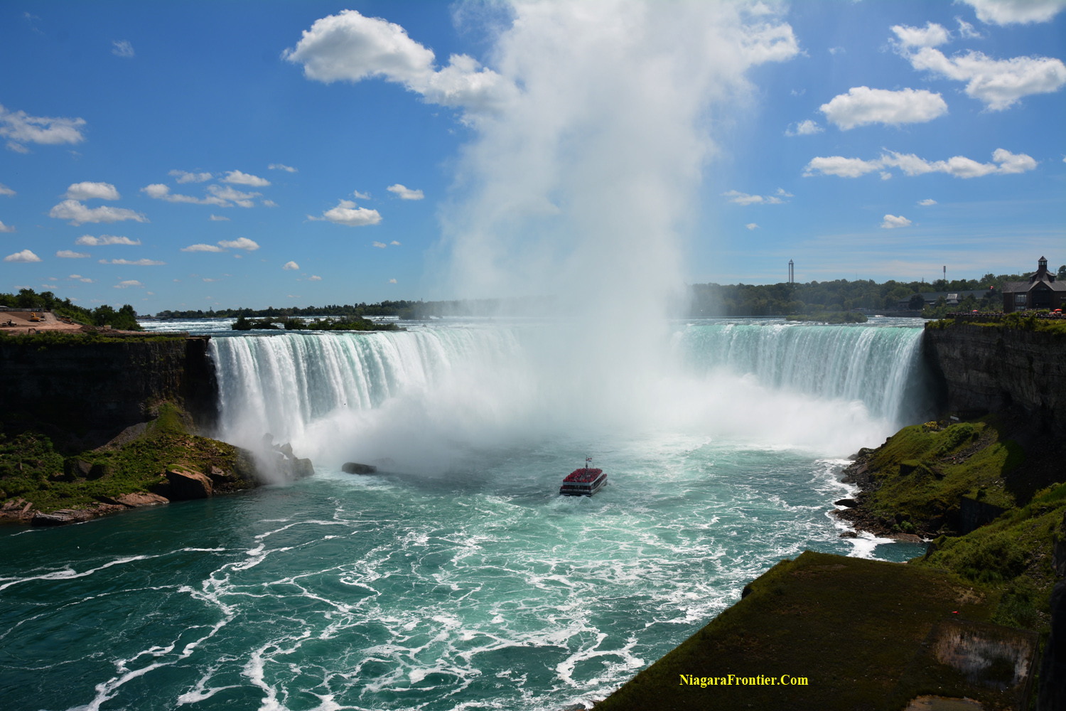
A GEOLOGICAL HISTORY
Last updated on September 14, 2022
You are invited to
journey back into time........460 Million Years Ago..........as the WIND, WATER and ICE
sculptured the land of Niagara into masterpiece of majesty and might giving birth to the
Falls of Niagara ICE AGE IN NIAGARA QUICK FACTS The ice thickness was estimated at 3,000 feet (914.4
meters). An ice thickness of 1,000 feet (304.8 meters) exerts a
pressure of 28 tons per square inch on the earth surface. If all the water from the last ice age were removed
today from sea level on a global basis - the water level would be
lowered by over 200 feet (60 meters). Rock layers from an oil well boring south of Niagara
Falls revealed rock layers to have a thickness of 3,000 feet (914.4
meters). The rock strata in Niagara that appears nearly flat
actually has a slight downward slope from north to south of about 20
feet to each mile (6 meters every 1.6 kilometers).
Ancient
Seas' of Niagara
Rocks
& Sedimentary Deposits Geography
of Niagara
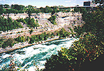
A view of
the rock strata along the Whirlpool Rapids section of the Niagara Gorge
The Niagara Region is located on a portion of a great plain which runs east to west from
the northern Laurentian Highlands (Canadian Shield) approximately 161 kilometers north of
Toronto, Ontario to the southern Allegheny Plateau which form the foothills of the
Adirondack Mountains and the Appalachian Mountains. The Niagara table land mass extends 100 kilometers (62
miles), both east and west from the Niagara River. This plain is a small part of the Great Lakes low lands
in which Lake Superior, Lake Michigan, Lake Huron, Lake Erie and Lake Ontario lie. The areas north and south of the Great Lakes low lands
are the high lands. Climate in Niagara has been similar to the current
weather patterns for the past 5,000 years. Today the Great Lakes hold twenty percent of the worlds
fresh water supply. Ninety-nine (99%) percent of this water is of glacial origin. The Niagara Peninsula is actually an isthmus. The Niagara Escarpment begins in Watertown New York,
USA and continues westerly along the Manitoulin Island in the Province of Ontario, Canada.
It continues through Wisconsin and Illinios. It is 1,609 kilometers in length and is the weathered
edge of a very ancient sea bottom. Throughout its length from Hamilton, Ontario to
Watertown, New York the escarpment ranges from 183 meters (600 feet) above sea level to
189 meters (620 feet) above sea level. The Niagara Escarpment is the ultimate reason the Falls
of Niagara was born. Without the escarpment, Niagara Falls may never have materialized.
After millions of years, the Niagara Escarpment continues to erode in a southward
direction. The Niagara Escarpment was formed and existed before
glaciations. The land that is now Southern Ontario emerged from the sea of the Paleozoic
Era at least 245 million years ago or more. The Ordovician and the Silurian rocks of the Niagara
Escarpment are of the oldest found in Niagara dating back to 430 - 415 million years ago. The escarpment is not a fault
line or a rift line but was created through erosion. It is a "cuesta". To understand the age of the Niagara Escarpment
consider the following time line: TIMELINE YEARS
AGO Five kilometers west of Lewiston, New York, the
escarpment is so steep that it rises 73meters ( 240 feet) in 0.4 kilometers (1/4 mile). The eastern portion of the Niagara Escarpment is higher
than in the west. The escarpment at Watertown, New York is 147 meters (483 feet) above sea
level. The ancient uplift and rising crust of the land in the
eastern portion of North America is quite noticeable. Only in Niagara can one find a gravel beach 147 meters
(483 feet) above the nearest body of water. A smaller Onondaga Escarpment runs east - west is
located along the northern shoreline of Lake Erie. Consisting of Onondaga limestone cap
rock, this escarpment runs through Buffalo, New York and Fort Erie, Ontario. This
escarpment is most noticeable east of Buffalo, however rarely rises more than 10 meters. Substantial breaks in the
Onondaga Escarpment have
allowed Lake Erie waters to flow into the low lands of the Wainfleet Marsh 10,500 - 11,000
years ago and again 4,000 - 5,000 years ago during periods of time when the water level in
the Erie Basin was much higher from the influx of waters from glacial Lake Agassiz. Other physical breaks in this escarpment can be found
at Lowbanks and Highway #58 in Port Colborne. Between the Niagara Escarpment and the
Onondaga
Escarpment is a relatively flat and poorly drained lowland called the Tonawanda plain.
A view of
the rock strata along the Niagara Gorge Eons ago, the Niagara area the bottom of an ancient
tropical salt water sea. Ancient specimens are being found today deep under the soils of
Niagara that are still today found at the bottom of our great oceans. Approximately 65 million years ago at the end of the
Cretaceous and the beginning of the Tertiary periods, scientists claim that a giant
asteroid collided with the Earth in the area of the Yucatan Peninsula of Mexico. This
collision resulted in a massive amount of debris being propelled into the atmosphere on a
world wide scale which caused a catastrophic change in the climate and led to the
extinction of the dinosaur and many other life forms. This event continues to be re-examined and debated and
will continue to be debated well into the future, however there is little doubt that the
climate made a dramatic change to an era of the Ice Age.
A view of
the rock strata along the Niagara Gorge The early Wisconsin Glacier covered the Niagara
District and most of the northern North America 65,000 years ago. This glacier remained
for a period of approximately 15,000 years before retreating 50,000 years ago. The middle Wisconsin Glacier advanced again over the
Niagara District 40,000 years ago. It remained for approximately 8,000 years before
retreating 32,000 years ago. The late Wisconsin Glacier advanced again 20,000 years
ago. It remained for approximately 8,000 years before beginning its final retreat 12,000
years ago. The plain of the lowest beach was 122 - 153 meters (400
- 500 feet) above present Lake Ontario (Lake Iroquois). As the Glacier retreated, the water levels slowly
lowered forming four lakes: As the late Wisconsin Glacier retreated northward, it
created several outlets: An outlet from Lake Algonquin (Lake
Huron) to Lake Iroquois (Lake Ontario) During the period of
glaciations and shortly afterwards,
the climate in Niagara was arctic. Vegetation was tundra and arctic fauna. The depth of Lake Iroquois was much lower initially
when Iroquois beach was created. The shoreline of Lake Iroquois was carbon dated at 12,000
years old with a degree of accuracy of plus or minus 450 years. During the life of Lake Iroquois the northern shore
rebounded at a greater amount than the southern shore. This resulted in the water levels
continually rising along the southern shore causing increased erosion along the edge of
the Niagara Peninsula. Lake Iroquois was a pro-glacial lake. The northern
shore of this lake was the southern edge of the retreating glacier. The waters of glacial Lake Iroquois were held back by
the ice of the giant glacier which lay across the St. Lawrence valley to the east. The
only outlet for this lake was at Rome and Utica, New York where the water exited to the
ocean through the Mohawk and Hudson River Valley. Later this route shifted to a route north of the
Adirondacks through the Champlain Valley. When this happened, the water level in Lake
Iroquois dropped 15 meters (50 feet). When the Wisconsin Glacier had retreated north of
the St. Lawrence Valley, Lake Iroquois's water level dropped to within several years to
sea level. Over the past ten thousand years, the lake water level
has risen to its present level as the eastern end of current Lake Ontario continues its
post glacial rebound uplift. During the past 100 years, the post glacial rebound at
the eastern end of Lake Ontario has resulted in the water level at the western end of this
lake to rise 0.3 meters. As the glacier retreated northward, a lower water
outlet was created at Rome, New York which resulted in the rapid draining of Lake Lundy.
For a very long time after the glacier retreated, it held back the melt waters to such a
great level that the Niagara Peninsula and Escarpment were covered by a large lake (Lake
Ontario, Lake Huron and Lake Erie were one). With the retreat of the glacier, the rising land
separated both Lake Ontario and Lake Erie
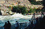
A view of an infant gorge along
the face of the Niagara Gorge Although large in area, it was shallow. The water along
the eastern shore at Rochester, New York was only four feet deep. At first Lake Tonawanda's only water outlet was the
same as Lake Lundy, at Rome New York. Rising land in the east cut off this outlet, forcing
waters to seek other outlets. Lake Tonawanda had five water outlets over the 644
kilometer (400 mile) Niagara Escarpment. These outlets were located in Holley New York,
Medina New York, Gasport New York, Lockport New York and Lewiston New York. Only the outlet to become the main spillway was at
Queenston - Lewiston. Here the draining waters flowed over the Niagara Escarpment. It is
here where the water falls of Niagara were born. This water course continues to be the
main outlet which exists today. Lake Erie was still very large and the width of the
Niagara River was much wider than it is today. The entire area where the Falls are today
was under water. The water depth was 9 - 12 meters (30 -40 feet). The slope (glacial
moraine) on the west edge of Queen Victoria Park (on top of which the Skylon Tower and
Minolta Tower are now situated) was a river bank about 12,000 years ago before the gorge
was created. The retreating glacier was the cause of the reduction
in size of this much wider and much deeper glacial river known as the St. David's River
into what is now a smaller and shallower river known as the Niagara River. As the glacier retreated north, the water followed to
the much lower land recently uncovered. This caused the draining of the Lake Erie basin
and Lake Tonawanda. As these waters drained, the river became much smaller resulting in
the uncovering of land such as Niagara Falls, New York. Also uncovered was the present
Grand Island and Three Sisters Islands and Queen Victoria Park in Niagara Falls, Ontario.
A view of Roy Terrace - the birth
site of Niagara Falls The Niagara River began to flow from the Lake Erie
basin through Lake Tonawanda and down the present path of the river to the escarpment. The site of the birth of Niagara Falls was discovered
by a geologist named Doctor Roy Spencer and today this site is known as "Roy
Terrace". The flow rate of water back then was only twenty-five
percent of the present flow rate. Scientists have calculated that the volume of water
flowing over the Falls initially was 37,500 cubic feet per second. Scientists have suggested that the eastern part of the
North American continent is still in the process of tilting as part of the glacial reflex
action. As the crust of the earth rises along the eastern seaboard the water flowing from
the Great Lakes system will become slower. The beginning of the last glacial retreat began 12,000
years ago. The third and last Wisconsin Glacier retreated east of Hudson Bay in Labrador.
As the glacier retreated, the land began to rise. The crust of earth rocks are elastic
when bent over large sections.
When the Falls of Niagara eroded the gorge back to the
present day Thompson Point (where the Spanish Aero Car and the Whirlpool is located), the
river found erosion of the rock much easier. The Niagara River broke through a rock barrier which
held back glacial debris which had been previously filled into what was the ancient gorge
of the St. David's River. The waters of the Niagara River quickly flushed this area of all
the glacial debris (what is today the Whirlpool) and changed direction to follow the
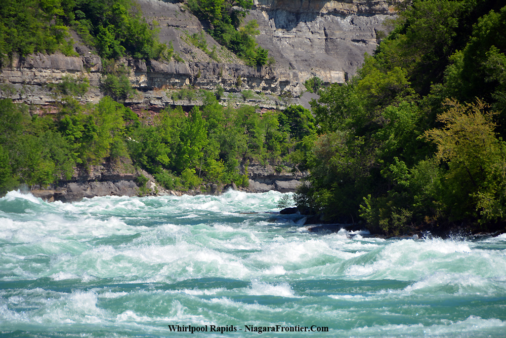
ancient gorge a short distance in a southward direction. It is believed that the Whirlpool Rapids Gorge which
extended southward to the present Michigan Central Railroad Bridge, had also been carved
from the rock from the ancient St. David's River which was also responsible for the
carving out of the now filled in St. David's buried gorge. The ancient Whirlpool Rapids gorge was 38 meters (125
feet) wide. During the advance of the late Wisconsin Glacier the ancient Whirlpool gorge
and the St. David's gorge were filled with glacial debris. At one moment in time, the ancient river did not make a
dog leg turn at the Whirlpool but rather followed a relative straight line via the St.
David's Gorge through the present Village of St. David's to the shore of Lake Iroquois
(Lake Ontario). The St. David's buried gorge existed 22,800 years ago.
It was a small portion of an ancient drainage system which extended the width of the
Niagara Peninsula from Low Banks at Lake Warren (Lake Erie) to St. Catharines at Lake
Iroquois (Lake Ontario). The St. David's Buried Gorge was found to be 1219
meters (4000 feet) long and 305 meters (1000 feet ) wide at the Whirlpool. The gorge was
91 meters (300 feet) deep. This gorge was 200 feet (60 meters) deeper that the current
floor of Lake Ontario. The gorge extends into Lake Ontario 2.4 kilometers (1.5 miles) west
of the present Niagara River. When Ontario Hydro was building the intake water
tunnels to feed the Sir Adam Beck Hydro-Electric power plant, it was forced to bring the
tunnels to the surface while crossing the St. David's Buried Gorge because they could not
bore into the glacial debris. Instead they had to build concrete flumes on each side of
this crossing to prevent water from being siphoned away through the buried gorge. In 1998, the Niagara Parks Commission
remodeled a
portion of the Niagara Parks Golf Course nearest Whirlpool Road. This project consisted of
the removal of the second hole and the installation of a large pond. This area of the golf
course was built on top of an area of the St. David's Buried Gorge known as Bowman's
Ravine. The ravine had previously been used by the Canadian Niagara Power Company as a
dumping area for rock debris taken from the wheel-pit excavation. When the unlined pond which when filled with water, the
water immediately leached away into the glacial debris of the buried gorge. This pond
needed to be fitted with a liner to hold the water within the confines of the pond. This is the site of the Falls of Niagara 6,000 - 7,000
years ago. The water falls at this point was 37 meters (120 feet) to the water pool below.
Here also existed an ancient island similar in size to
the present Goat Island. Water flowed around both sides of this island before falling over
the edge of the Wintergreen Flats to the water below resulting in two separate water
falls. The dual falls continued until the main gorge to the east eroded back far enough
past the beginning of the island effectively cutting off the secondary flow to the west of
the island. The Falls of Niagara became a single Falls once again. Today the remnants of the ancient island lay below the
Wintergreen Flats in two identifiable terraces. They are: Fosters Flats is the portion
of the Niagara Glen closest to the river. The word "glen" is a Scottish word for a
steep sided narrow valley. Read more about
the Niagara Glen After the Niagara River eroded the Niagara Gorge beyond
Devils Hole, the waters of Lake Tonawanda was still draining. One of the secondary outlets
was at Devils Hole where a water falls created a ravine perpendicular to the wall of the
Niagara Gorge. The flow of Lake Tonawanda diminished before this
infant gorge could establish itself. Read more about
Devil's Hole.
In 1841, Charles Lyell, a British scientist and a
father of modern geology came to Niagara Falls. From observations of the rocks at the
Falls and along the Niagara River, Lyell was able to demonstrate beyond a doubt that the
cascading waters had eroded the gorge from the edge of the escarpment at Queenston -
Lewiston to its present location. Lyell's conclusions were supported by an equally
distinguished pioneer American geologist, James Hall. His independent studies for the
State of New York included the first accurate survey of the rim of the falls to establish
a basis for measuring the rate of recession. The slowing of the erosion rate is caused by two major
factors: 1) the erosion resistant limestone
cap rock the Falls of
Niagara have been flowing over. This limestone layer began approximately ½ kilometer
north of the Rainbow Bridge. As the Falls erode southward, the erosion rate will increase
when it reaches Navy Island where the Falls reach a softer layer of rock. 2) the development of hydro electric generating plants
along the shoreline of the Niagara River have vastly reduced the rate of water flow
through water diversion. Read more about the
Niagara River Water Diversion
Treaty There was a single water falls 800 - 600 years ago. The
separation of the water falls into the two current water falls: the American &
Horseshoe Falls is remarkably new in terms of its 12,000 year history. The crest line of water falls was relatively straight
until after 1775 when the Horseshoe shape began to form. Two thousand (2,000) years ago, the crest line of the
Falls was located north of the current Rainbow Bridge. Four thousand - five hundred (4,500) years ago, the
crest line of the Falls was located north of the current Whirlpool Bridge. The shape of the crest line determines its stability.
The uniform Horseshoe shape of the crest line of the Falls provides greater stability. The deepest plunge pools are carved out when the crest
line of the Falls is relatively stable. The American Falls has no regular mode of collapse. The
present amount of water flowing over the American Falls is insufficient to erode the
Irondequoit Dolostone (limestone) talus at the base of the Falls. The rock surface reaches its maximum at Hubbard Point
(along Canadian side of gorge). This point is known as the Lyell / Johnson Ridge. Stress measurements taken near the
crest of the American Falls measured 870 pounds per square inch parallel to the Niagara
Gorge. Tensional forces measured near the crest of the American Falls equaled 300 pounds
per square inch acting perpendicular to the gorge. A core sample taken from the bed of the
American Falls reached the level of Queenston Shale at the depth of 359.2 feet. In 1972, remedial work was conducted at the Bridal Veil
Falls and Luna Island. This included the installation of steel dowel bolts and cable
tendons. In addition a series of holes were drilled to relieve hydrostatic pressure. m/yr. = meters per year (average)
ACTUAL RATES OF EROSION
HORSESHOE FALLS
The decrease in the recession rate of the
Horseshoe Falls is related to the reduction of the river
discharge over the Falls because of water diversion
upriver for hydro generation and the increase in the
waterfall lip length, whereas that of the American Falls
is solely due to the reduction in water flow volume.
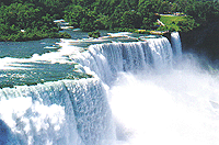
The jagged edge of the American Falls
Niagara Falls is the jewel of
geological history in the Niagara District. Did you ever wonder; How old is Niagara Falls?
How did the Falls begin? What is the Niagara Escarpment? What is the Whirlpool?
Table of Contents
Geography of Niagara
Niagara Escarpment
Onondaga Escarpment
The Wisconsin Glacier in Niagara
Glacial Lake Iroquois
Glacial Lake Lundy
Glacial Lake Tonawanda
The Birth of Niagara Falls
St. David's Buried Gorge
The Smeaton Ravine
The Niagara Glen Terraces
The Devils Hole Ravine
Erosion
Niagara River Drainage
The Fonthill Kame - Delta
Fossils
Future of Niagara Falls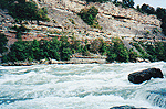
EVENT
430 - 415 million years ago
rocks of the Niagara
Escarpment
295 million years ago
Appalachian Mountains
225 - 83 million years ago
Triassic, Jurassic Period
(dinosaurs roam earth)
83 - 60 million years
dinosaurs extinct
1.5 million years ago
earliest man in Africa
14 thousand years ago
continental glaciers in
Northern Hemisphere at their maximum extension
14 - 12 thousand years ago
Wisconsin Glacier cover -
retreats
12 thousand years ago
Niagara Falls begins
12 - 11 thousand years ago
Lower Great Gorge
10 - 6 thousand years ago
Whirlpool Rapids Gorge
6 thousand years ago
modern Lake Erie
5 thousand years ago
Upper Great Gorge
The height of the Niagara Escarpment at Lewiston, New York is 76 meters (250 feet).
It is said that the Earth was created 4,600 million years ago. Ever since that time, the
forces of nature have been masterfully creating an artwork of ever changing landscape and
seascape known as Niagara.
the
Wisconsin Glacier in Niagara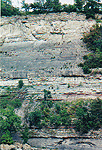
The Niagara Escarpment was covered with a sheet of ice 2 - 3 kilometers thick (Wisconsin
Glacier) 23,000 - 12,000 years ago.
The last glacial ice age occurred during three distinct periods of time during the past
65,000 years. The glacier originated east of Hudson Bay in northern Quebec and Labrador.
This great glacier was known as "the Wisconsin Glacier".
Glacial Lake Algonquin - ( area including Lake Superior, Lake
Michigan and Lake Huron)
Glacial Lake Warren - small (Lake Erie)
Glacial Lake Iroquois - small (Lake Ontario)
Glacial Lake Tonawanda - area western
New York
Glaciers ranged up to 4.8 kilometers (3 miles) thick. Ice at 1.2 kilometers (1 mile) thick
would exert a pressure of 150 tons per square foot. It is estimated that the weight of the
glacier depressed the earth 61 meters ( 200 feet). When the glacier retreated the land
began to rise in what is referred to as glacial rebound.
An outlet from Lake Algonquin (Lake Huron) through Lake Nippissing to the Ottawa Valley
An outlet from Lake Iroquois (Lake Ontario) through the Mohawk Valley (Rochester) to the
Hudson River
The rising of the lands from glacier rebound finally cut off these outlets with the
exception of the Niagara River.
Lake Iroquois (Lake Ontario) was nearly the same depth as Lake Warren (Lake Erie).
Following the retreat of the middle Wisconsin Glacier and ancient lake which occupied the
present Lake Ontario basin was created. This Lake was called Lake Lundy. After the waters
of Lake Lundy fell due to the reflex action of the land, it became a smaller lake named
Lake Iroquois.
Fifty thousand years ago, a broad glacier pressed over the Niagara Escarpment holding back
the melt waters to the South. This formed a large glacial lake named Lake Lundy.
caused from a spillway from former Lake Tonawanda
Glacial Lake Tonawanda was created with the retreat of the last Wisconsin Glacier. The
lake was located east of the Niagara River and covered most of the western New York area
to Rochester.
at the Niagara Escarpment (Queenston-Lewiston)
As the Glacier retreated, the upper Lakes began draining into the lower lakes at five to
six locations across the Niagara Escarpment. Twelve thousand years ago, the Niagara River
ultimately became the main water outlet over the Niagara Escarpment. The waters of a much
larger Lake Erie began to flow over the escarpment into a larger Lake Iroquois (Lake
Ontario).
At this time, the lake plain from Queenston to Niagara on the Lake was covered with the
waters of Lake Iroquois (Lake Ontario). The height of the lake was within 11 meters (35
feet) of the average level of the Niagara Escarpment at Queenston, Ontario.
The height of the initial Niagara Falls was only 11 meters (35 feet) as it flowed over the
Niagara Escarpment at Queenston to the waters of Lake Iroquois below. As the water flowed
over the escarpment to the water below, the water began eating through the glacial
material and the limestone rock of the Niagara Escarpment to begin the formation of the
Niagara Gorge.
As the Glacier continued receding further north, it opened silt barriers allowing waters
to drain to the ocean resulting in the lowering of the water levels of Lake Iroquois (Lake
Ontario).
The rising of the northern crust of the earth, a reflex action to the weight of a Glacier
a half a mile or more thick, caused a faster outpouring of Lake Iroquois (Lake Ontario).
The lower 11.2 kilometer (7 mile) stretch of the Niagara River to Lake Ontario was once 19
kilometers (12 miles) long.
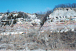
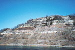
the
Whirlpool - St. David's Buried Gorge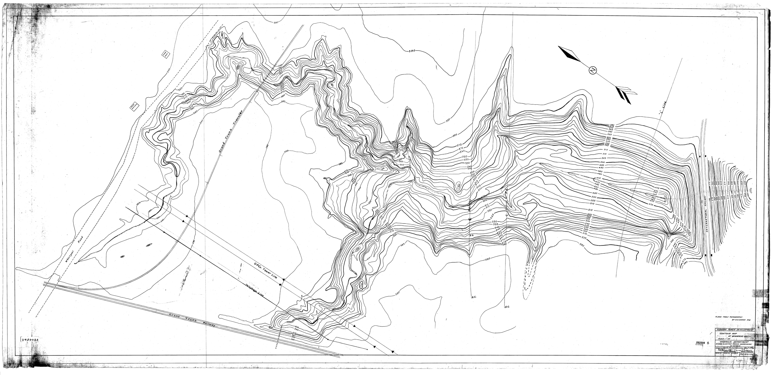
1918 Bowman's Ravine Topographic Chart
(before hydro canal project)
Courtesy of Scott Ensminger and Ontario Power Generation
The Whirlpool - St. David's Buried Gorge was a channel for an ancient river which existed
before the advance of the third Wisconsin Glacier. It is believed that this gorge was
buried in glacial silt during the retreat of this glacier 12,000 years ago and never
reopened.
The Smeaton's Ravine is located on the Canadian shoreline opposite the Ontario Hydro
Floral Clock. It is the site of an infant water falls that began cutting a small gorge
into the side of the existing Niagara Gorge. The gorge of Smeaton's Ravine measures 152
meters (500 feet) long and 46 meters (150 feet) wide. The water fall was only 40 feet to
the water below. The source of this water was of the then much wider version of the
Niagara River that had a small branch flowing in from the west adjacent to the Niagara
Gorge.
The Niagara Glen is today a favourite site for thousands of visitors each year. It is a
beautiful picnic area located on the top of the Wintergreen Flats and nature trails to the
river below are well marked and plentiful.
Wilson Terrace is the first level just below the Wintergreen Flats. This portion is the
steepest and most demanding physically.
Today, the speed of the water flow past the Niagara Glen is 40 kilometers/hr (25 mph).
Devils Hole Ravine is located along the American shoreline of the Niagara River Gorge just
north of the Niagara Glen. It is a deep, bowl shaped basin of the Bloody Run tributary from
Glacial Lake Tonawanda.
The name Bloody Run recalls the massacre of British soldiers by the Seneca Indians in
1763.
Niagara Falls has eroded 11.4 kilometers (7.1 miles) during the last 12,300 years.
In 1938, the deepest flow of water at the crest of the Horseshoe Falls was recorded at 7.6
meters (25 feet). Hydro diversion has reduced the water rate of flow.
Recession of the waterfall brought the Falls of Niagara to the brink of the bedrock sill
known as the Lyell / Johnson Ridge at Hubbard Point . The Lyell / Johnson Ridge was the
location where the cap rock reaches it maximum height above sea level. This is the location
the Falls of Niagara were at their highest. From this point the height of the Falls began
to diminish as the cap rock drops dramatically in a southward direction to the site of the
current location of the Falls.
The US Army Corps of Engineers uncovered a number of problems during
the 1969 de-watering of the American Falls. They were:
1. a complex system of joints in the Lockport Limestone cap rock was uncovered. The joints
were more numerous near the crest and reached vertically to shale level below increasing
likelihood of undermining.
2.Ground water seepage into the numerous joints increased the hydrostatic pressure as did
winter freezing forcing segments of the limestone to be forced further a part creating the
possibility of further fracturing of this cap rock layer.
3.Weathering and Erosion:
(a) falling and flowing water carry broken or weakened pieces of rock away.
(b) some of the mineral deposits of the Lockport Limestone are washed away when water
flushes through the fissures in the rock. These minerals which are normally used to
maintain the strength and resilience when absent speed the fracturing process.
(c) wetting and drying of Rochester Shale - tests show that after approximately ten (10)
such cycles, the Rochester shale will deteriorate naturally undermining the Lockport
Limestone cap rock.
(d) freezing and thawing repeatedly forcing rock to separate and break away.
(e) rock falls that occur expose more weakened and vulnerable rock layers.
Instruments were installed on Prospect Point, Luna Island and Terrapin Point to monitor
any future rock movements. Rock bolts, steel dowels and cable tendons were inserted in a
pattern at Luna Island and the Bridal Veil Falls to solidify and stabilize the rock as
much as possible. Drainage holes were drilled into the Limestone at the American Falls,
the Bridal Veil Falls and Terrapin Point to relieve the hydrostatic pressure. Now its up
to nature.
The rock talus at the base of the American Falls was left to the forces of nature. It was
decided that to remove the talus would be too expensive and create too much of an
artificial look. The water flowing over the American Falls is too little to erode the
talus so it will be there until the American Falls remains as it is.
PUBLISHED
RATES OF RECESSION OF NIAGARA FALLS
From
To
Interval
American Falls
Horseshoe Falls
1842
1875
33 years
0.23 m/yr.
0.61 - 1.34 m/yr.
1842
1890
48 years
0.20 m/yr.
0.66 m/yr.
1842
1905
63 years
very little
1.16-1.61 m/yr.
1842
1911
69 years
n/a
1.52 m/yr.
1875
1886
11 years
0.03 m/yr.
0.57 m/yr.
1875
1905
30 years
n/a
1.70-2.01 m/yr.
1886
1890
4 years
0.50 m/yr.
1.52 m/yr.
1905
1927
22 years
very little
0.70 m/yr.
DURATION
RECESSION RATE
SOURCE
1842-1875
1.2-1.3 metres per
year
3.9-4.2 feet per year
Gilbert, 1907
International Joint Commission, 1953
1875-1905
1.3-2.0 metres per
year
4.2-6.5 feet per year
Gilbert, 1907
International Joint Commission, 1953
1905-1927
0.98 metres per
year
3.2 feet per year
International
Joint Commission, 1953
1927-1950
0.67 metres per
year
2.19 feet per year
International
Joint Commission, 1953
1950-2000
0.1 metres per
year
0.32 feet per year
Tinkler, 1993,1994
Modern Era
0.1 metres per
year
0.32 feet per year
Tinkler, 1993,1994
AMERICAN FALLS
500 y-1905
0.098 metres per
year
0.32 feet per year
Gilbert, 1907
Modern Era
0.01 metres per
year
0.032 feet per year
Tinkler, 1993,1994
Accurate surveys of erosion of the Falls of Niagara began in 1842.
From 1842 to 1905, the average rate of erosion of the Horseshoe Falls was 1.16 meters (3.8 feet) per year.
From 1906 to 1927, this rate of erosion was reduced to .70 meters (2.3 feet) per year. This reduction coincided with the large quantity of water being diverted for hydro-electric generation.
In 1896, Thomas Martin wrote that the annual recession of the American Falls was 7½ inches per year and the Horseshoe Falls was 2.18 feet per year.
From 1842 to 1905, the average rate of erosion of the Horseshoe Falls was 1.16 meters (3.8 feet) per year.
From 1906 to 1927, this rate of erosion was reduced to .70 meters (2.3 feet) per year. This reduction coincided with the large quantity of water being diverted for hydro-electric generation.
The mean rate of erosion was 3.5 meters (5 feet) per year. Since 1942 the rate has been much slower.
Today, through increased water diversion and anti-erosion remedial steps, the rate of recession at the Horseshoe Falls has been reduced to a fraction of what it used to be. Today it is estimated that erosion of the Horseshoe Falls is less than one foot per year. In the future, through remedial efforts and further water diversion that the amount of erosion at the Horseshoe Falls has been projected to be reduced to approximately 1 foot every 10 years.
Today, erosion of the American Falls is estimated at 3 - 4 inches every 10 years. The water flow which is regulated at a minimum level of 10% of the estimated 100,000 cubic feet per second during the summer (50,000 cubic feet per second during winter) is insufficient to cause major erosion.
Niagara River Drainage
The Niagara River drains an area of 254,708 square miles (409,901.5 square kilometers) including the Upper Great Lakes.
The surface area of Lake Erie is 9,910 square miles (25,655 square kilometers). It is the shallowest of all the Great Lakes, averaging 60 feet (18.29m) in depth.
The levels of the Great Lakes vary on an annual basis in relation to season, rainfall, evaporation and runoff. The highest water levels are found in mid-summer and the lowest water levels are found in mid-winter.
The internal time required for an increase supply of water to show its effect upon the level of Lake Erie is approximately 76 days.
The internal time required for a decrease in the supply of water to show its effect upon the level of Lake Erie is approximately 132 days.
The extreme variation of water levels in Lake Erie:
greatest variation between 1860 and
1907 was 3.89 feet
maximum one year range occurred in 1892 was 2.28 feet
minimum one year range occurred in 1895 was .87 feet
annual average Lake Erie level variation is 1.56 feet
A variation in the level of Lake Erie of one foot at Buffalo, New York equates to a difference in the rate of water flow discharge from Lake Erie into the Niagara River of 20,000 to 25,000 cubic feet per second.
During storms, the water level of Lake Erie at each end may vary as much as fifteen feet.
The average annual rainfall in the Great Lakes equals 36 inches. The average annual evaporation rate in the Great Lakes equals 24 inches.
The water discharge of the Niagara River has been determined by measurements taken at the International Railway Bridge at Buffalo/Ft. Erie (1,800 feet south of Lake Erie). Measurements began in 1897 the engineering staff of the U.S. Great Lakes Survey.
The maximum monthly mean discharge of 257,000 cubic feet of water per second from Lake Erie occurred in March of 1896. This was equivalent to the entire surface of Lake Erie to a depth of 2.44 feet.
The average discharge of the Niagara River between 1860 and 1907 equaled 212,000 cubic feet of water per second.
Between 1860 and 1907, the greatest excess average for any month occurred in June of 1876 at 45,000 cubic feet of water per second or an increase in water flow of 21% (refer to maximum mean discharge).
The greatest average in excess water flow in any one year occurred in 1876 at 26,000 cubic feet of water per second or an increase of 12%.
The greatest water flow deficiency average for any month was March of 1896 at 43,500 cubic feet of water per seconds or a decrease of 21%.
The greatest water flow deficiency in any year occurred in 1895 at 31,800 cubic feet of water per second or a decrease of 15%.
In September 1999, Lake Erie's water level was at 571.19 feet (174.10m) above sea level. This was 4.3 inches (11 cm) below the long term average. Lake Erie's water level was the lowest that has been recorded since 1967.
In February 2000, Lake Erie water level was at 570.08 feet (173.76 m) above sea level. This was 9 inches (23 cm) below the February long term average. Lake Erie's water level was the lowest that has been recorded since 1967.
Summer of 1999 Great Lakes water levels were 16-24 inches (40-60 cm) below those levels recorded in 1998.
In flow water rates from Lake Erie into the Niagara River have been recorded as follows:
Sept. 1999 - Feb.2000 = average
173,400 cubic feet per second
March - August 1999 = average 186,100 cubic feet per second
1900 - 1989
= average
191,800 cubic feet per second
The water out flow rates of the Niagara River at Queenston are as follows:
Sept.1999 - Feb.2000 = 184,000
cubic feet per second (greatest one month average = 188,930 cf/s)
March - August 1999 = 200,660 cubic feet per second (greatest one month average = 207,610
cf/s)
March - August 1998 = 244,620 cubic feet per second (greatest one month average = 256,000
cf/s)
Lake Erie Precipitation Rates are as follows:
Sept.1999 - Feb.2000 = 15.8 inches
(40.2 cm) of rain
March - August 1999 = 15.9 inches (40.3 cm) of rain
1900 - 1995
= 19.1
inches (48.5 cm) of rain
Approximately ten thousand - five hundred (10,500) years ago, the water level of Lake Erie rose 3 - 4 meters above its present water level. At this time the Upper Great Lakes drained through North Bay and the Mattawa River, to the Ottawa River to the St Lawrence River Valley. This resulted in the water drainage through the Niagara River being reduced to only one tenth (1/10) of its present flow (representing only the drainage of Lake Erie). The reduction of water flow through the Niagara River continued for approximately six thousand - five hundred (6,500) years before the drainage route returned to its previous course through the Niagara River.
This water reduction through the Niagara River correlates to the narrowness of the Niagara River Gorge.
Isostatic rebound had lifted the land surrounding North Bay cutting off the out flow of water from the Nipissing Lakes (Upper Great Lakes). The rising waters on the southern shores of Lake Huron breached the Lake Huron moraine and discharged the entire flow into the Lake Erie basin. This new direction of flow was initially shared with an exit at the southern shore of current Lake Michigan. Over several hundred years, the water level of the Lake Erie Basin rose 3 - 4 meters increasing the flow through the Niagara River. This increased flow caused the rapid recession of the Falls of Niagara through the gorge south of the current Niagara Glen.
Glacial Lake Agassiz had a great influence on the Lake Erie basin.
Eleven thousand (11,000) years ago, pro-glacial Lake Aggassiz initially drained southward over a divide into the Mississippi River basin. As the divide rose from isostatic rebound, the entire flow of the Upper Great Lakes flowed into the Lake Erie basin through the Niagara River.
The increased flow into Lake Erie caused water levels to rise in the basin up to five (5) meters. Water levels of Lake Tonawanda increased accordingly.
Today, the winds can cause the water level in Lake Erie to rise 2 - 5 meters in several hours. Lake Erie is the shallowest of the Great Lakes with an average depth of sixty (60) feet.
A view of rock strata of the Whirlpool Gorge
above the Whirlpool Rapids
The average flow of water through the Niagara River equals 212,000 cubic feet of water per second, falling a distance of 325 feet from Lake Erie to Lake Ontario would yield a potential 8 million horsepower or 5,965,600 kilowatts.
The difference in elevation from Lake Erie to the base of the Falls of Niagara is a fall of approximately 226 feet.
The difference in elevation from the head of the upper rapids to the base of the Falls is a fall of 212 feet.
The difference in elevation from the Whirlpool Rapids to the mouth of the Niagara Gorge is a fall of 94.5 feet.
The difference in elevation from the head of the gorge (base of Horseshoe Falls) to Fosters Flats at the Niagara Glen is a fall of 78.5 feet.
The Ontario Hydro (Ontario Power Company) Generating Station at the base of the Horseshoe Falls operates under a normal head of 180 feet, utilizing only 85% of the available height of 212 feet.
.075 cubic feet of water per second = 1 horsepower
1 cubic foot of water dropping 170 feet = 25 horsepower
1 cubic foot of water dropping 1 foot = 0.147 horsepower
1 cubic foot of water = 59.5 pounds
A water discharge of 168,000 cubic feet per second falling 212 feet would yield 2,250,000 horsepower.
A horsepower is equivalent to 33,000 foot/pounds per minute or 550 foot/pounds per second.
In 1894 the average flow of water through the Niagara River was 270,000 cubic feet per second = 1,000,000,000 pounds per minute:
61.7 pounds per cubic foot of water X
60 seconds =
3,702 pounds per minute X 270,000 cubic feet of water =
999,540,000 pounds per minute
multiply by height of Falls (161 feet) = 160,925,940,000
divide by 33,000 = 4,876,543.6 Horsepower
Horsepower is a unit of power in the English system of units. It is equal to 33,000 foot pounds per minute or 550 foot pounds per second or approximately 746 watts. The term horsepower originated with James Watt, who determined by experiment that a horse could do 33,000 foot-pounds of work a minute in drawing coal from a coal pit.
To convert horsepower to watts (multiply by 745.7)
To convert kilowatts to horsepower (multiply by 1.341)
During the daytime between April 1st and October 31st each year, 100,000 cubic feet of water flow over the Falls of Niagara. Water diversion for Hydro generation is maintained at 112,000 cubic feet of water per second.
During the night between April 1st and October 31st of each year, 50,000 cubic feet of water flow over the Falls of Niagara. Water diversion for hydro generation is maintained at 162,000 cubic feet per second.
From November 1st to March 31st of each year, 50,000 cubic feet of water flow over the Falls of Niagara. Water diversion for hydro generation is maintained at 162,000 cubic feet per second.
Today hydro-electricity being generated at Niagara Falls as follows:
1) Sir Adam Beck Generating Station #1
= 403,900 kilowatts
2) Sir Adam Beck Generating Station #2 =1,223,600
kilowatts
3) Sir Adam Beck Reservoir Generating Station = 176,700
kilowatts
4) Ontario Power Generating Station = 132,500
kilowatts (25 cycle) - Retired November 1999
5) Canadian Niagara Power Generating Station =
82,500 kilowatts (25 cycle) - Retired November 2010
6) Robert Moses Generating Station = 1,950,000
kilowatts
7) Robert Moses Reservoir Generating Station = 240,000
kilowatts
A Total of 4,209,200 kilowatts are presently being generated
From September 1999 - February 2000, the average water diversion for hydro-electric power generation was as follows:
Sir Adam Beck #1 & #2 = 57,630
cubic feet per second
Robert Moses Power Station = 63,110 cubic feet per second
Canadian Niagara Power Station (Rankin Plant) = 1,380 cubic feet per second
Ontario Power Generating Station = 390 cubic feet per second (Sept.- Nov.)
From March 1999 - August 1999, the average water diversion for hydro-electric power generation was as follows:
Sir Adam Beck #1 & #2 = 58,800
cubic feet per second
Robert Moses Power Station = 63,140 cubic feet per second
Canadian Niagara Power Station (Rankin Plant) = 560 cubic feet per second
Ontario Power Generating Station = 990 cubic feet per second
Where Rock and Power meet
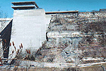
A view of rock strata of the Niagara Gorge
at the Robert Moses Power Generating Station
STRATA OF THE NIAGARA GORGE CHART
The Niagara District sedimentary deposits include:
sandstone
shale
marine limestone
which was laid down during the Silurian period 430 - 390 million years ago.
Throughout the ages, nature has in conjunction with the wind, water & ice created stratified layers of rock and earth in Niagara. The Niagara Gorge provides a snapshot of those layers which would otherwise go unseen.
Rock Layers from top to bottom are:
Silurian Age
Clinton Group
Lockport Limestone
Decew
Rochester Shale
Irondequoit
Neagha
Thorold
Medina Group
Grimsby
Power Glen
Whirlpool
Ordovician
Queenston
The base of the current Horseshoe Falls is at the lower portion of the Clinton Group of
rocks.
The base of the Whirlpool is at the base of the Medina group of rocks.
The water level of Lake Ontario is at the rock strata of the Queenston Shale level.
As the water falls reached an area just south of the present Michigan Central Railway Bridge erosion slowed when it encountered the highest limestone ridge in the Niagara District. This limestone ridge extended to just north of present day Eastwood Avenue. The water falls at this point was 15 meters (50 feet) higher than the current water falls. Because of the greater height of the falls the gorge is deeper. At this time Grand Island & Queen Victoria Park was submerged under 30 feet of water.
Precambrian rocks record 80 -85 percent of the Earth's history.
The Phanerozoic Age (the era of well developed life) is recorded in only 15 -20 percent of Earth's history.
The Village of Fonthill in the Town of Pelham (located approximately 20 miles west of Niagara Falls) is remarkable for what is known as a Kame - Delta . It was the pro-glacial delta of glacial Lake Warren. It was beach of this ancient glacial lake. Gravel's of this sea are found 242 meters (793 feet) above sea level. The steep northern slope marks point of contact with the ice field. The gentler southern slope is the lake ward slope of this glacial delta. This glacial lake was located east of the present day Great Lakes. It exited high over Lake Erie territory and exited into the Lake Ontario basin. Its beach was the last and highest of the gravel margins formed.
During the retreat of the Lake Erie ice lobe of the Wisconsin Glacier which covered the Niagara Peninsula, the southern limit of the ice field remained nearly stationary at the Niagara Escarpment. Melt water from the glacier formed a series of glacial lakes. This melting water flowing from the glacier carried large amounts of debris, laying down a series of layers forming the kame - delta.
The Fonthill Kame-Delta is the highest point of land in the Niagara area. Today this site is readily identified by the many transmission and microwave relay towers situated upon it.
Approximately 425 million years ago, Niagara was the bottom of an ancient tropical sea. Today fossils from that era can be found deep in the layers of rock of Niagara. Because of the depth of the Niagara Gorge, many of these fossils have been exposed along the walls of the gorge.
Fossils found are:
Trilobites (Trilobata) - sea floor crustaceans (425-240 million years ago) found in
Rochester, Grimsby and Clinton layers of rock
Snails (Gastropoda) - spiral shells of snails found in Silurian rocks
Sea Lilies (Crinoidea) - sea floor starfish (425 million years ago) found in
Rochester shale rock layer - still in existence at bottom of Atlantic Ocean
Horn Coral (Enterolasma Caliculum) grew on sea bottom (425-400 million years ago)
found in Lockport and Clinton layers of rock
Lamp Shells (Phyla Brachiopoda) - clam like shells, eighty different species found in the
Clinton & Rochester rock layers
Nautilus (Cephalopod) - ancestors of nautilus, squid & cuttlefish (425 million years
ago) found in Medina and Queenston rock layers
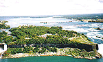
A view of Goat Island and its rock structure -
Niagara Reservation NY State Park
The future of Niagara Falls is not easily predicted. The Falls of Niagara as we know it today will remain as it is for thousands of years to come.
Erosion is the largest factor which will alter its appearance in the future. Some have estimated that the Falls would continue eroding southward for the next 8,000 years at which time it would reach the limits of Lake Erie.
The eastern seaboard of North American is today still rising from the glacial rebound effect. It has been suggested that as the land rises on the eastern seaboard that water flow to the ocean will slow and reverse so that in the future the Falls would be much diminished or cease to exist entirely.
Perhaps the most realistic outlook is that the Falls will continue to erode southward. There is no doubt that at some point in its future that the main Horseshoe Falls once it has eroded far enough south, will cut off the water flow to the American Falls. The Falls of Niagara will once again become one.
The greatest threat to the integrity of the Horseshoe Falls and the American Falls is rock falls. The American Falls has been the victim of many rock falls in the past. As the rock talus collects at the base, it reduces the distance of the water fall and creates more of a cascade effect.
In the future substantial rock falls may affect the appearance and change the Falls of Niagara to mere water cascades and/or rapids.
Hydrology of Niagara Falls
Quick Facts
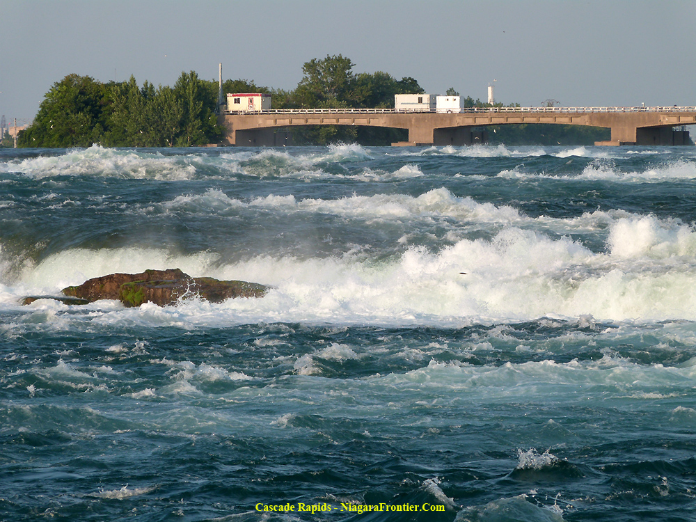
|
The greatest flow rate of water in
the Niagara River is at the
Cascade Rapids (above the Falls), the Horseshoe
Falls, the Whirlpool
Rapids and the Devils' Hole Rapids.
The Cascade Rapids above the Horseshoe Falls has a velocity of 18.5 - 35.4 km/h (11.5 mph to 22 mph) or 17 - 22 ft/sec.
The water velocity at the Canadian edge of Horseshoe Falls flows at a rate of 8 -12 ft/sec (6 - 8 mph). The water velocity at the American edge of the Horseshoe Falls at Goat Island flows at 6 - 8 ft/sec (4 - 6 mph)
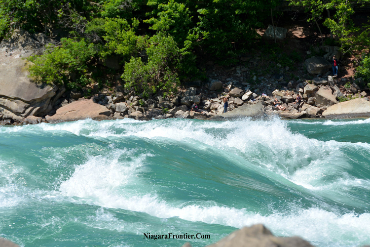
Whirlpool Rapids water velocity is 48.3 km/h (30 mph) or 44 feet per second (13.4 metres per second)
Devils' Hole Rapids has a water velocity of 35 km/h (21.7 mph) or 31.8 feet per second (11.5 metres per second)
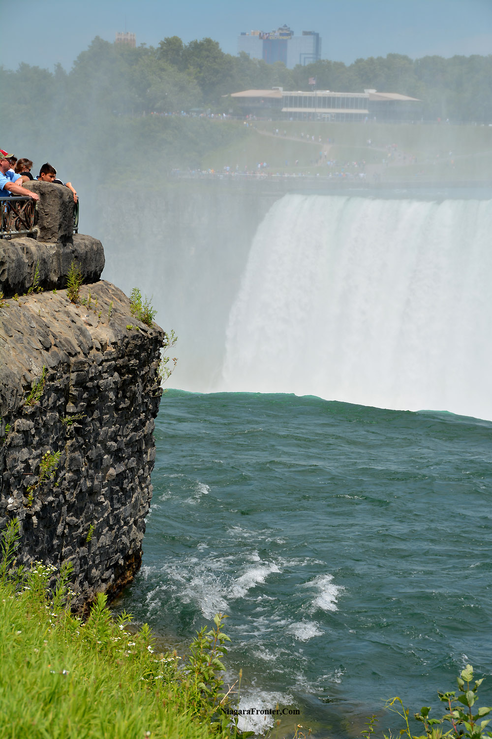
The Horseshoe Falls has an accepted height of 53.6 metres (176 feet). The water falls at a velocity of 58.7 mph (94.4 km/h) or 86.2 feet per second (26.27 m/s). The water accomplishes this freefall in 3.56 seconds
|
NIAGARA FALLS THUNDER ALLEY NAVIGATOR SITE MAP
Date last updated: May 02, 2019
The following locations and facts about them are but a few of many famous sites & attractions to be found in Niagara Falls. The best of it is FREE to see...so think of Niagara Falls when planning your next vacation.
THANK YOU FOR VISITING
ORIGINS OF NIAGARA
A GEOLOGICAL HISTORY
page