Niagara Falls Thunder Alley
THE
NIAGARA
GLEN
a history & pictorial

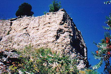
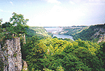
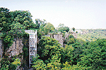
a current
view of the Lockport Limestone cap rock of Wintergreen Flats
site of an ancient Water Falls - 7,000 years ago
at the Niagara Glen
(rock over-hang was scaled in 1959 for safety reasons)

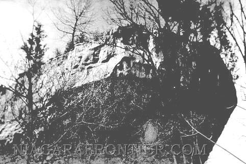
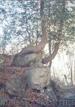
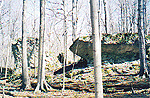
the original
"Stern of the Great Eastern" rock of Wintergreen Flats in 1937
The
"Stern of the Great Eastern" was named after the stern of the British
iron steamship "Great Eastern". The ship was launched in 1858 under the name
"Leviathan" which aptly described its size at a time when a ship of 1000
tonnes was considered large. This ship became a famous passenger liner until
1866 when the ship was renamed the "Great Eastern" and was used to
successfully lay a Trans-Atlantic cable from England to North America. The
Great Eastern at 22,374 tonnes was truly monstrous. It was to remain the
largest ship in the world until the arrival of the Lusitania 48 years later.
It was also steam powered when the vast majority of the world's merchant
fleet still relied on sail power. The Great Eastern was a demonstration of
Britain's domination of the waves and industrial pre-eminence. But the Great
Eastern was plagued by misfortune and ended its short life, rather ignobly,
as a floating amusement park. The "Great Eastern" was scrapped in 1888.
The Niagara Glen is today a
favourite site for thousands of visitors each year. It is a beautiful picnic area
located on the top of the Wintergreen Flats with well marked and plentiful
nature trails to the river below.
The Lockport Limestone rock
on which the top of the Wintergreen Flats rests was formed over 400 million
years, beginning with an ancient salt water ocean which encompassed this region.
This limestone rock layer is about 80 feet thick.
This Lockport Limestone rock
layer was undercut by a softer layer of rock underneath by the water flow of a
wild river 7,000 years earlier. One edge of this etched rock was shaped like the
stern of an ancient ship. Hence the name "the Stern of the Great Eastern".
the Niagara
Glen Nature Area
A walk through the Niagara
Glen is a walk through the hourglass of time. The layers of rock and fossils
that are visible provide a geological snapshot of period dating back 350 - 430
million years ago - a geological masterpiece which today continues unabated.
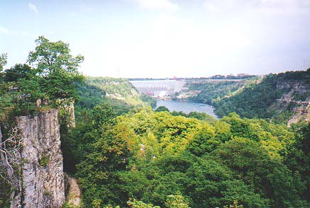
The Niagara Glen is located
approximately 2 kilometers north of the Whirlpool, along the Niagara River
in an area known as the "Lower Great Gorge" or "Devil's Hole Rapids".
Today, the speed of the water
flowing through the Lower Great Gorge at the Niagara Glen is 40 kilometers per
hour (25 mph).

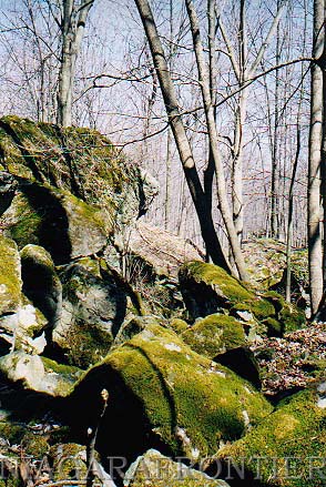
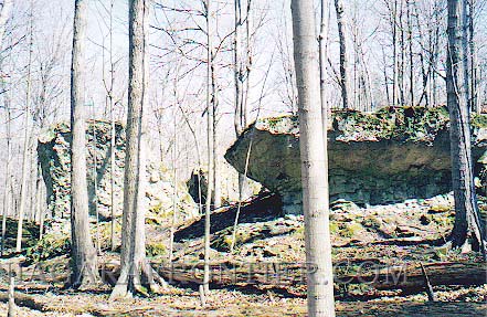
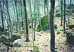
Foster's
Flats -where rocks, moss and trees are one
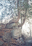
Cedar trees
grow from the rocks
This was the site of the
Falls of Niagara 6,000 - 7,000 years ago.
The waters of ancient Lake Iroquois (Lake
Ontario) were approximately 137 feet higher than the current water levels of
Lake Ontario. Water falling into a deep water basin lessened the erosion rate.
As the Falls of the Niagara Glen eroded to the south end of the present Niagara
Glen area, the water flow from the inland lakes increased seven fold. During
this period of time, the waters of ancient Lake Iroquois (Lake Ontario) began
draining through the Mohawk River Valley resulting in the lake level dropping
approximately 100 feet (30 meters). The water fall increased substantially to 37
meters (120 feet) in height to the plunge pool below.
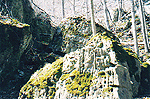
Massive
boulders which once fell from the crest
of the Wintergreen Flats waterfall, rest on the ground of Foster's Flats
Here also existed an ancient
island similar in size to the present Goat Island. Water flowed around both
sides of this island before falling over the edge of the Wintergreen Flats to
the water below resulting in two separate water falls. The dual falls continued
until the main gorge to the east eroded back far enough past the beginning of
the island effectively cutting off the secondary flow to the west of the island.
The Falls of Niagara became a single Falls once again.
Just to the south of the
Niagara Glen, the water flow of the Falls increased immensely when the
waters from the upper great lakes began flowing into Lake Erie and this increase
in water flow was channelled along the Niagara River.
boulders are
pitted showing evidence of having been subjected to an ancient waterfall
Rocks which were once under a tremendous amount of water
are now high and dry on Foster's Flats
Today the remnants of the
ancient island lay below the Wintergreen Flats in two identifiable terraces.
They are:
1)
Wilson Terrace:
Wilson
Terrace in the Spring Season
is the first level just below
the Wintergreen Flats. This portion is the steepest and most demanding
physically. This terrace was named after James Wilson, the first Queen Victoria
Niagara Falls Parks - superintendent. It was Mr. Wilson's desire to preserve the
glen as a nature area.
This ancient waterfalls
caused the rocks of this layer and those layers underneath to erode and break
away. The falling rocks; some larger than a house fell down to the river bottom.
It is these rocks which restricted the water flow of the Niagara River which has
resulted in the rapids that are today known as the "Great Gorge Rapids" or
"Devils Hole Rapids".
The rocks that underlie this
terrace are Clinton Limestone and Thorold Sandstone.
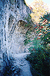
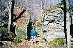
a rock path
along the Wilson Terrace portion of the Niagara Glen
2) Fosters Flats:
This portion of the Niagara
Glen closest to the river. It is located approximately 35 feet (11m) above the
river surface. Many of the famous caves and potholes are found on this level.
Foster's Flats are the
remnants of the old river bottom underlain by Medina Sandstone and Queenston Red
Shale.
Foster's Flats was named
after a hermit named Mr. Foster.
Mr. Foster lived at the
Niagara Glen during the 1850's. Here, Mr. Foster after obtaining government
approval, built a saw mill on these flats at the edge of the river. For many
years, Mr. Foster made his meager living by cutting
wood in the glen and using the Niagara River to float the wood downstream to
Queenston for sale.
The Queen Victoria Niagara
Falls Parks Commission acquired the Niagara Glen property in 1894.
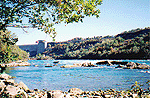
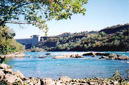
a north view
along the river edge at an area known as Pebble Beach
the Robert Moses Power Plant can be seen in distance
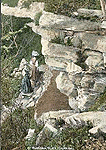
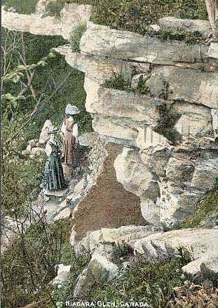
Early
postcard of two women walking on the pathway under a ledge of Medina (Whirlpool)
sandstone. Areas of this ledge collapsed on this pathway during the 1950's
effectively cutting off any access to the spring
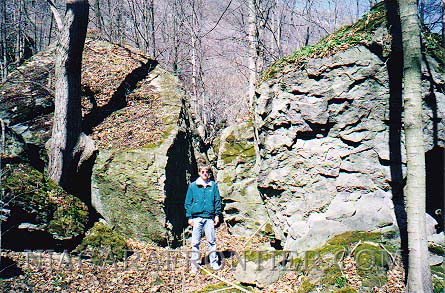
The word "glen" is a Scottish word for a steep sided narrow valley.
In 1900, the first shelter at
was built at the Niagara Glen. It was an arbour of cedar and bark.
In 1907, three rustic
shelters were built on Foster's Flats near the water at points of special
interest.
Between 1906 and 1907, two
small dining pavilions were erected at picnic grounds located near the waters
edge.
In 1928, a large dining
pavilion was built on the top of Wintergreen Flats at the Niagara Glen. This
pavilion was of similar construction to those pavilions erected in Queen
Victoria Park.
In 1908, the main stairway
leading down into the Niagara Glen was reconstructed.
In 1923, the Niagara Glen
Restaurant was built.
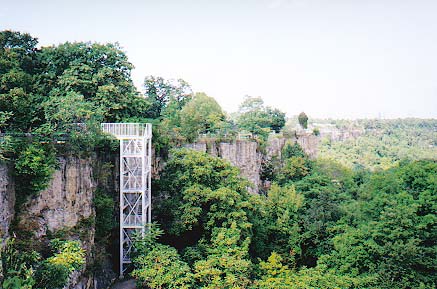
a stairway
leads from Wintergreen Flats to the glen below
The rocks of the Niagara Glen include:
1) Wintergreen Flats - Lockport Limestone
2) Wilson Terrace - Clinton rocks
3) Fosters Flats - Medina Sandstone
Foster's
Flats - a walk through an enchanted forest
To learn more about the
Geography and Geology of Niagara Falls visit the
Origins of Niagara Falls