|

of
NIAGARA FALLS
Click on any picture below
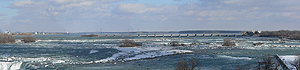
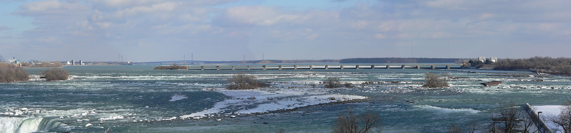
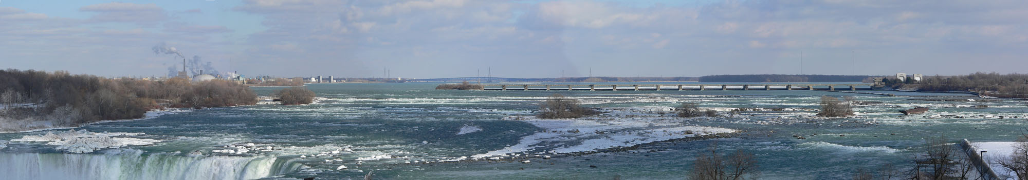
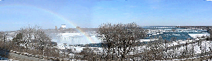
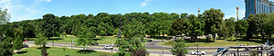
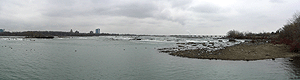
A View of the Upper Niagara River Rapids in March
(2006)
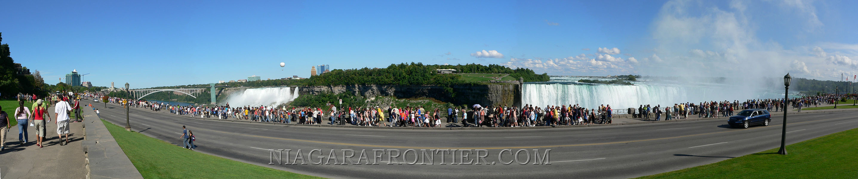
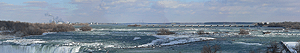
A View of the Falls of Niagara
The Rainbow International Bridge and the American Falls is at
the far left - the Horseshoe Falls at the right of the picture. The
island (middle) between the two water falls is Goat Island
for more information visit
the CATARACTS
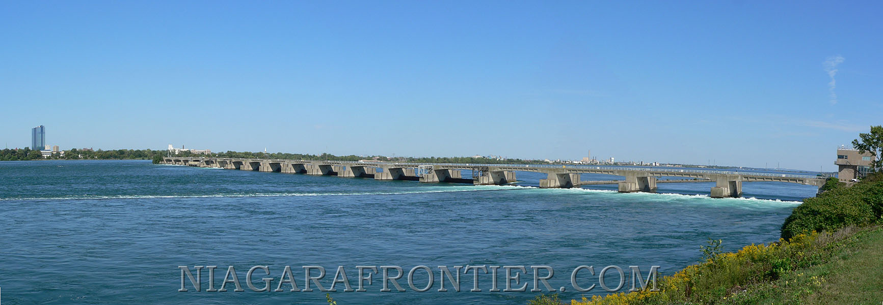
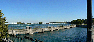
The International Water Control Dam
The International Control Dam is operated by the Ontario Power
Generation Company under the control of the International Niagara
Board of Control of the International Joint Commission (American &
Canadian). The dam was built to ensure a treaty minimal amount of
water flow over the Falls and to create a pool of water behind the dam
sufficient for water diversion for power generation
for more information visit
HISTORY OF POWER
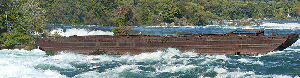
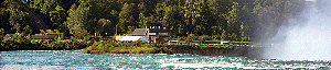
The Scow
In 1918, the Scow (barge) broke free from a tug while dredging
operations were in progress near Port Day (located on the American
side of the river). Two men were stranded aboard the scow. As the scow
floated perilously close to the Horseshoe Falls on the Canadian side
of the river, it became lodged on the rocks near the former Toronto
Power Station. With great heroic efforts, both stranded men were
brought to shore by a breeches buoy. The scow could not be salvaged
and has remained stranded several hundred yards above the Falls ever
since.
for more information visit
the SCOW
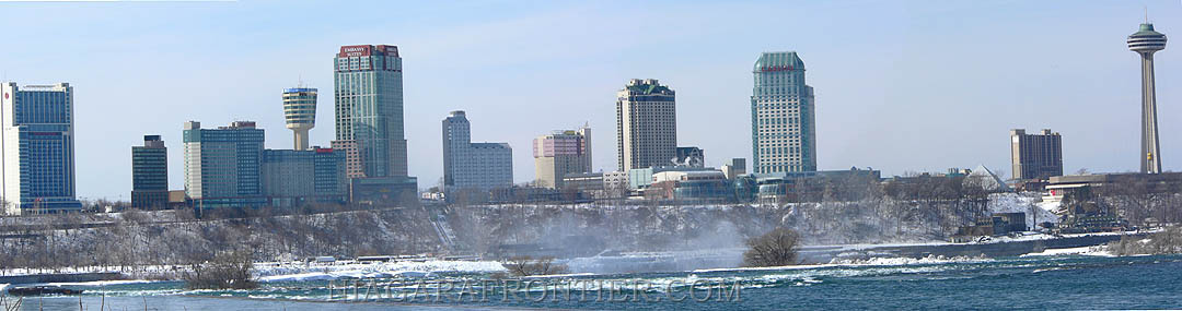
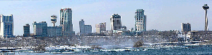
The Canadian Skyline - Summer
The Horseshoe Falls is located lower right
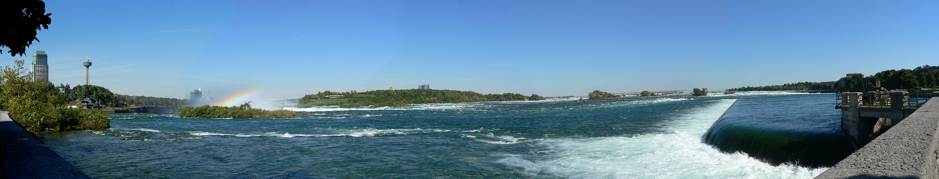
The Upper Rapids of the Niagara
River
Looking in an Easterly Direction -
The upper rapids (flowing towards us) of the Niagara River
approaching the Horseshoe Falls (middle left). The island in the center
background is Goat Island (USA). The Canadian Niagara Power Company
water gathering weir is located at the right side of the picture
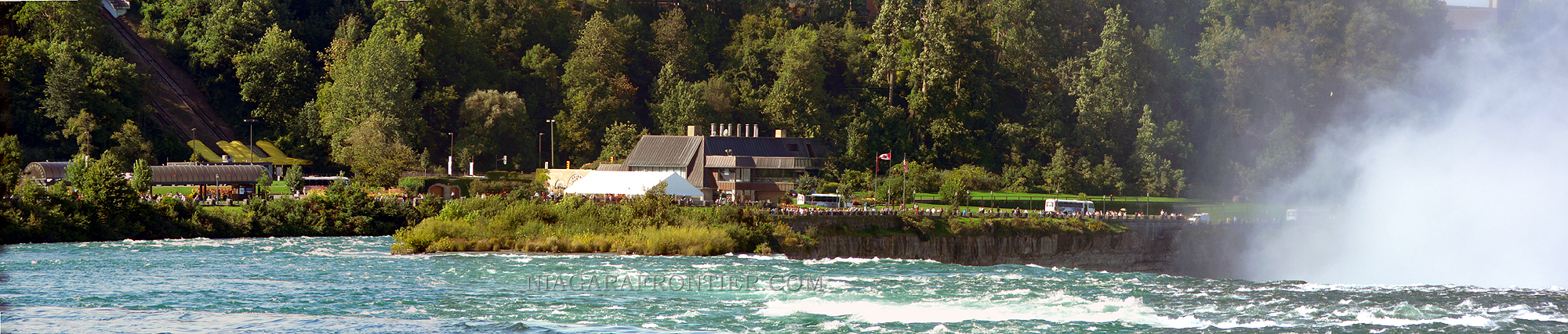
The Upper Rapids and the Table Rock
The upper rapids (flowing away from us) of the Niagara River
approaching the Horseshoe Falls (middle right). The mist is rising into
the air from the base of the 170 foot tall Falls. The Canadian Table
Rock Pavilion and the Niagara Parks Commission -Queen Victoria Park is
seen in the background
for more information visit
the FRONT and
the NIAGARA PARKS
The Upper Rapids of the Niagara River
The upper rapids (flowing away from us) of the Niagara River
approaching the Horseshoe Falls (middle right). The mist is rising into
the air from its base.
for more information visit
the CATARACTS
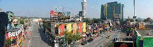
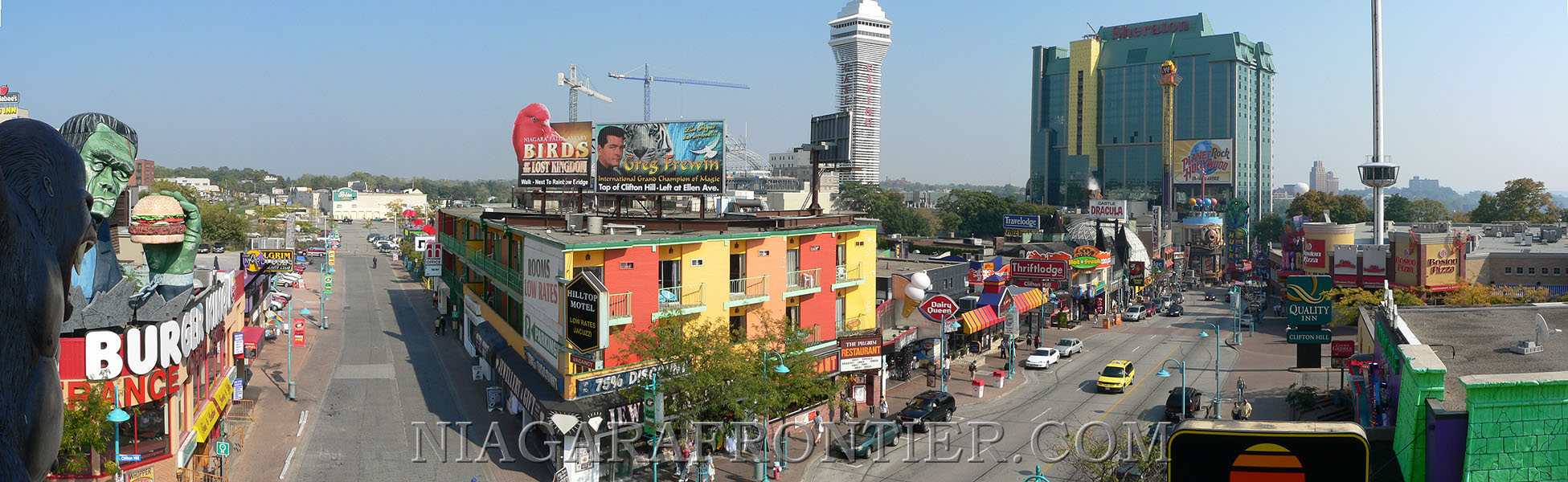
Clifton Hill
The Street of Fun at the Falls is the heart of the attractions
and amusement tourist core of the city. This unique roof top picture
shows Oneida Lane (left side) leading to Casino Niagara. Clifton Hill
(center right) runs from Victoria Avenue to the Niagara Parkway at the
base of the hill.
for more information visit
CLIFTON HILL
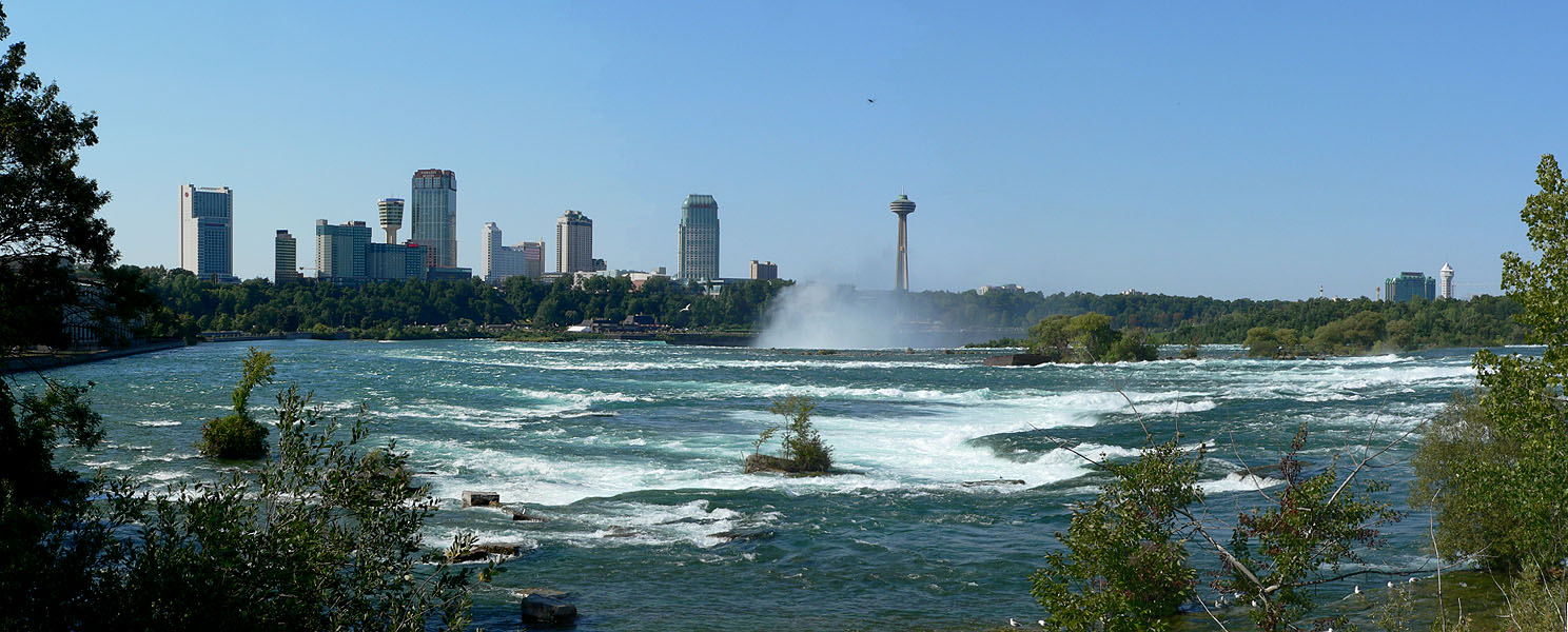
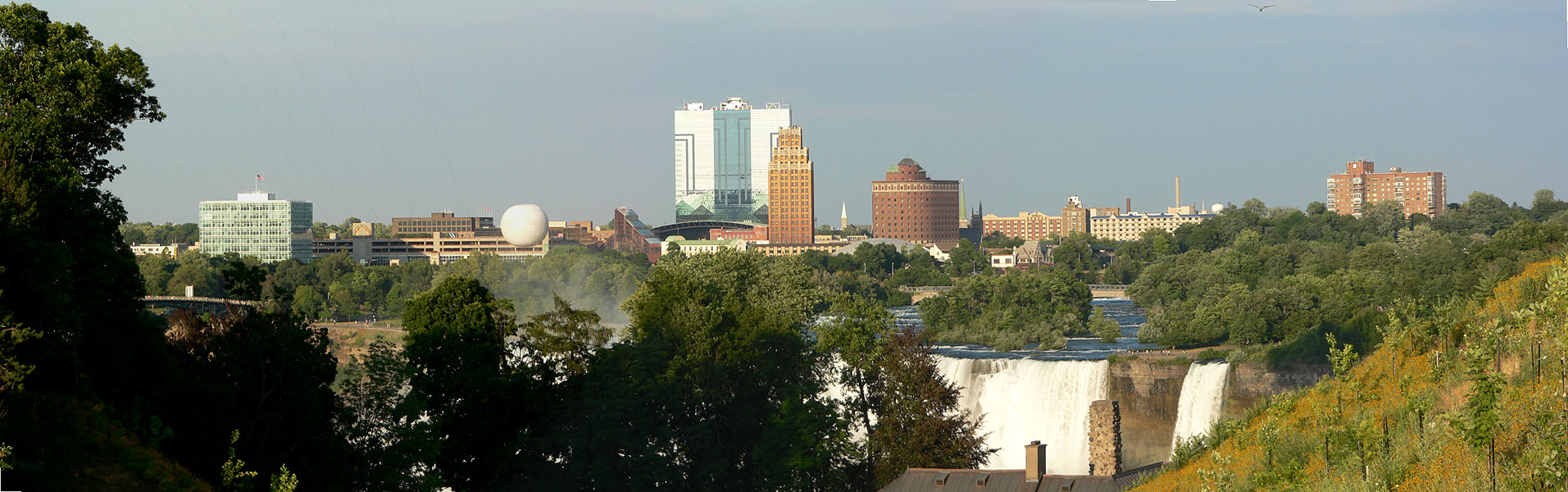
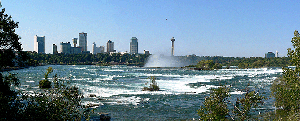
The American Skyline
A view of the American Skyline with the American Falls and the
Bridal Veil Falls (small falls) located at the center of this picture.
The former Occidental Building is located at the left background with
the Flight of Angels Balloon rising. The 26 storey Seneca Casino Hotel
backs onto the Niagara Falls Seneca Casino. The United Building (20
storeys was for many years the tallest in the city). The historic and
majestic Niagara Hotel (to the right of the United building stands vigil
over the rushing rapids of the American channel leading to the American
Falls.
A View from the Falls View
Tourist District
The Rainbow International Bridge is at the far left - the
Horseshoe Falls in the left middle with a rainbow

A wide view of the American Side of
the Niagara Gorge
The Prospect Point Tower is at the far
left - the American Falls is at left/center
Goat Island is located
between the American Falls and the Horseshoe Falls at far right
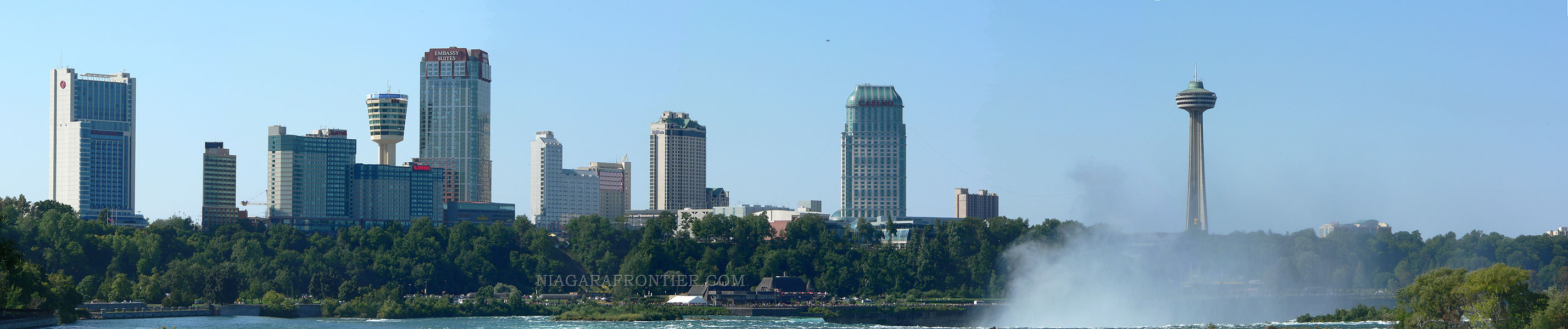
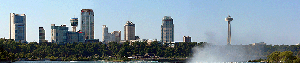
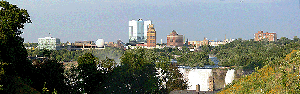
The Canadian Skyline
The Horseshoe Falls is located lower center with the upper rapids in
foreground
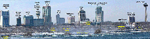
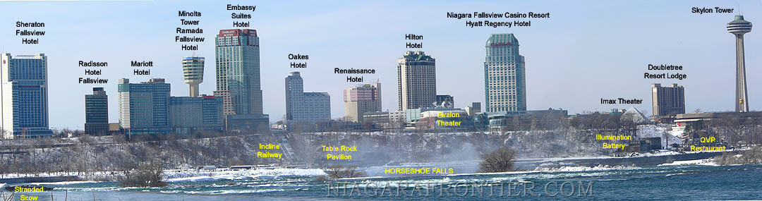
The Canadian Skyline
A view of the Canadian Skyline with tags identifying landmarks
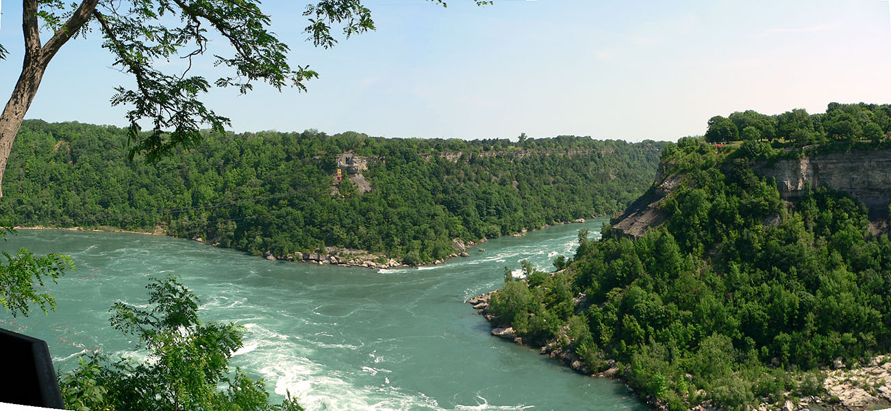
The Niagara River Whirlpool
The Whirlpool is created when the waters of the Niagara River
enter the Whirlpool (bottom of the picture) and circles counter
clockwise around the Whirlpool basin before crossing underneath the
inflow current and exits the channel (upper right). The land mass at the
extreme right is Whirlpool State Park (USA). The remainder of the land
is Canadian territory. The Spanish Aero Car crosses the Whirlpool from
Canadian side to Canadian side. Look closely and you can see the Aero
Car near the far terminus (left of center).
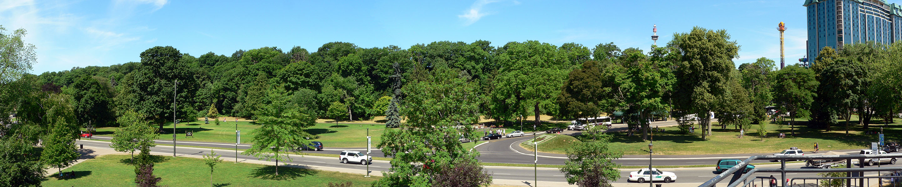
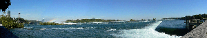
Queen Victoria Park
A view of the northern end of Queen Victoria Park with Clifton
Hill and Falls Avenue located at the extreme right of the picture. The
hotel is the Sheraton On The Falls Hotel located on Falls Avenue. The
two towers are located on Clifton Hill
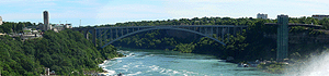
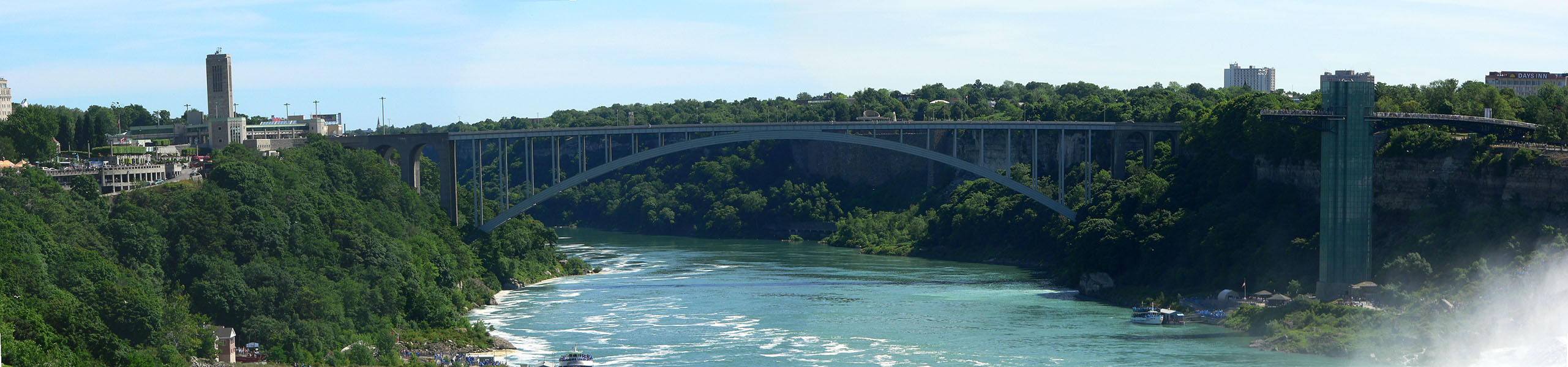
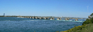
The Rainbow International Bridge
spanning the Niagara River Gorge
The Canadian shore is to the left side of the picture. The
American shore is along the right side of the picture. The Prospect
Point Tower is located at the right edge of the picture (the white in
the lower right is the mist blowing off of the American Falls)
for more information visit
BRIDGES OVER
NIAGARA
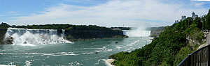
The Falls of Niagara and the
Niagara River Gorge
The American Falls is located along the left side and the
Canadian Horseshoe Falls is in the distance. The Canadian shore and
skyline is located along the right side of this picture. A Maid of the
Mist Boat is returning to the dock while another is a the base of the
Horseshoe Falls
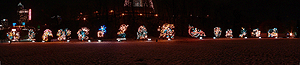
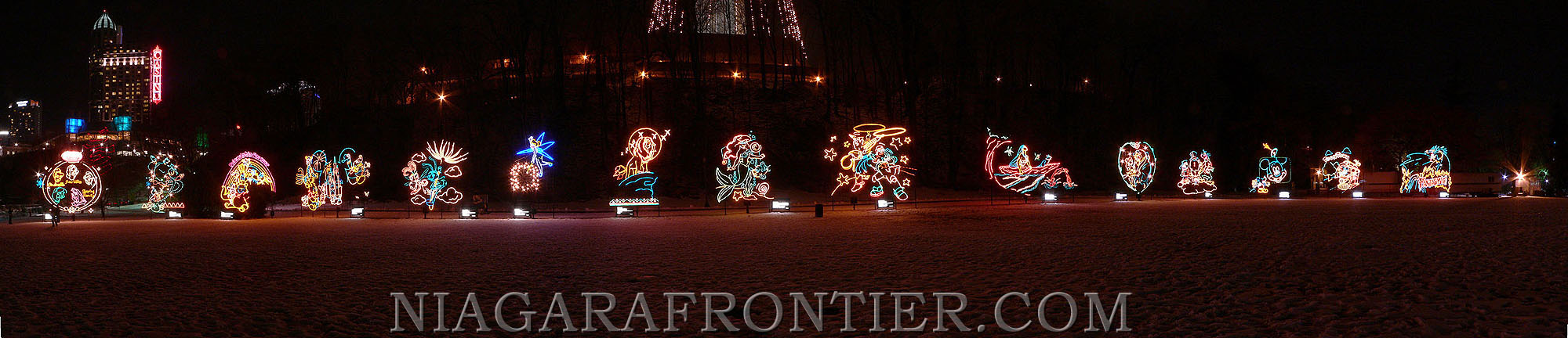
The Niagara Falls Winter Festival of Lights
The Disney Light Display in Queen Victoria Park (Niagara
Parks Commission) at the base of Murray Hill
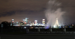
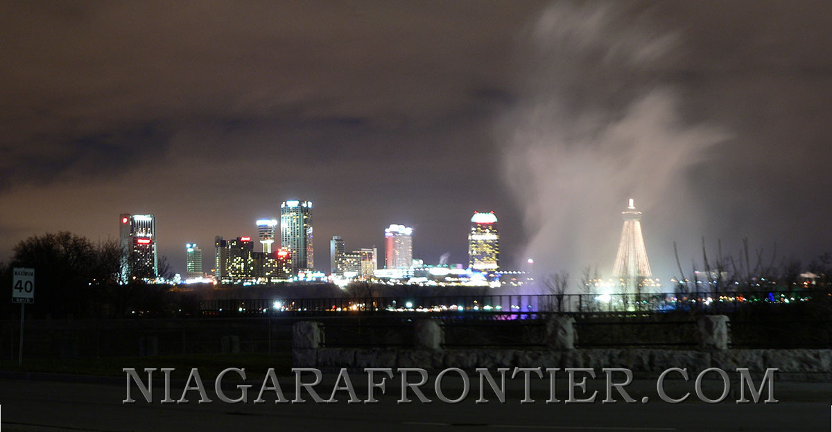
The Falls of Niagara and the
Skyline at Night
The Canadian Skyline on a December night
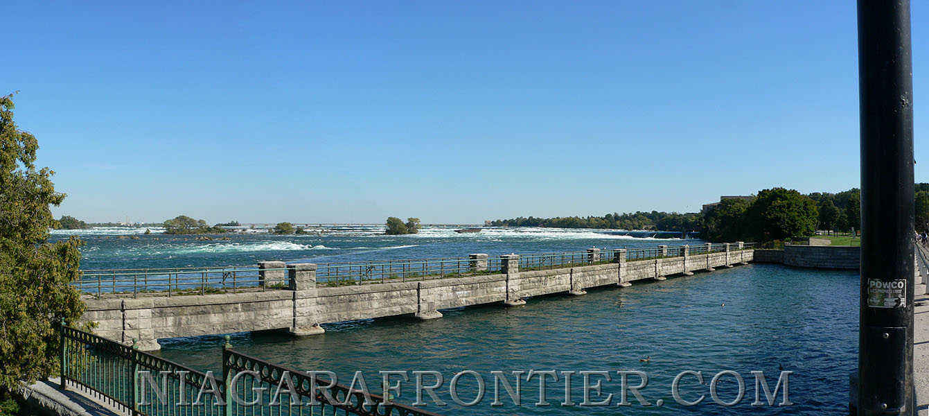
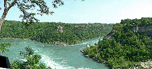
The Upper Niagara River Gorge in
December with low water levels
A View of the Upper Niagara River
Rapids
The Upper Niagara River From the
fore-bay of the Canadian Niagara Power Plant
|
NIAGARA
FALLS THUNDER ALLEY NAVIGATOR |
|
|
|
|
SITE MAP |
Date last updated:
February 16, 2011
THANK
YOU FOR VISITING
Niagara
Falls
PANORAMIC
VIEWS
of Niagara Falls
page

|