Niagara Falls
the Summer of '69
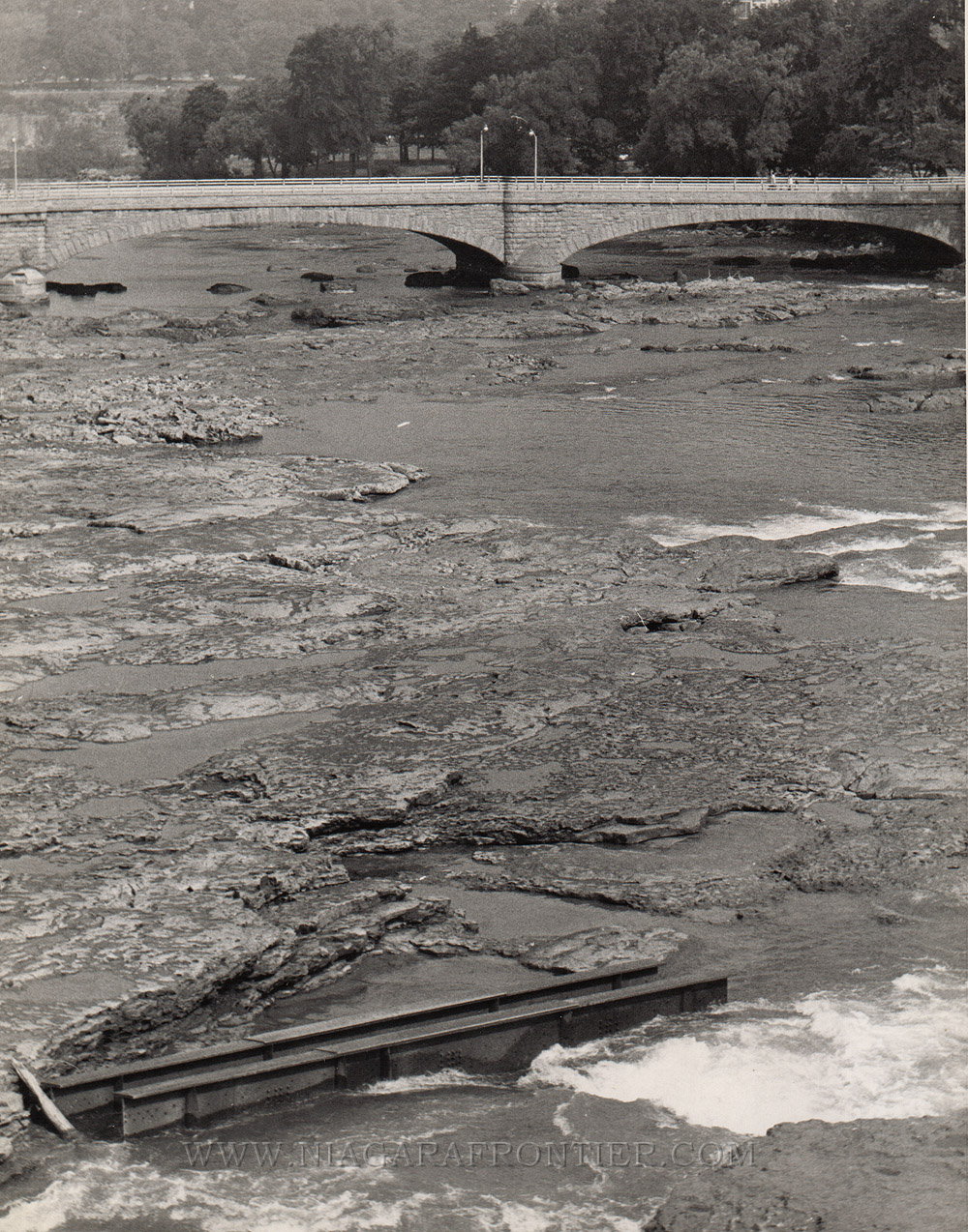
the dewatered
American Falls
Beginnings This chapter in history has a beginning in 1965 with a local newspaper reporter. Mr. Cliff Spieler of the Niagara Falls Gazette thought it would be a good idea for a series of articles to be written about the imminent “death” of the American Falls. Rock falls in 1931 and 1954 had dumped unsightly talus at the base of the Falls. Spieler was concerned that if erosion of the American Falls were allowed to continue and rock falls continued to collect at its base, the waterfall would be destroyed. The story came out in a front page editorial issue on January 31st 1965. In advance of the newspaper release, New York State Senator, Earl Brydges and District Representative Henry Smith had been informed and had drawn up legislation on the issue to present in the United States Congress. The issue became a major issue within the community and the government. The Gazette article had generated a vigorous and effective campaign to “save the American Falls”. In late 1965, the U.S. Congress authorized the International Joint Commission to study this issue. In 1967, as a result of this growing public outcry, the International Joint Commission (IJC) created a full time board to study the matter and make definitive recommendations. The American Falls International Board was created. After two years, this ongoing study resulted in the temporary dewatering of the American Falls. The completed dewatering of the American Falls was made easier because only 10% of the water follows that route.
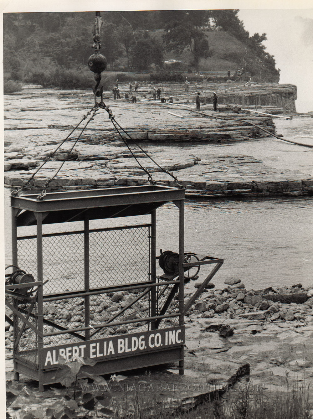
Precursor Sunday November 13th 1966 – the first man-made dewatering of the American Falls took place in order to allow workmen to clear debris from the upper American channel above the American Falls. Forty (40) Niagara Frontier State Park Commission employees wearing hip boots waded out into the channel to remove tree trunks and other assorted debris. A bulldozer was utilized to pull a 10 ton pontoon float which had become grounded in the rapids 600 feet (183m) above the Falls in 1959. The water diversion was accomplished by opening the gates of the International Water Control Dam a short distance upriver as well as maximizing water diversion to the hydro generating stations downriver. This action cut back the normal flow 60,000 gallons a second (8,000 cubic feet of water per second) to a manageable 15,000 gallons a second (2,000 cubic feet of water per second). This project was allowed as part of a $90,000 study undertaken by the United States Army Corps of Engineers (USACE) to see what could be done to halt erosion at the Falls. The water flow was reduced for a six hour period. While employees cleared debris, Corps officials conducted on the spot inspections and took aerial photographs of the river bed. Dewatering American Falls- 1969 The United States Army Corps of Engineers (USACE) – Buffalo District was tasked with the dewatering of the American Falls project in 1969. The Albert Elia Construction Company of Niagara Falls, New York was awarded a $445,412 contract to build and remove a 600 foot (183m) cofferdam from the mainland to the head of Goat Island in order to divert the water from the American channel. In addition, they were required to clean the surface of the river bed, scale loose rock from the face of the Falls, and install a water spray system. The remainder of the $1.5 million was spent on the study for the International Joint Commission. Colonel Amos L. Wright, USACE - District Engineer from Buffalo was the first officer in charge of this project. Shortly after the project began, Colonel Wright was reassigned to duty in Vietnam. He was replaced by Colonel Ray Hansen. He was in charge of overall operations of this project. Captain Douglas Wilkinson of the USACE was the chief project geologist. He joined the USACE in 1959. Captain Joseph Guertin is the USACE officer assigned to the project because of his background in rock mechanics. Captain L.B. Waites of the USACE from Mobile, Alabama was the site drilling supervisor
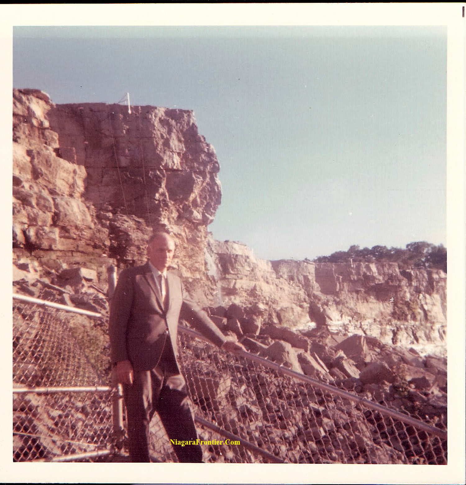
Photographs by Clifford & Madeline Valentine
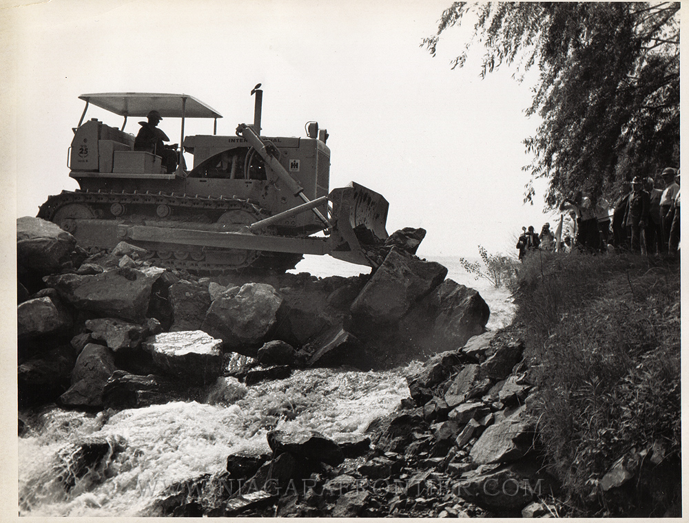
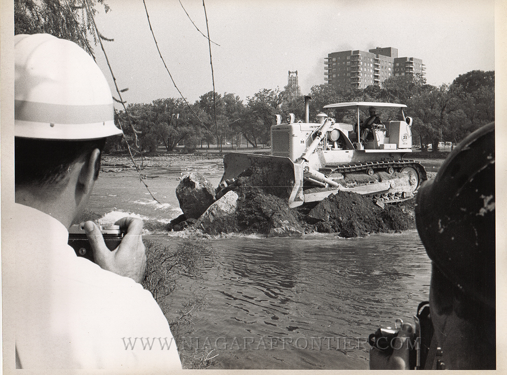
Monday June 9th 1969 - The first major safety problem occurred as workers from Albert Elia Construction Company of Niagara Falls, New York pushed rocks and earth into the Niagara River at the head of Goat Island to erect the 600 foot long cofferdam in order to divert the water. A lifeline was strung by helicopter from the mainland to Goat Island before the operators began. The line was to give everyone who might fall into the treacherous water something to catch before being swept downriver in the racing current to the American Falls. Construction to build the cofferdam began at midnight.
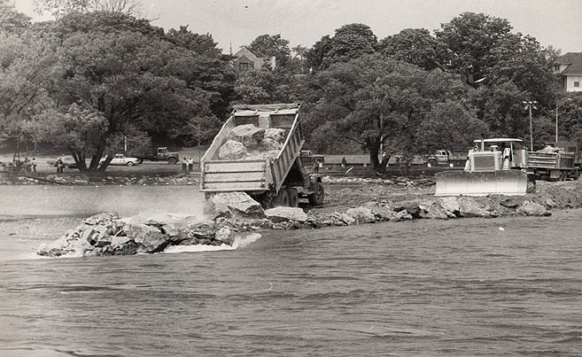
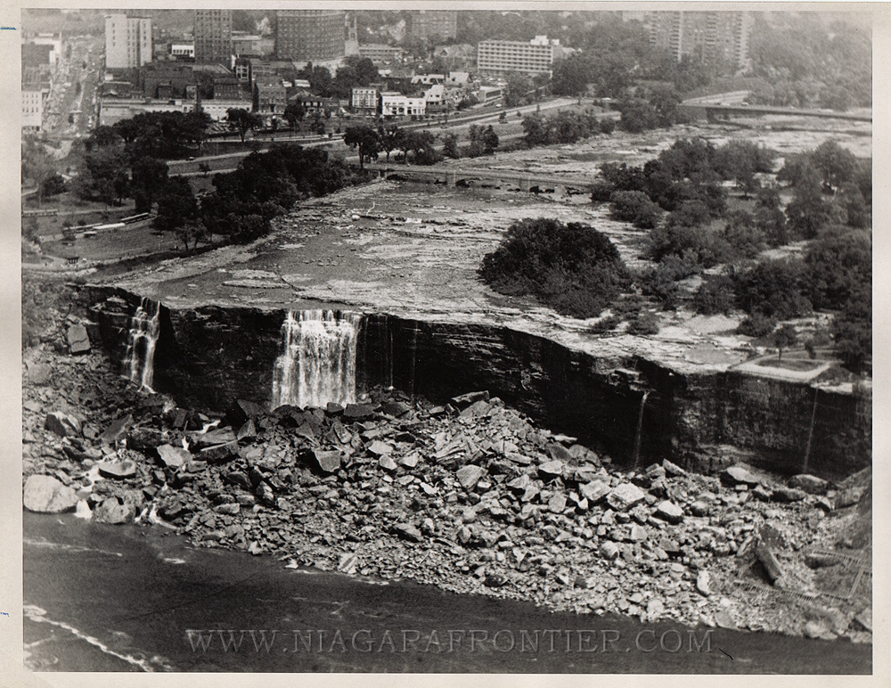
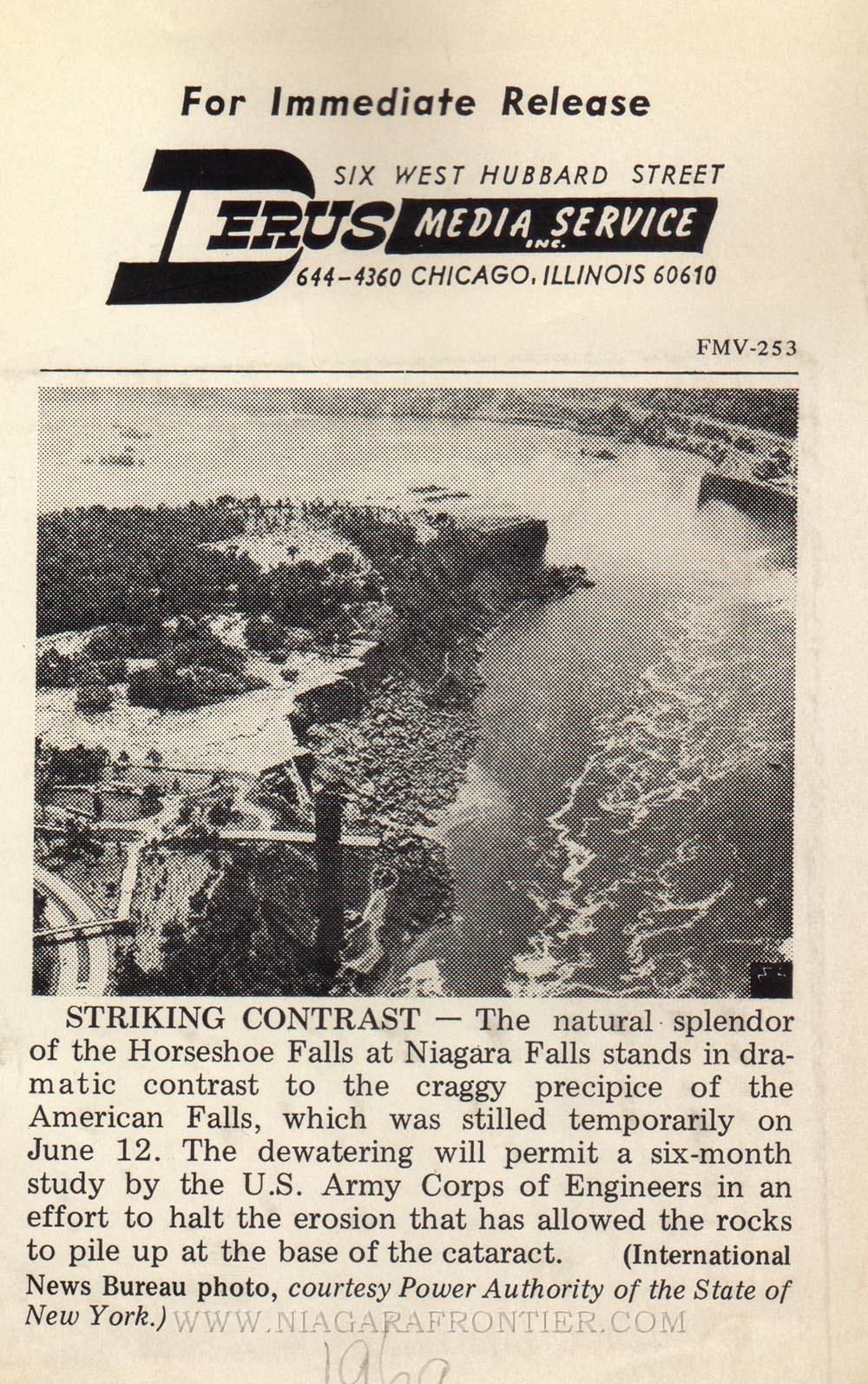
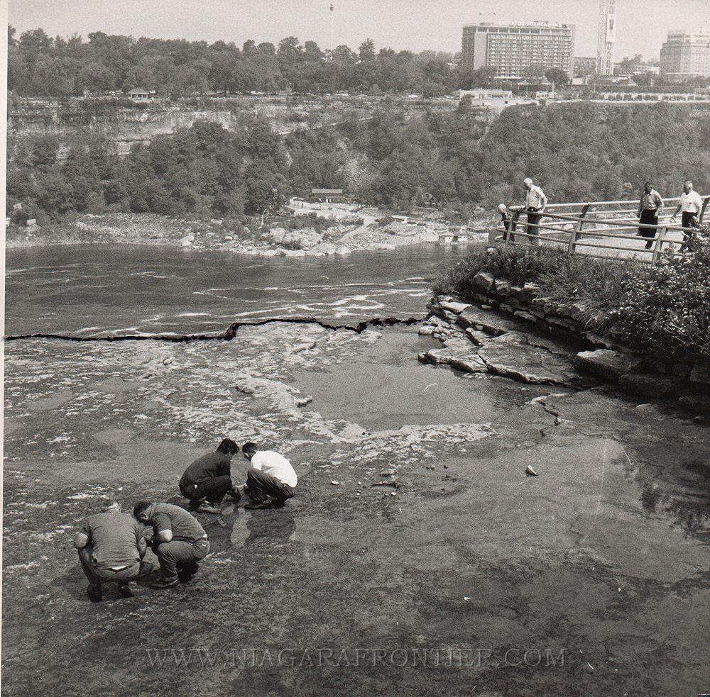
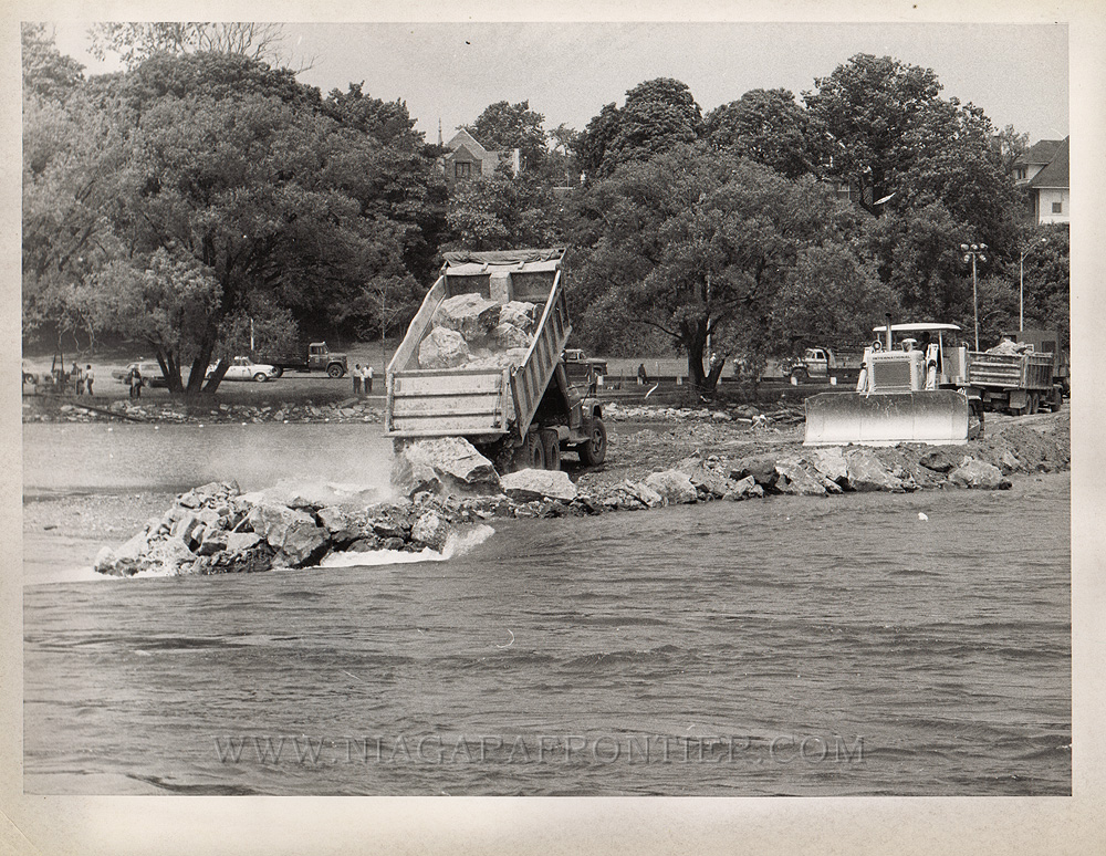
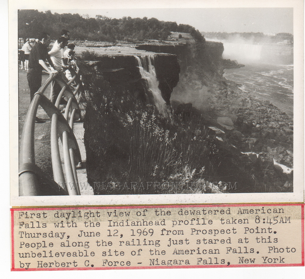
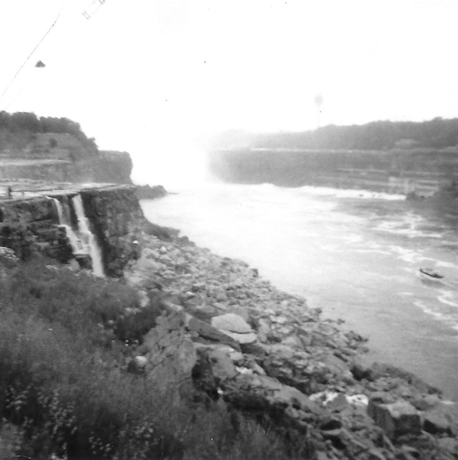
Thursday June 12th 1969 - The waters of the American Falls were shut down. After 3 days of working two 11 hour long shifts, thirty (30) workmen from the Albert Elia Construction Company sealed off all but a small gap in the cofferdam by Thursday at 2:40 a.m. Three truck loads of fill and three boulders were pushed into place seal the cofferdam completely this morning by 10:40 a.m. The dam was now holding back the eight (8) foot (2.4m) deep water of the Niagara River. It took 1,264 truck loads of fill to stop the flow of water. The fill consisted of 27,800 tons of rock and earth to build the cofferdam. One truck driver received the scare of his life as a front tire of his vehicle slipped over the soft edge of the dam. Mr. Pat Stoutamire, the dewatering superintendent for the Albert Elia Company was one of the first persons to inspect the dry river bed. As soon as the river was diverted, workmen constructed a fence along the brink of the Falls. Police have so far discovered the remains of a man, a woman and the carcass of a deer amongst the rocks of the talus at the base of the Falls. At approximately 8 a.m., the body of a man was recovered amongst the drying talus. According to Sergeant Dominic Conti of the Niagara Frontier State Parks Police, the man was seen diving into the water of the American channel on Wednesday June 11th at about 1:50 p.m. Three visitors at first thought the man was a worker on the dewatering project The man was 20-25 years old with brown hair. He was wearing a green plaid shirt and green pants. The man had walked along the shore until he reached the brink and jumped in. Police officers: Sergeant Conti, Patrolmen Ronald Tobin, James McNeil and James Gizzarelli, while searching for the man, discovered the badly decomposed body of a woman jammed head first amongst the rocks about half way up talus bank. The woman was clad in a red and white horizontally striped jersey or dress. During a subsequent post mortem examination, the woman was found to be wearing a narrow gold wedding band with the inscription “forget me not” on the inside. The dewatering project allowed the recovery of the bodies from the talus. This normally would never have been possible. By the of the dewatering of the American Falls, the woman ironically became part of this history and would be remembered forever.
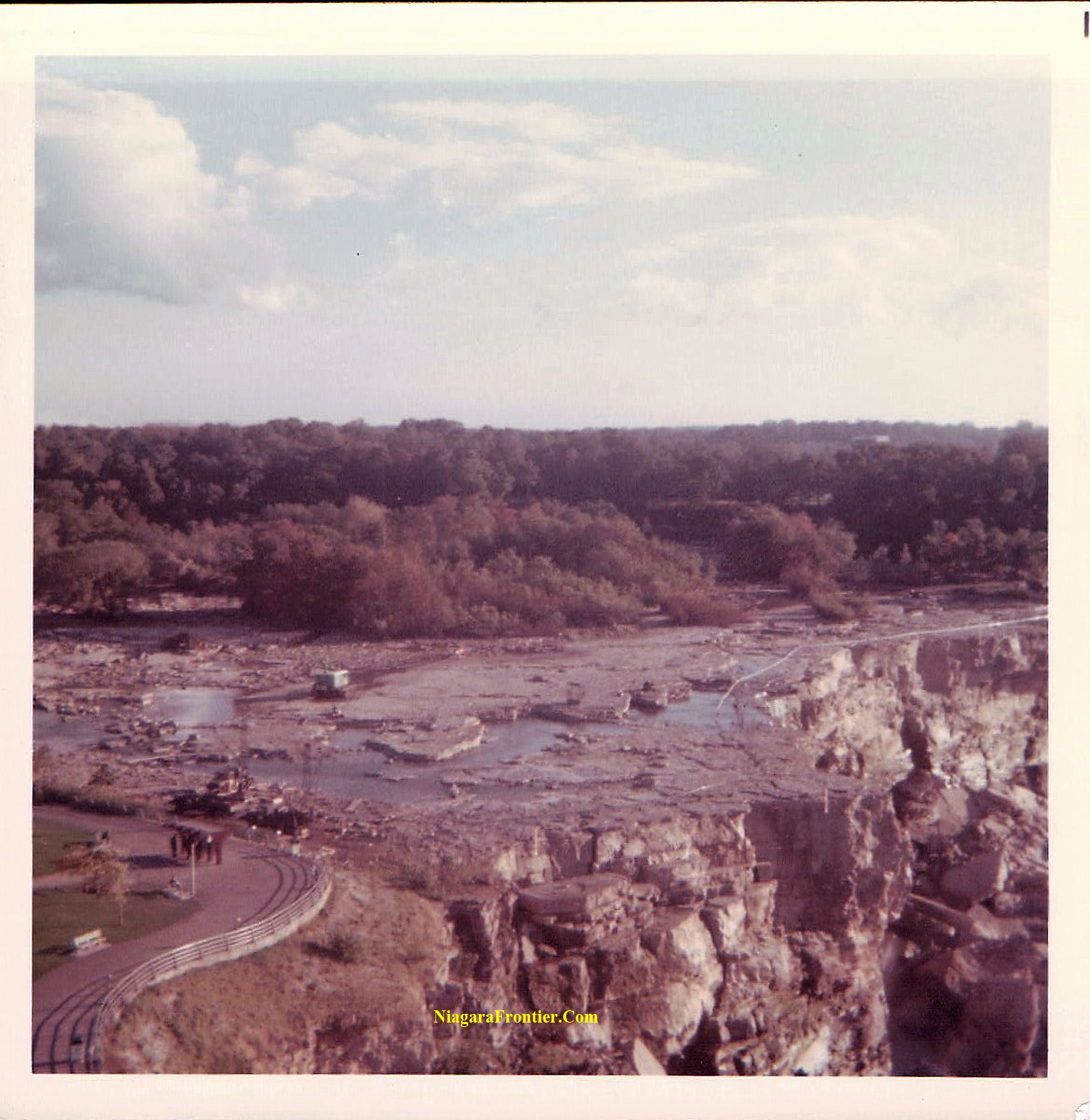
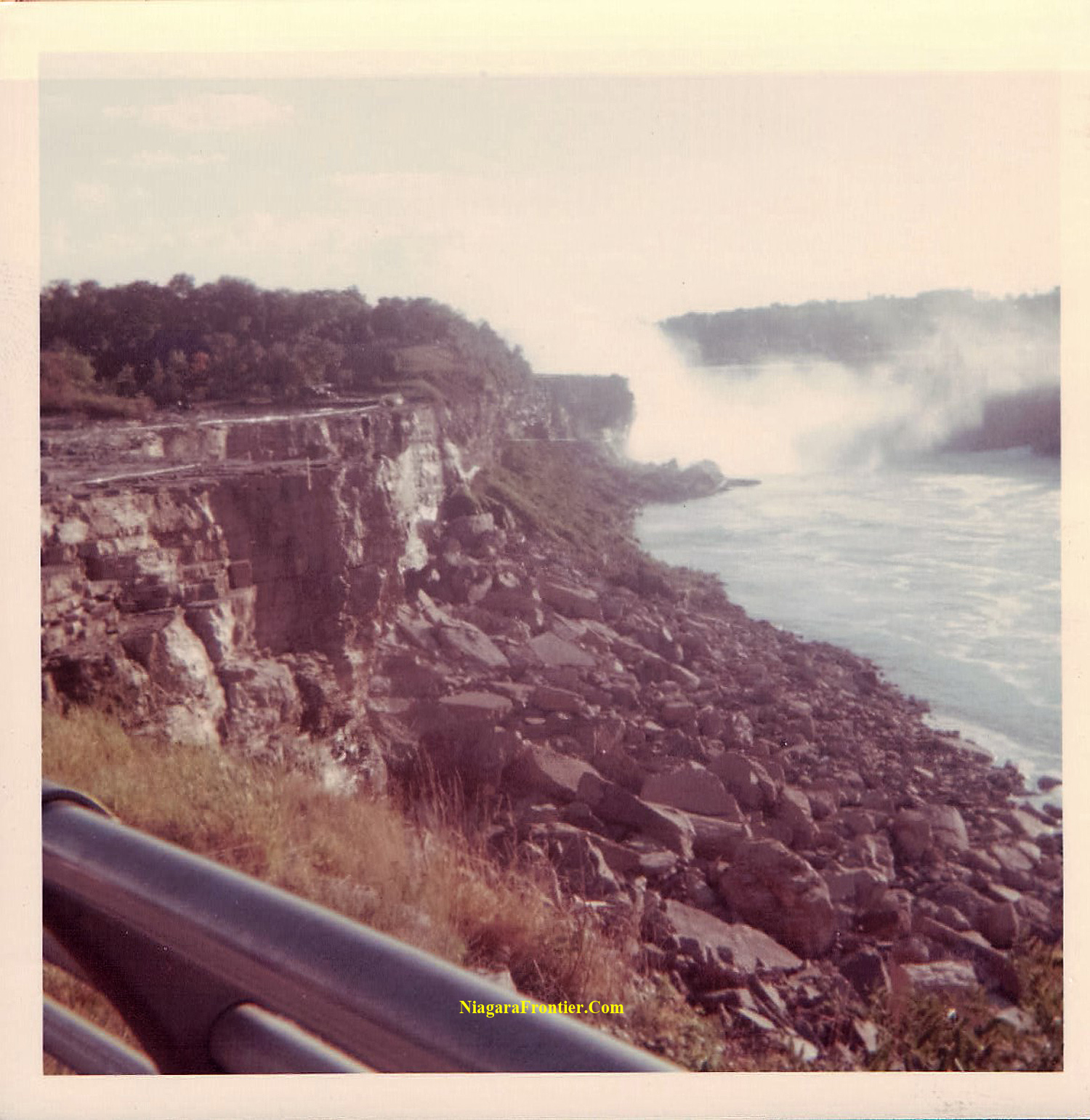
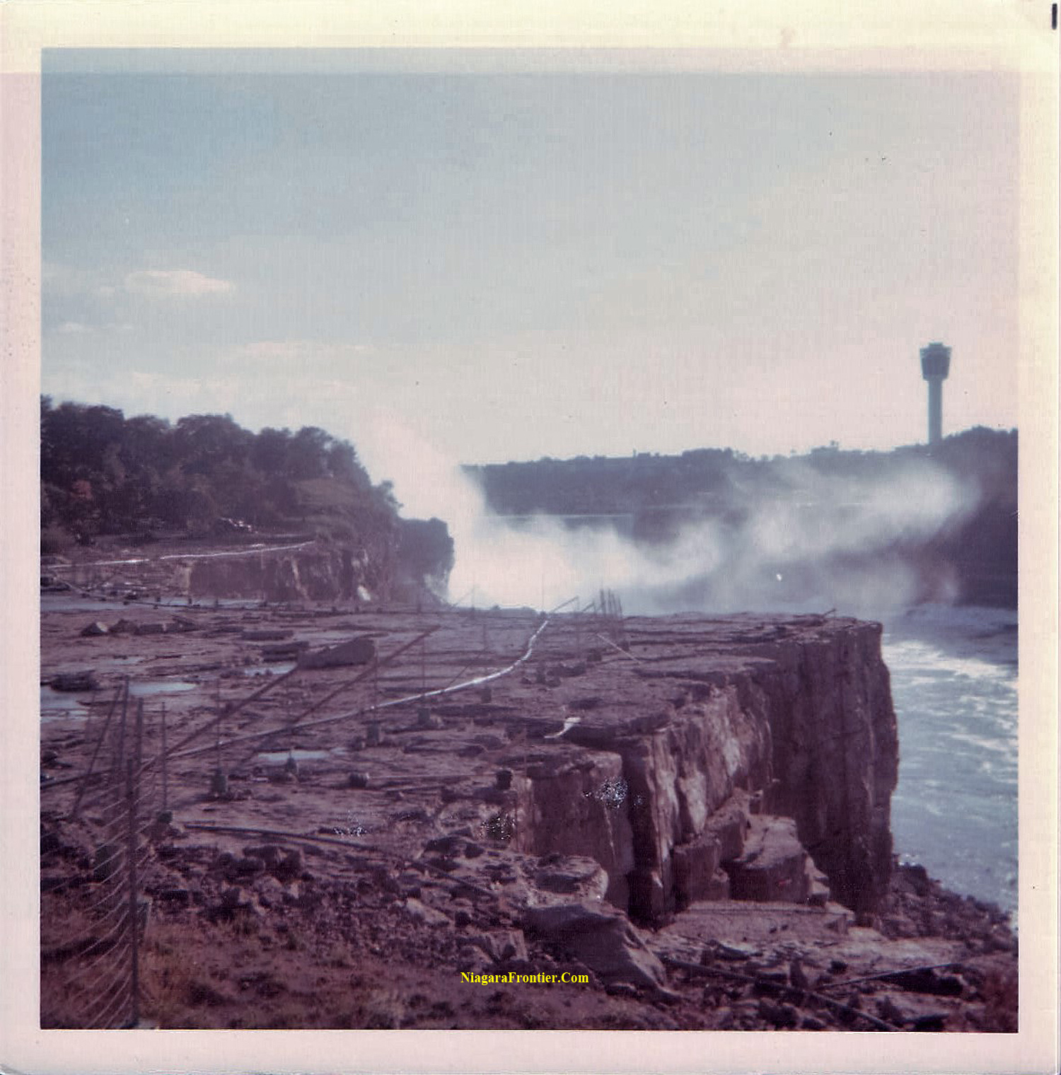
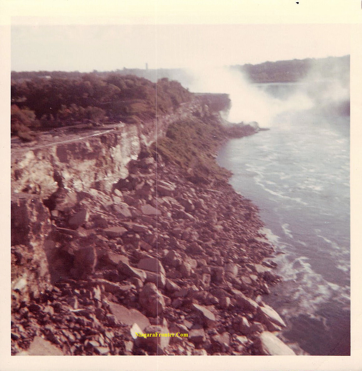
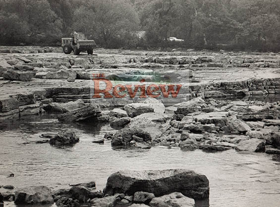
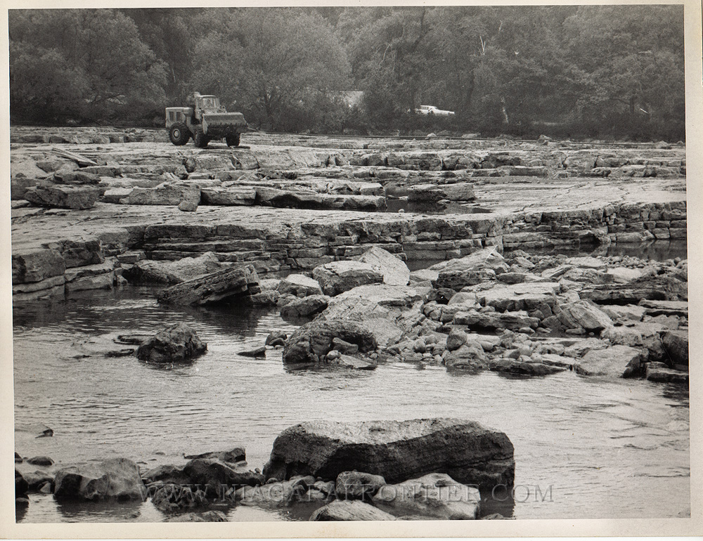
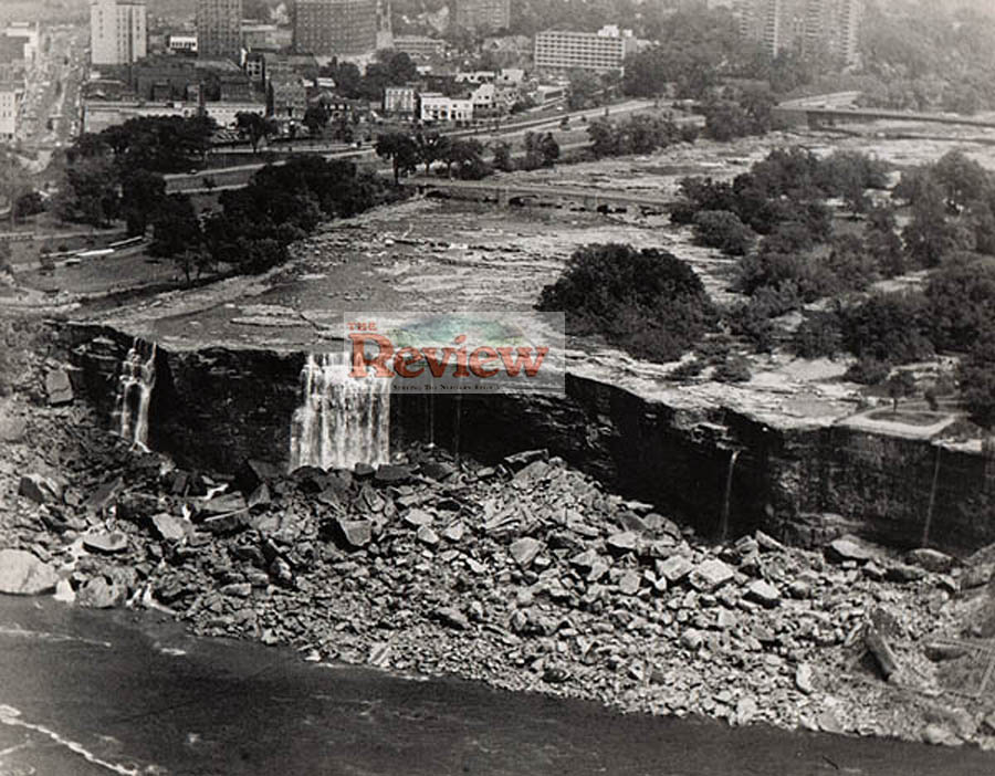
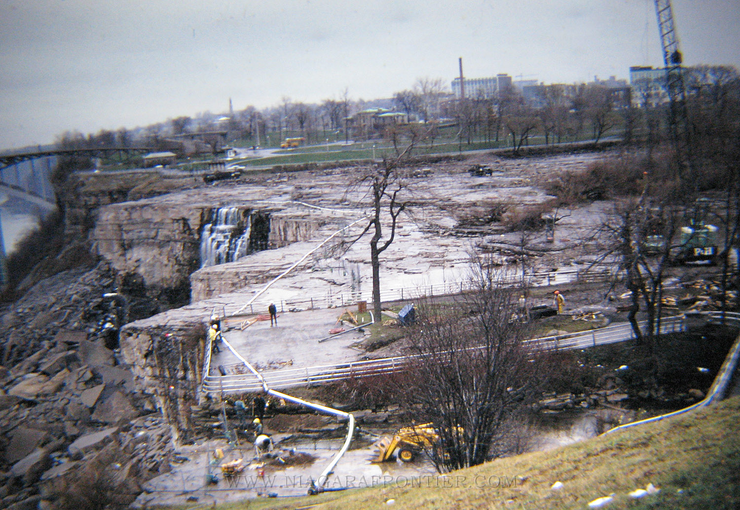
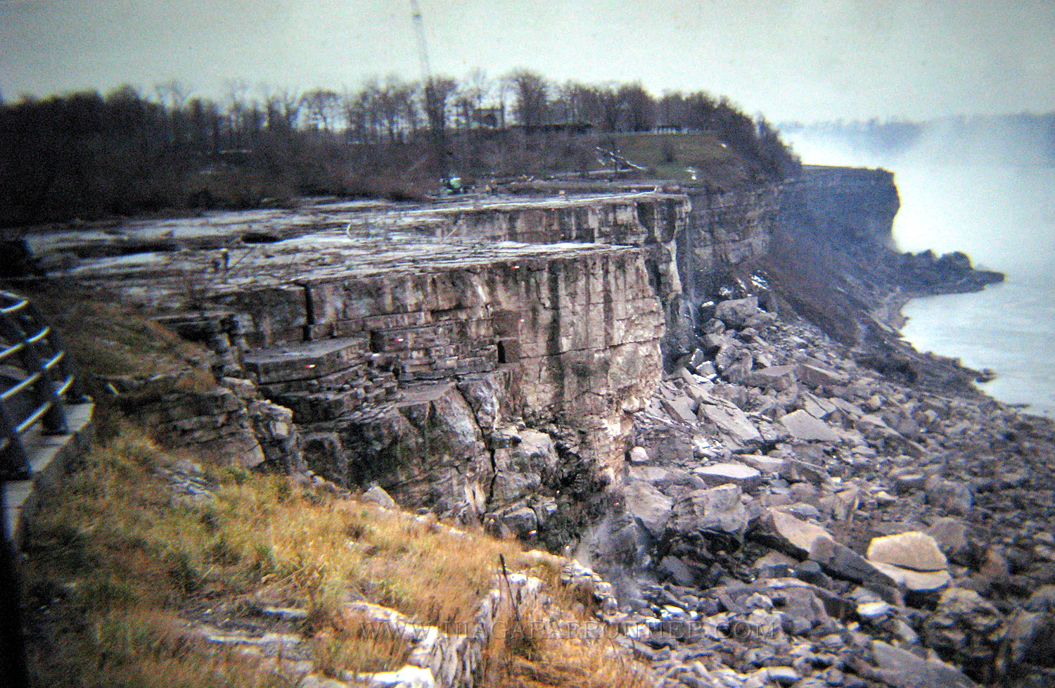
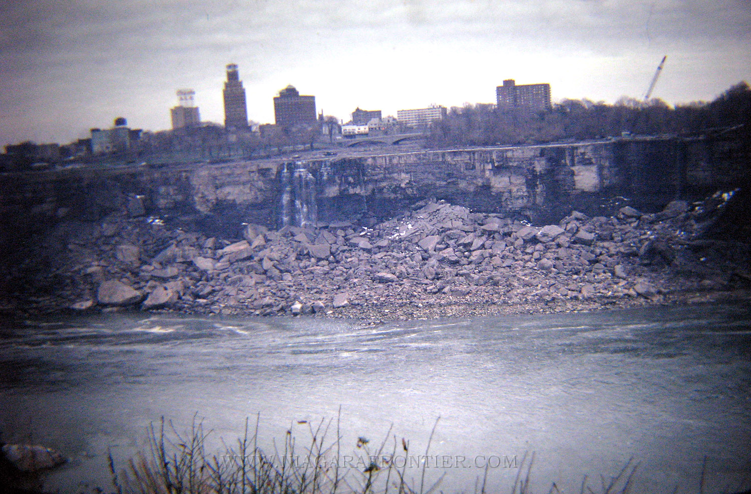
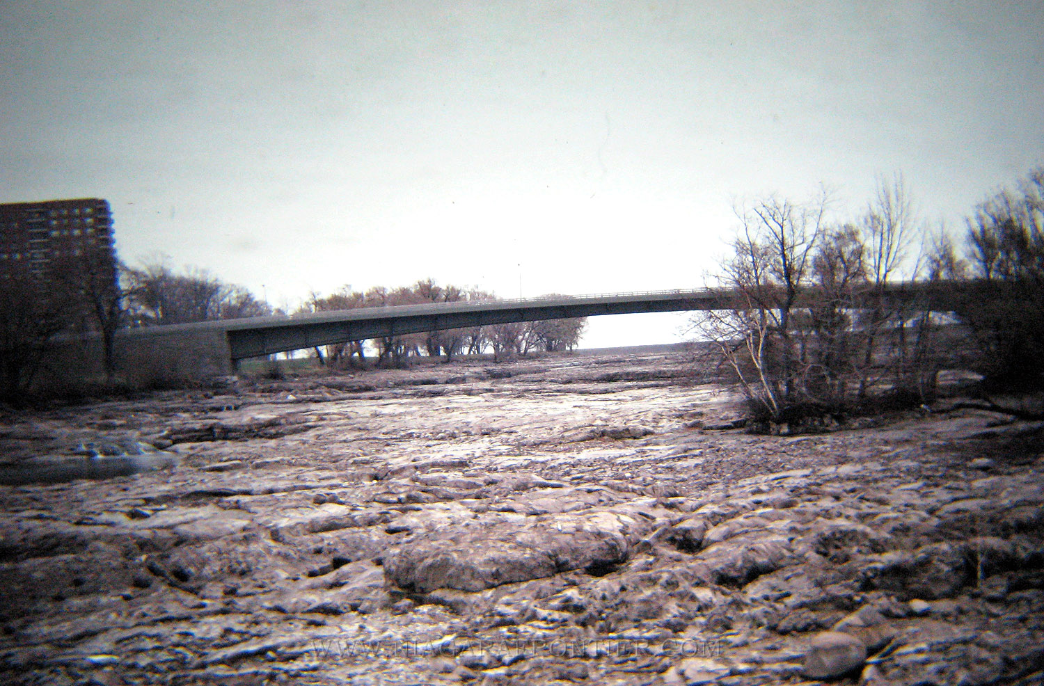
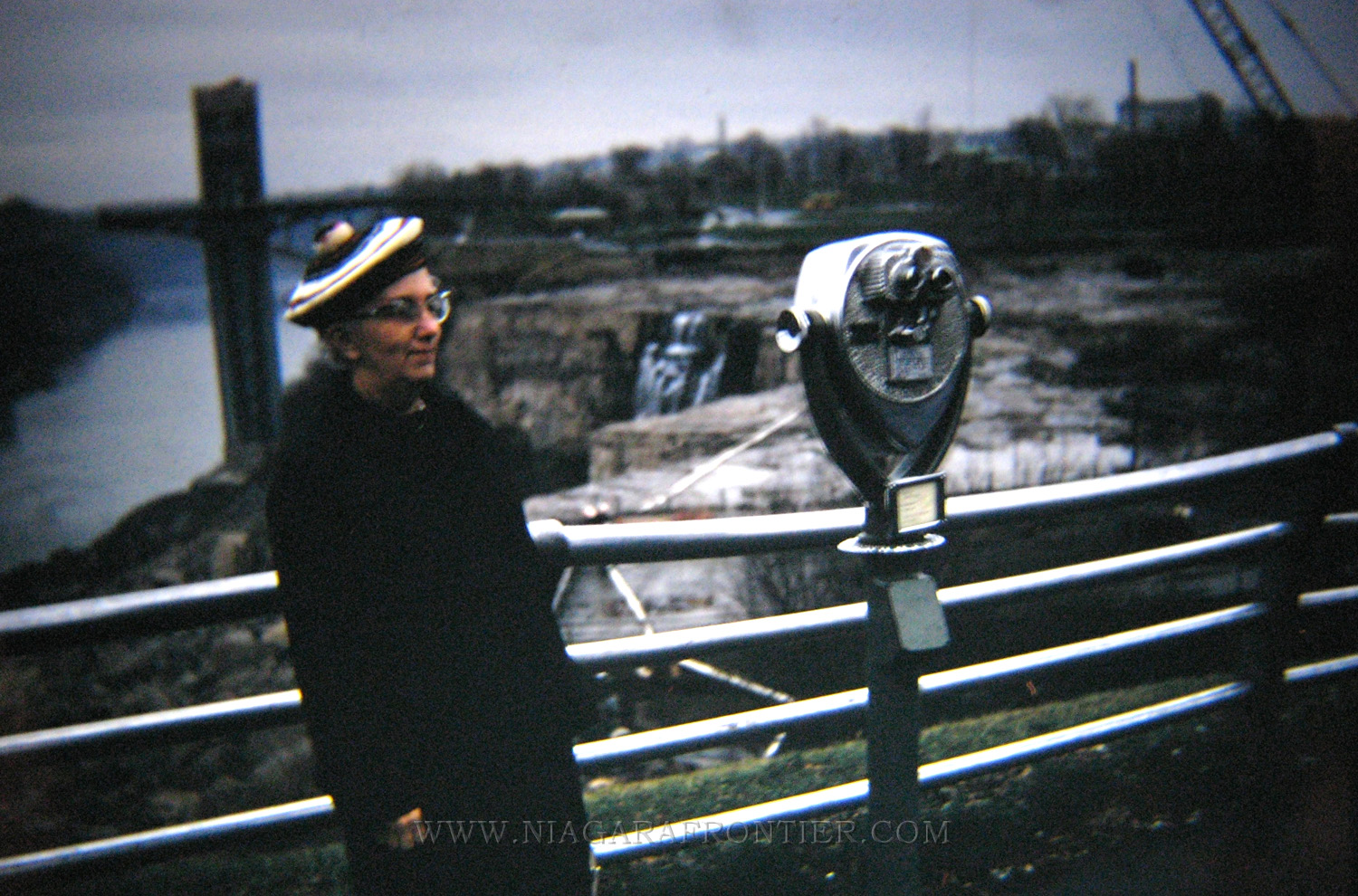
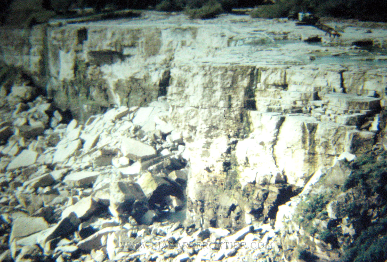
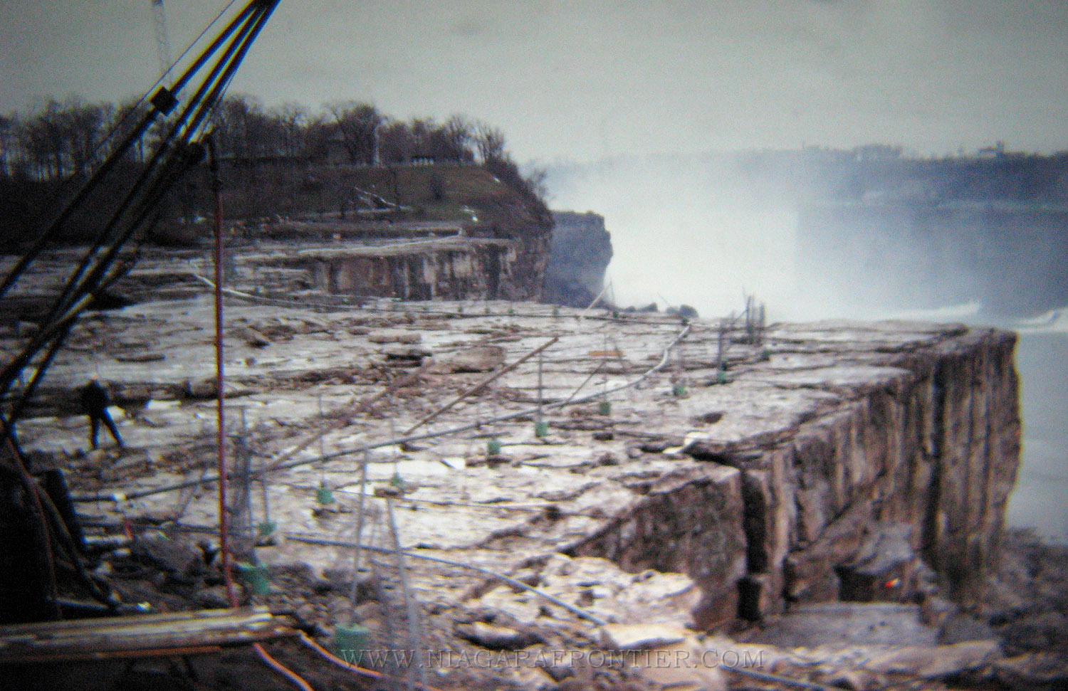
Friday June 13th 1969 - The spectacle of the dry American Falls is already drawing visitors from local and far away to see the phenomenon. Most agree the double barrel attraction of the trickle of water trailing forlornly over the rocks on one side of Goat Island and water flowing mightier than ever on the other side was worth seeing. Last night traffic was so heavy on Goat Island that cars were backed up to parking lots at both ends of the island. Tourists stood behind protective fencing at the cofferdam at the head of Goat Island to see what had stopped the Niagara River. The water was now being channeled to the Horseshoe Falls. At the crest of the American Falls, a temporary fence blocked the way to Luna Island. The most daring spectators walked onto the river bed, despite rocks that were slippery from the water and moss and a stream that continued down the center. Several people walked over and peered over the crest of the Falls. With the water not flowing, the channel looked like any other part of the Niagara Gorge. A pile of 185,000 tons of unsightly talus from the 1954 Prospect Point rock fall at the base bear testimony for a need of a way to prevent further rock slides in the area and to remove some of the offending material.
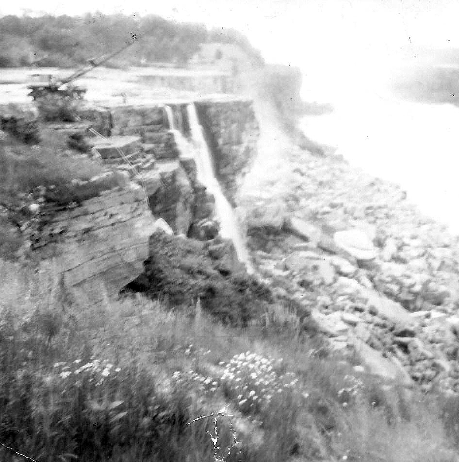
Monday June 16th 1969 - Rochester Shale begins to crumble at the dry American Falls. Cranes will be used for scaling. Workers will begin scaling loose rocks from the face of the American falls on Tuesday or Wednesday. The rocks must be removed before USACE geologists begin studies at the base of the Falls. Installation of water pipes with sprinklers are being installed faster then originally planned. They will moisten the shale layer which has been undermining the dolomite at the crest of the Falls. A 70 ton crane must be moved out onto the river bed before scaling operations begin. A 50 ton crane is already in place. The crane boom will suspend workmen in cages while scaling loose rock. An access road has been built across the mossy surface of the river bed. A protective fence stretches from Prospect Point to Luna Island.
Photographs by Lory Watts
Tuesday June 17th 1969 - Sprinklers for dry Falls are nearing completion. Albert Elia Construction Company installed a spray system to moisten the face of the American Falls, completing the installation 3 weeks after the installation began. Nearly 800 feet (243.8m) of six inch diameter water pipes are required to carry water to continually moisten the under laying shale layer on the face of the Falls to prevent the shale from crumbling. Three lines extending from the cofferdam will channel water to the spray areas. A permanent spray system was erected before geological studies started to keep the shale continuously moist. If left exposed to the sun and wind, the shale will deteriorate more quickly than normal.
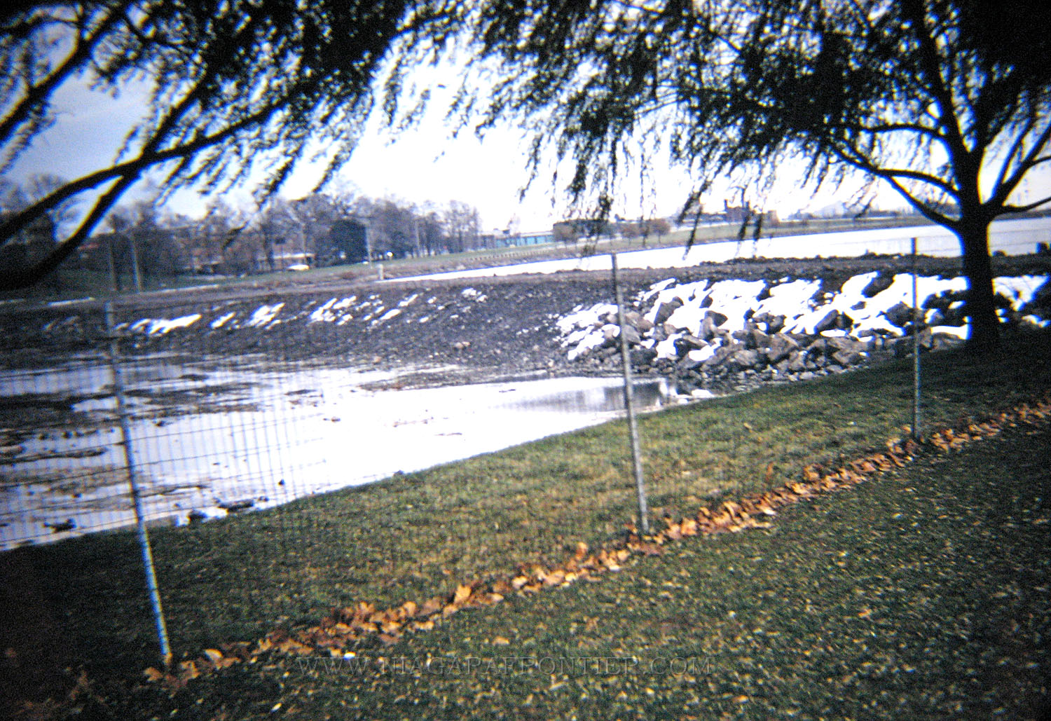
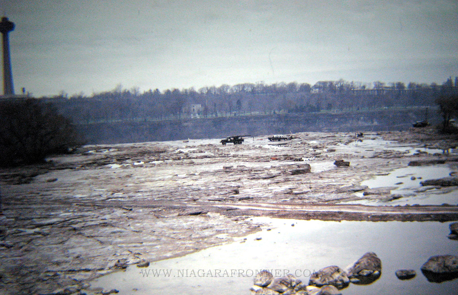
Thursday July 3rd 1969 - despite mans best efforts and technology, some waters continue to trickle through the 600 foot long cofferdam at the head of Goat Island and wind their way to the American Falls. With evaporation it is expected to dry most of the pools in the upper river channel. If water keeps falling, drill crews may not start testing the talus at the base of the Falls at the end of July. Engineers will divert any remaining streams of water towards Luna Island.
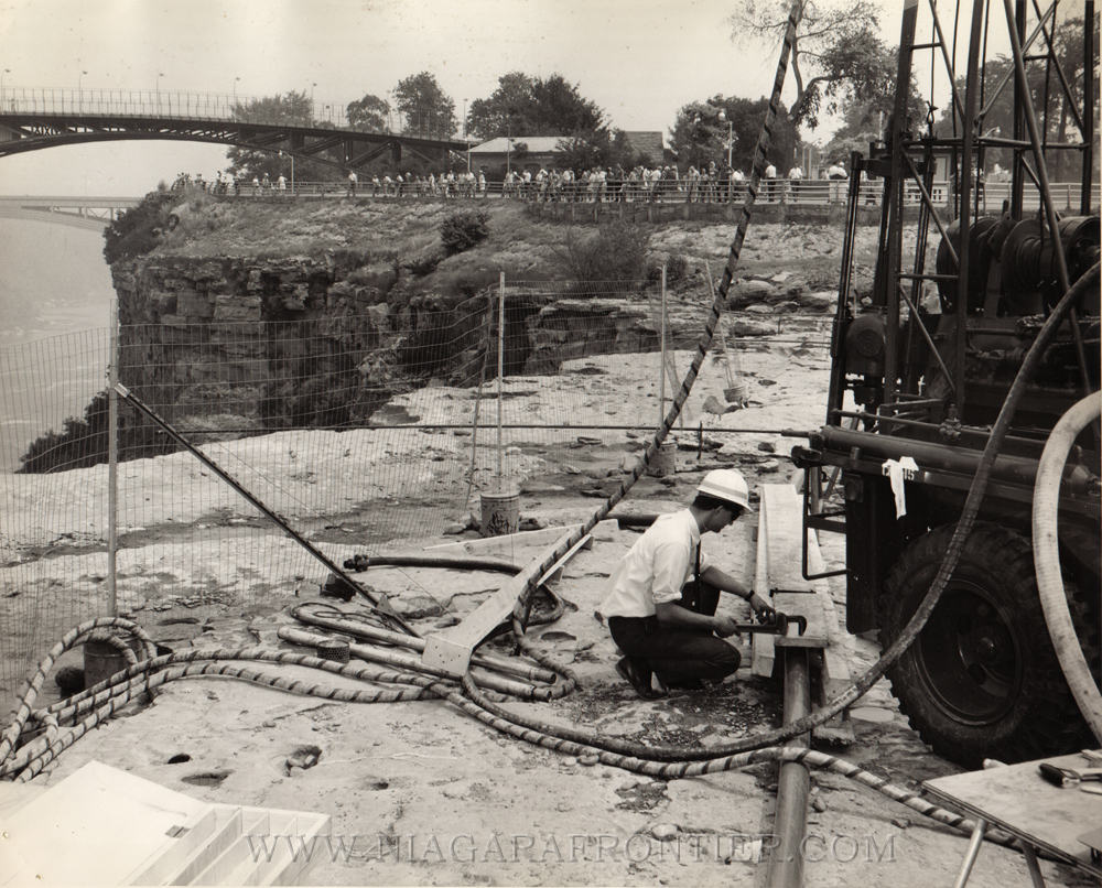
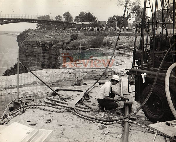
Wednesday July 9th 1969 - The United States Army Corps of Engineers (USACE) continue drilling in the dry river bed of the American Falls. The drilling crews today will finish drilling one hole to a depth of 180 feet. Then gravity pressure tests will be made in the hole to determine the permeability of the rock. Workmen will stuff packers at five foot intervals and fill the area with water to gauge the absorbency of the various sections of the rock. Early this morning a survey crew came to the Canadian side to view the American Falls in order to prepare a contour map of the dry falls to try to determine where a platform should be located for a second drilling probe.
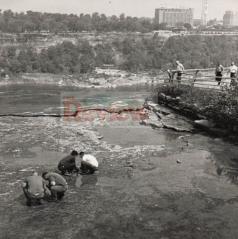
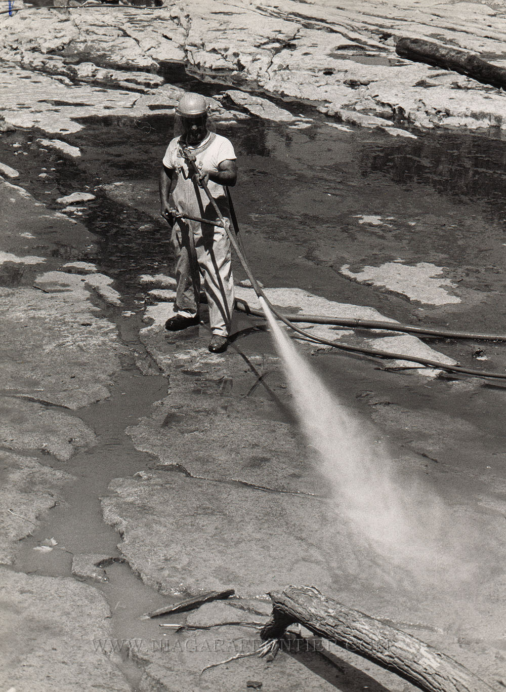
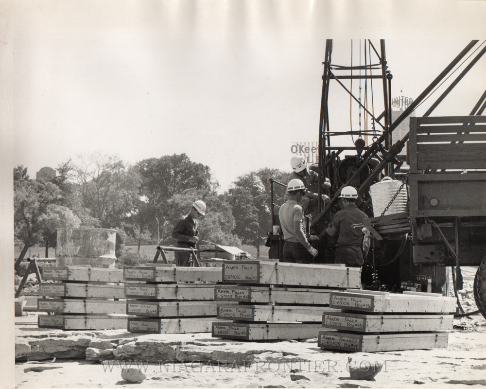
Friday July 11th 1969 - Samples of rock from the American Falls are stored in boxes before being sent to the USACE laboratory for tests. Tourists are still unable to walk on the dry river bed above the American Falls. Two display boards are being prepared to depict events of this geological project. Since the project was announced in late winter, officials planned to allow tourists to walk on the dry river bed, a possible once in a lifetime experience. The main problems are liability in case anyone is hurt and keeping tourists from interfering with workmen. Original plans called for a walkway to within ten feet of the brink of the Falls said Arthur Williams, manager of the Niagara Frontier State Park Commission. He further stated a meeting would be held to try to resolve the problem. Workmen are continuing to use air-water jet streams with 100 pounds pressure per square inch to clean algae from the rocks in the river bed. Sand blasting equipment is then used when water pressure alone is not enough. All fractures and joints within 500 feet (152m) of the Falls need to be flushed to a depth of three inches to allow mapping of the area. All loose debris less than 2.5 inches in diameter must be removed with the organic growth. Drill crews are continuing penetration of the rock above the Falls and survey crews are working on a contour map of the vertical face of the Falls.
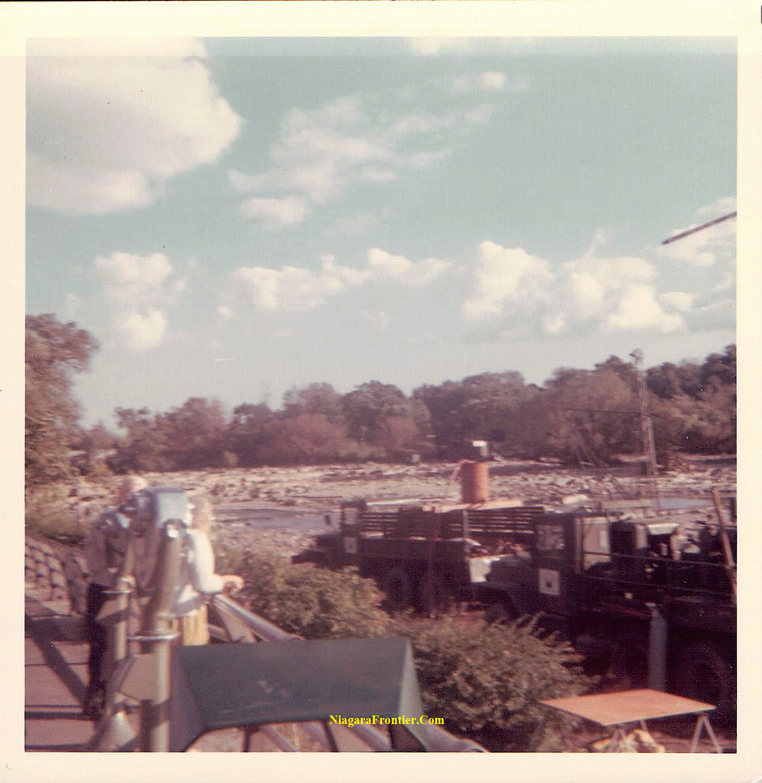
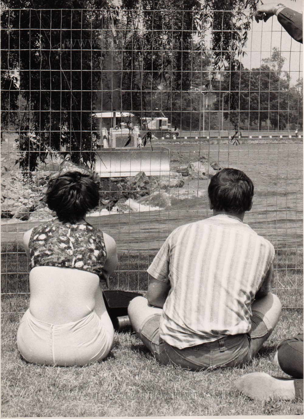
Monday July 14th 1969 - Thousands of spectators inspect dry American Falls. Niagara Falls, New York attendance records at the Niagara Reservation Park continue to be broken as thousands flock to view the dry American Falls. On Saturday and Sunday a total of 89,790 people visited the park near the dry falls. Police ordered scores of spectators and rock collectors off of the dry Niagara River bed during the weekend. Persons walking on the dry river bed, police said are risking injury. Niagara Frontier State Park Police said many people are walking on the dry river bed from time to time and police are hard pressed to get them off.
Wednesday July 16th 1969 - United States Army Corps of Engineers (USACE) drillers are scheduled to begin boring a 320 foot (97.5m) vertical hole from a point about 45 feet (13.7m) from the brink of the American Falls today near Prospect Point. The hole will be 3 inches in diameter and will sink as deep as the river bed at the base of the dry American Falls. The purpose of this part of the study project is to study rock formations. Once they finished the hole, they will do different tests within this same hole to check engineering capacities of the rock and wheat could be done with it and to it.
Tuesday July 22nd 1969 - Tourist Walkway is still Unsettled. Drilling operations on the 320 foot vertical hole is about 45 feet from the brink of the Falls has reached a depth of 50 feet.
Thursday July 24th 1969 - “Our geologists are in a dream world” says Colonel Amos L. Wright, District Engineer from Buffalo. He added “We are looking forward to an exciting and unusual summer”. The explorations to determine ways to prevent future erosion at the Falls and perhaps rectify the results of previous rock falls involve both civilian and army personnel. Six geologists must describe the rock types including chemical analysis and microscopic inspections in order to learn reasons why various rock types are susceptible to the weathering process, to determine the strength of the joints between the rocks above the Falls and to study the strength of the rocks a low temperatures. To do this, they are drilling a series of holes below and through the face of the Falls for core samples. There are three army drill crews consisting of three men each with an overall supervisor Chief Engineer, Howard Simonson from Mobile Alabama. Simonson is responsible for anything not falling under the geology category. Workmen from Albert Elia Construction Company that built the 600 foot cofferdam are continuing to clean the horizontal rock surface with an air-water jet spray. The Army officials estimate it will be 1972 before all the tests are completed and recommendations are prepared.
Friday July 25th 1969 - A once in a lifetime chance to walk on the dry river bed of the American Falls is to become reality shortly according to Arthur B. Williams, General Manager of the Niagara Frontier State parks Commission.
Tuesday July 29th 1969 - Work began today on a walkway stretching about 20 feet (6.1m) out onto the dry river bed and running for a distance of about 80 feet (24m) along the shoreline. Visitors will be able to come within 200 feet (60m) of the brink of the Falls. Steps will be located at each end of the walkway. Two wooden railings about 5 feet (1.5m) apart will be constructed. Here visitors will walk on the dry river bed. Williams said there were too many dangers to allow visitors to walk any further out onto the river bed. Since Thursday work has been concentrated on the 200 foot (60m) area at the base of the Bridal Veil Falls. The spokesman for the USACE said construction of three platforms 20 feet (6m) by 25 feet (7.6m) would begin by the end of the week. A drill crew will then punch seven horizontal holes into the talus to take samples for analysis.
Friday August 1st 1969 - Tourists today begin walking on the dry river bed of the Niagara River for the first time when the walkway built by the Niagara Frontier State Parks Commission was open to let visitors go on the river bed 20 feet from the shore from Prospect Point for a distance of 80 feet.
Saturday August 2nd 1969 - Geologists at the dry American Falls have found signs of another section of rock are ready to collapse once the water begins flowing again. Douglas Wilkinson, chief geologist of the project said drillers boring a vertical hole 32 feet (9.7m) from the precipice ran into a void and lost a drill in the rock core at a depth of forty feet last week. A test made with blue dye showed the hole extended another 30 feet (9m) with dye emerging in three places along the cliff edge indicating vertical seepage from the top layer of the rock into the secondary shale.
Tuesday August 5th 1969 - Traffic snarled the Queen Elizabeth Highway (QEW) in Niagara Falls, Ontario as visitors flock to dry Falls.
Tuesday August 19th 1969 - The only undermining to date found in the rock at the dry American Falls is in the area of Prospect Point. According to the USACE, Prospect Point was the site of the last major rock falls in 1954 when approximately 185,000 tons of rock crashed into the river below. Dye poured into a fracture 40 feet (12m) from the brink of the Falls near Prospect Point appeared in three spots on the vertical face of the Falls. Tests in the Luna Island area have turned up no evidence of undermining. Testing on the talus beneath the Falls began this morning. The wooden platform protected by steel and tile roofing has been erected to hold the rig and equipment. Testing will be done on rock only covered by the water flowing over the Falls. Shale has been falling off the vertical face of the Falls in one foot intervals
Friday August 22nd 1969 - A layer of shale at the dry American Falls to come under close scrutiny for the next 5-6 weeks as drill crews probe its secrets. The purpose of drilling is to learn if fractures located at the top of the Falls extend into the shale. It studies a series of closely spaced vertical joints parallel to the face of the Falls. Shale is the softer rock just under the top layer of Lockport Dolomite. It is a consolidation of clays, mud and silt. It erodes quicker than the top Dolostone layer. When the shale is cut by the water, the upper Dolostone layer is left with no support. Stress and the added water pressure cause the dolomite to break off. A drill crew will concentrate on the vertical face beneath the Bridal Veil Falls. Here five holes will be drilled to a depth of 100 feet. Two of the holes will be drilled horizontally. Two holes will be drilled: one at a 10° degree angles and one at a 30° degree angle. Work is expected to last until late September.
Wednesday August 27th 1969 - Eleven members of Brock University’s Geological Science Department toured the dry river bed in the Falls on Tuesday afternoon for more than two hours. Melvin Hill, a USACE geologist escorted them on the tour.
Thursday August 28th 1969 - Quiet Tourist Season in 1969 - Dry Falls Blamed for Decline
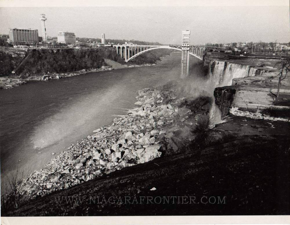
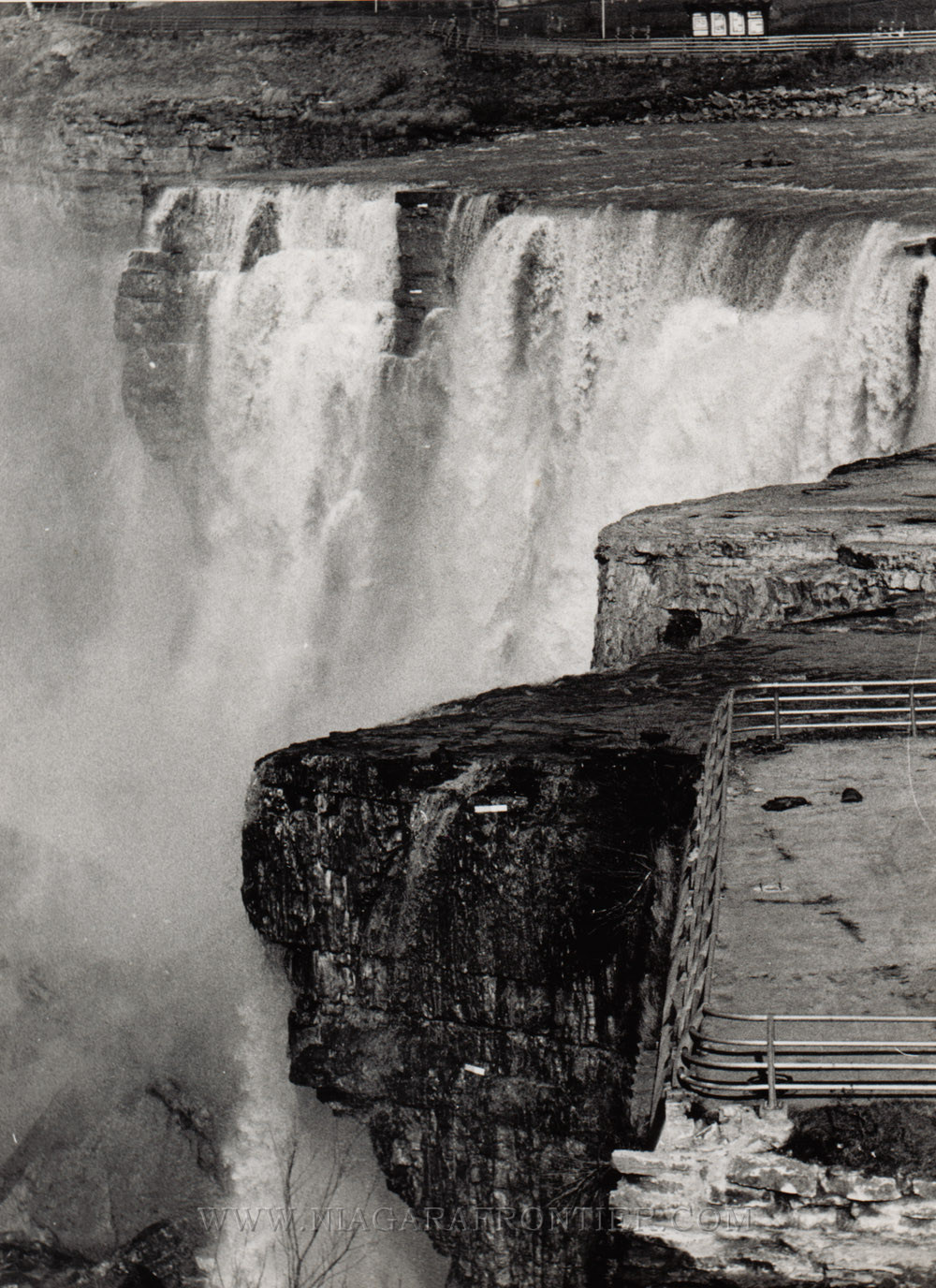
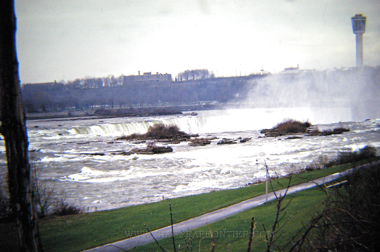
Saturday August 30th 1969 - The Horseshoe Falls is not drawing the same attention that Dry Falls is getting. Although its billed as bigger and better than ever, the Horseshoe Falls is neither dry nor attracting many visitors or as much attention as its American counterpart. The extra 2 percent in water tumbling over the 2,200 crest can’t compete with the dry American Falls. During daytime hours 92,000 cubic feet of water per second plunges 176 feet drop of the Horseshoe Falls. At night the flow is reduced to 50,000 cubic feet of water per second to allow for hydro diversion. Now the entire 100,000 cubic feet of water per second is flowing over the Horseshoe Falls. While attention focuses on geological studies to determine ways to retard future erosion, the cleaning up of the talus at the base of the American Falls remains problematic. The Horseshoe Falls eroded at even stages at a rate of about 2.2 feet per year. The Horseshoe Falls has never had a major rock slide of the magnitude of those plaguing the American Falls.
Wednesday September 10th 1969 - Safety is main concern at Dry Falls Project. Safety features built into the study of the dry American Falls are as important as any technological equipment being used. An outcrop of rock near Prospect Point that was undermined and in danger of breaking off with pools of water still lying in the channel - rocks are slippery to walk on. Anyone slipping off the brink or having a rock break off beneath them, it would be a long fall to the jagged rocks below. As an added precaution, any men having to go to the edge of the Falls beyond the safety fence wore safety belts attached to safety lines which were pinned to the rock on the other side of the fencing. The tiniest and most accurate and important safety device are the Extensometers. They operate on an air bubble principal and measure any horizontal or vertical movement of the rock to the nearest 1/100th of an inch. Shifting rock indicates to geologists that a rock slide is imminent. To this date, the meters have recorded no movement in any of the rocks at the Falls. Some metal caps called monuments are also used to ensure the rock doesn’t change position. Their main purpose is as reference points for geological studies in mapping. They will be left in the rock even when the water begins flowing over the Falls again.
Wednesday September 17th 1969 - The Cofferdam is not causing high water in Lake Erie. Although there had been early estimates that the dewatering of the American Falls might cause the water level in Lake Erie to rise up to five (5) feet this has not been the case. High water levels in Lake Erie are not caused by the cofferdam above the Falls said Colonel Ray Hansen of the Buffalo District USACE.
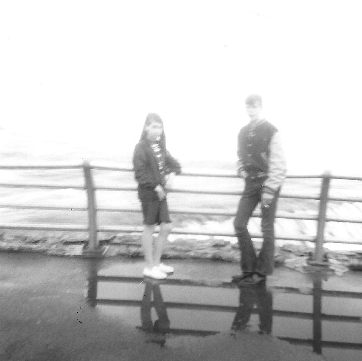
July 1969 - Lynn Paul and
her family visited
Saturday September 20th 1969 - Drill crews from the USACE have completed more than half the holes to be drilled at the American Falls rock bed for geological studies. A tenth hole was completed on Tuesday September 16th. Six more are scheduled in the series. One hole will be 230 feet (70m) deep and the other five about 15 feet (4.5m) deep. Six holes 30 feet (9m) deep have been drilled into the talus at the base of the American Falls. Geologists are uncertain as to the composition of the rock layer beneath the talus and how much of it is talus rock that has broken off from the gorge wall and fallen to the bottom. Two stress measurement holes will be drilled about the center of the river bed about 50 feet (15m) from the edge and the other 60 feet (18m) from the brink. Instruments will be installed in these holes to determine the presence or absence of abnormal rock pressure. Geologists think that these rock stresses will influence the rate of recession at both the American Falls and the Horseshoe Falls. All five holes in the horizontal series have been drilled. They are 100 feet (30m) deep.
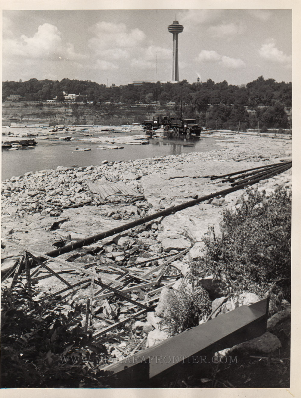
Tuesday October 21st 1969 - Only a few tests remain before the USACE complete their studies on the American Falls. The purpose of this $1.5 million dollar project is to learn ways to prevent future erosion and determine the feasibility of removing some of the talus from the base of the Falls. One hole is still to be drilled near the cofferdam between Goat Island and the mainland and another in the laboratory test series. Corps officials hope to remove the earth and stone cofferdam between November 15th and December 1st.
Thursday October 30th 1969 - The date to remove the cofferdam and restoring the flow of the American Falls will be announced in a week. A group of geological consultants and engineers visiting the site today have Friday to review and evaluate the field work so far. If current tests have provided enough data the cofferdam could be removed in mid-November.
Monday November 24th 1969 - Full flow of the Falls will come gradually. Anyone expecting the parched American Falls to roar back on like a giant when the cofferdam diverting the water is removed is doomed to disappointment. The USACE in charge of the five month long erosion study at the Falls is doing its best to ensure the water is restored only gradually. Workers will begin removing the large boulders at 10 am. and the first water flow should appear by 3 pm. A sudden burst of water is apt to endanger the men from Albert Elia Construction Company who will be removing the dam. At Prospect Point where the rock structure is weak, a sudden heavy flow of water could trigger a rock slide. The full flow will be reached in about 24 hours - gradually increasing as the cofferdam is removed. Crowds are expected to watch as the earthmovers and trucks remove the cofferdam. Pipes used to keep the shale and river bed moist were removed last week According to Colonel Hansen, there is no way to know whether the Indian Head (rock formation at the brink of the American Falls) near Prospect Point will cave in. Pins have been placed on either side of the cracks to measure any rock movements but none has occurred since June.
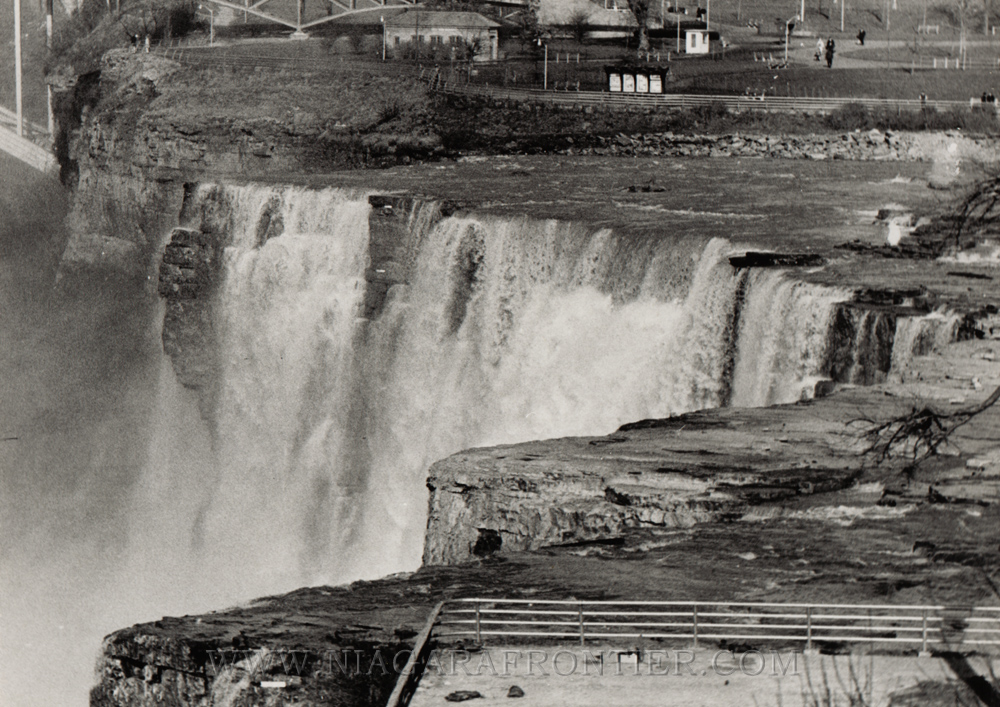
Tuesday November 25th 1969 - There is water flowing over the American Falls Again. At 10:05 am this morning a drag-line lifted out the first scoops of earth and rock from the 600 foot (182.8m) long cofferdam that had been in place since June 12th. At 10:43 a.m. the first trickle of water flowed through the dam but it was mid afternoon before water once again plunged over the falls. About 2,650 people watched from various vantage points with cameras and newsreels as workers began removing the dam. Normal flow is expected by tomorrow morning as crews work around the clock to restore water flow. A breach of the cofferdam began about 30 feet (9m) from the Goat Island shore. It was originally planned to begin at the center but Colonel Hansen explained that a soft spot in the dam was discovered this morning and the decision to begin work near the island was made. There was a little ceremony to mark the beginning of the return to normalcy. David Kennis, age 11, of Lockport, New York symbolizing the next generation, pulled a cord which operated a horn. The blast from the horn signaled the drag-line operator to begin work. The first gush of muddy water spurted through the dam at 11:05 am. There was not a noticeable difference in the river bed until noon when water slowly began to fill the fissures and holes.
Tuesday November 25th 1969 - The roar of Niagara is returning to normal.
Thursday April 23rd 1970 - Luna Island and Cave of the Winds closed.
Friday April 24th 1970 - Luna Island was closed Thursday when 24 large cracks were discovered on the surface. Fractures ranging from 4 feet (1.2m) to 12 feet (3.6m) long and up to ½ inch in width were found within a 9 foot (2.7m) arc pattern. The cracks may have been caused by the weight of the debris from the Bridal Veil Falls. Luna Island had just re-opened following the winter season. Thomas Wilkinson, USACE District Chief Geologist described the fractures as a "sloping failure" of a slide nature as opposed to a rock slide. The fractures began approximately 20 feet (6m) from the Bridal Veil Falls.
Wednesday June 30th 1971 - Large cracks have been discovered in the American Falls and Horseshoe Falls. The United States Army Corps of Engineers plan a further $4 million dollar study. Remedial work currently underway costs $2 million dollars.
Saturday August 28th 1971 - A small area at Prospect Point was barricaded to prevent people from interfering with equipment and workmen.
Tuesday August 31st 1971 - Cracks have been found in the rock wall at Prospect Point. They are located midway between Prospect Point and the Prospect Point Observation Tower. As a result of these finding, the rock face will have to be scaled.
Tuesday January 20th 1972 - The Luna Island project which began in November 1971 when a 175 foot (53m) cofferdam was erected from Goat Island to Luna Island, shutting off the water flow to the Bridal Veil Falls. A parks commission crew spent 10 days building the earth cofferdam to dewater the Bridal Veil Falls.
Thursday July 20th 1972 - Remedial work at Luna Island and Prospect Point begin on July 24th according to Keith R. Hopkins, Regional Administrator of the Niagara Frontier State Parks Commission. A $99,223 contract was awarded to Herbert F. Darling Construction Company with supervision provided by Acres American Incorporated of Buffalo, New York. At Prospect Point, exploratory trenching and test pitting will take place.
Friday July 28th 1972 - New warning devices part of a $300,000 program will be installed at Terrapin Point and at Goat Island's flank. Two such devises have operated for a year and are monitored by the Niagara Frontier State Parks Police. Ross Steel Erection Company of Niagara Falls, New York were awarded a contract in the amount of $121,695 to construct a platform to facilitate installation of warning devices at the base of Terrapin Point. Work will begin to add four additional sensor devices at Terrapin Point, Goat Island's flank and two at Prospect Point.
Saturday August 19th 1972 - Remedial work on Luna Island and the Cave of the Winds which began in July of 1972 should be completed by September 15th. The Herbert F. Darling Construction Company is installing tendons in the rock face and clearing away rock debris from rock slides which have closed Luna Island since early 1970. Although Luna Island will be open as soon as work has been completed, the cave of the Winds will not re-open until 1973.
Monday September 11th 1972 - Because of a recently discovered crack at Terrapin Point, it has been fenced off to keep members of the public out. This is a precautionary measure. An extensometer has been installed to monitor any movement in the earth. The device is monitored by the State Parks Police. A program is now underway at Luna Island to shore up the rock following the discovery of cracks two years ago. The remedial work is being done by the Herbert F. Darling Construction Company of Williamsville, New York.
Friday December 1st 1972 - USACE engineers have determined that Terrapin Point and Prospect Point could topple at any time due to the instability of rock formations. A multiple position extensometer is placed in a hole in the rock and connected by telephone line to State Park Police Headquarters. There are many of these sensors now being installed in dangerous areas to detect rock movement. The Niagara Frontier State Parks Commission has installed more than 200 feet (60m) of trench at Prospect Point. The trench is covered with boards to create a boardwalk look. These wooden sidewalks can be raised to allow geologists access to the rock cracks below.
In June of 1973, the International Joint Commission distributed 220,000 brochures with ballots in Niagara Falls, Ontario and Niagara Falls, New York in order to obtain a public consensus of what should be done about the talus of the American Falls. The ballots contained various proposed options for the American Falls. There were four basic options: 1. Remove the talus at the base of the American Falls 2. Increase the flow over the American Falls 3. Restore the Maid of the Mist Pool level 4. Make no physical changes in the American Falls appearance
In 1975, the International Joint Commission presented their results, conclusions and recommendations in a report entitled "Preservation and Enhancement of the American Falls at Niagara. These results were made public. The talus at the base of the American Falls is estimated by engineers at 358,000 tons (280,000 cubic yards) with the talus reaching 135 feet (41M) high in places reducing the water fall from 100 feet (30m) to a mere 45 feet (13.7M). The depth of the talus ranges from 25 feet (7.6m) to 50 feet (15m). The talus was accumulated as a result of major rock falls in January 1931, July 1954 and December 1959 which cumulatively deposited approximately 130,000 cubic feet of talus at the base of the American Falls. During the dewatering process, tests included 46 core borings totalling 4,882 feet (1488m). In addition to various mapping and probing processes, piezometers were installed to measure water pressure on rock joints and extensometers to measure rock movements. The public response was overwhelming. Five thousand prepaid cards were returned along with 70,000 other replies. The conclusion of this process was that a majority of respondents chose to not change the American Falls. The International Joint Commission came to five basic conclusions: 1. while it is technically feasible to remove the talus which has collected at the base of the American Falls, it is not desirable to do so at the present time 2. while structural solutions are available to arrest erosion at the crest of the American Falls, the Falls should not be stabilized by artificial means 3. a broad environmental study should be jointly carried out by Canada and the United States to identify and give priority to those measures which best enhance the total setting and beauty of the Niagara Falls area 4. that the two flanks of the American Falls and the Goat Island flank of the Horseshoe Falls are sufficiently unstable to warrant remedial action ... 5. a statistically minor element of risk from unpredictable rock movement will remain and must be accepted by the viewing public.
Date last updated:
September 07, 2019
THANK YOU FOR VISITING
|
||||||||||||||||||||||||||||||||||||||||||||||||||||||


fx.jpg)